Are you ready to go to Israel?

Are you ready to go to Israel?

We just returned from Israel on June 1st (2022). It was a sixteen day trip with our favorite travel company, Overseas Adventure Travel.

We booked a trip to Israel many years ago but it got cancelled due to fighting in Israel. We were planning to go at least two other times but changed our minds due to conflicts in the area. This time I waited until there were conflicts and booked it then, expecting all major conflicts to be over by the time of our trip. After going to Israel, I’m not sure the conflicts will ever be over, but we had a great trip.

Covid was still a big headache for us, both planning and getting tested before our trip in a timely manner, getting tested at the airport in Tel Aviv and scheduling and taking another test before our flight back home. We managed it all and tested Negative every time.

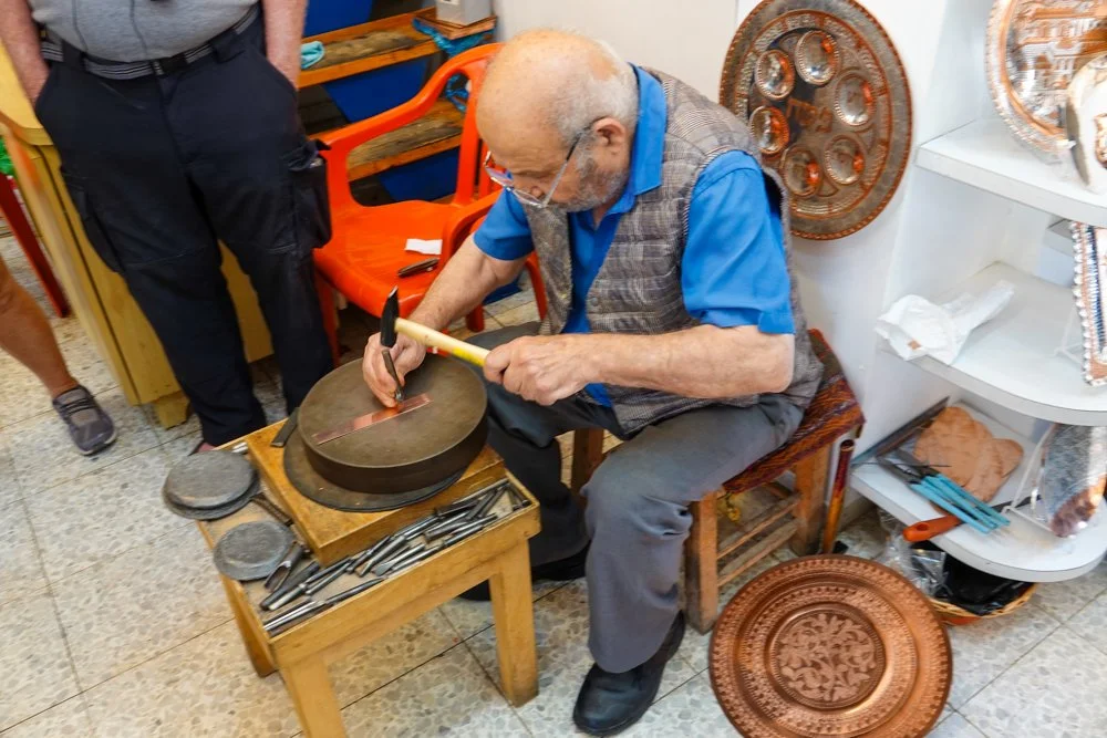
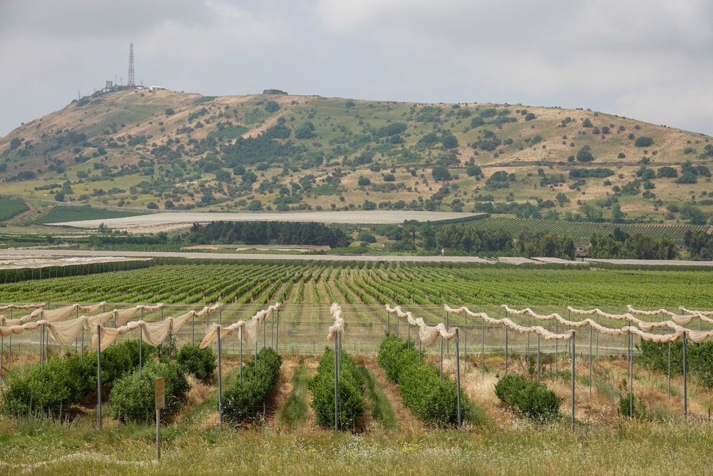
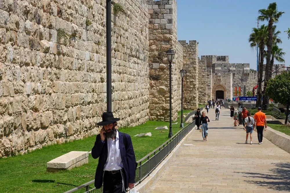
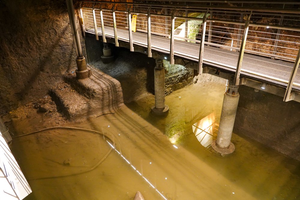
I’ve included a few photos to give a small glimpse of our trip.

The view from Mount Carmel in Haifa. Our hotel was near the bottom of the street in the center of the photo, across from the port

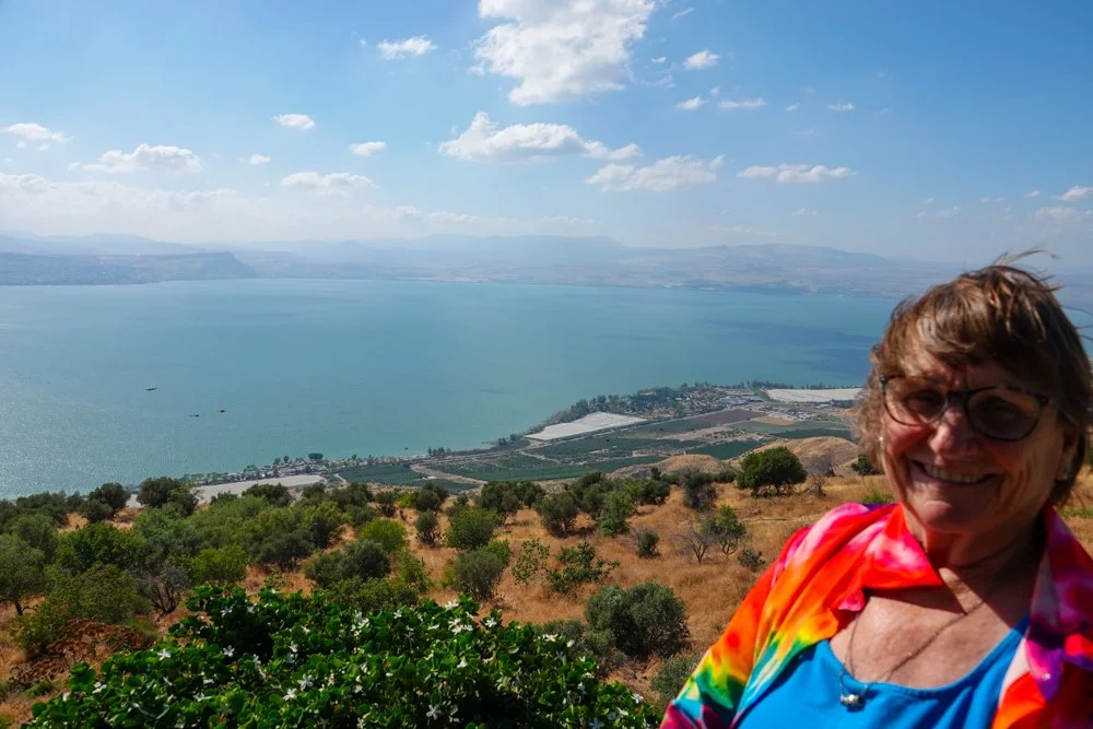
Our view of the Sea of Galilee from the kibbutz where we stayed in the Golan Heights

Saying a prayer and inserting a note at the Western Wall in Jerusalem

Vicky and I at the Dead Sea. I think you’ll agree, it needed some color…and we provided it!

The Tel Aviv coast and let me tell you, Tel Aviv is a party city

Haifa

Haifa was our first stop in Israel. We went there directly after landing in Tel Aviv.

Haifa is the third-largest city in Israel and is located on the Mediterranean coast about 55 miles north of Tel Aviv. Settlement history here spans over 3,000 years and it has been a seaport of some note all that time. Like much of Israel, Haifa has been conquered and ruled by the Assyrians, Babylonians, Canaanites, Israelites, Phoenicians, Persians, Hasmoneans, Romans, Byzantines, Arabs, Crusaders, Ottomans, and the British. This was something of a recurring theme in Israel.

Haifa is an important business center for Israel. Besides the port, Haifa has some great academic institutions, Israel’s oldest and largest high-tech park, heavy industry, petroleum refining and chemical processing. Haifa is one of Israel’s mixed cities with an Arab-Israeli population.

The view looking up at Mount Carmel from near our hotel. Haifa is built on the slopes of Mount Carmel. Haifa is home to the Baha’i Faith and you can see the 19 terraces of the Baha’i Gardens.

The next view is from the top of Mount Carmel where you can see the gardens, the city, and the port which has a lot of ships waiting to dock.

Our hotel was in the German Colony area, right down near the port. The Germans were evidently close friends of the Ottomans and got into Haifa on the ground floor. The photo below is an old German farmhouse that was near our hotel.

We spent several hours walking the Wadi Nisnas neighborhood of Haifa. It was very picturesque with narrow roads, old stone buildings, passageways, pomegranate and fig trees, grape vines, and lots of bars, restaurants, and coffee shops. But I should add that in addition to walking, we ate and drank our way around Wadi Nisnas. We tried falafels, pizza, coffee, paradise (dates with pistachios and other nuts), and more. In the photo below, we tried multiple cooked vegetable and meat dishes at this shop. The woman in black is the owner and cook and she also served us lots of samples.

The last photo was dinner on our second night at Shtroudl Restaurant. We had a handful of salads, pita bread, chicken skewers, stuffed zucchini, beer, wine, and dessert.


Caesarea

This was a visit south of Haifa at the Caesarea National Park. Caesarea was built by Herod I or Herod the Great over 2,000 years ago. It was built on another ancient city from the 4th century BCE. Herod was known for his colossal building projects and we saw three of them on this trip. This park spans the time from Herod’s Roman ruins up through the Crusader period, in many layers. We spent a couple of hours here but we could have spent more time here.

I don’t think I’ve ever visited a major Roman ruins that didn’t have an amphitheater, and Caesarea was no exception. You can tell from looking at Vicky that it was a bright and sunny day. You can see that this amphitheater still gets used.

In the middle of the next photo was the Herodian hippodrome. I included this photo more to give a small idea about the size and scope of Caesarea.

Caesarea was one of the largest and most magnificent ports in the Mediterranean back in Herod’s time.

The Caesarea Nymphaeum was the public fountain that stood at the center of center of ancient Caesarea and one of the town’s main monuments. It was both decorative and provided drinking water.

Our guide said that barely ten percent of this park has been uncovered. We watched an excavation that was underway by Israel and Vanderbilt University. It looked like slow work.

Crusader Citadel and Knights Halls

This day we drove north from Haifa to Akko (called Acre in the Bible). Akko sits on the coastal plane and has a natural harbor. It dates to the Bronze age and has been shaped by Romans, Ottomans, Crusaders, Mamelukes, Byzantines, and the British. The Akko Old City is a UNESCO World Heritage Site.

Akko is also a mixed Israeli city with Jews, Muslims, Christians, Druze, and Baha’i’s.

Our main visit was to the Crusader Citadel and Knights Halls. It was layers of stone-walled and stone-vaulted chambers, tunnels, and rooms. This was where the medieval knights patrolled, dined, and prayed. Other uses of the chambers included space for artisans, production of sugar, treating sick and wounded, shelter, vendors, and storage. We spent a good deal of our time here underground.

The first photo was near the entrance and gives an idea of the scope of the ruins.

We spent most of our time in areas like the second photo. Each of the chambers is a really large area.

I believe that the next photo was the Beautiful Hall, where pilgrims en route to the Holy Land were welcomed.

I think the next photo was the dining room. Wow, if those pillars could talk…

The last photo was just another outside photo but I can’t remember the purpose of this space.

Akko

We are still in Akko. After the Crusaders Citadel, we visited Akko’s main marketplace and the spice market. I love to visit the markets when we travel. Thanks to Noa, our guide, we also got to smell, taste, drink, and listen our way around the markets.

Noa also had some other surprises for us in Akko.

This was our group heading into the main marketplace. Akko had a great look and feel to it.

We met this man at the David Miro Copper workshop. We also got to see him work. You can see a little of his work around him but the walls were covered with his work and it was very impressive.

This might have been my favorite stop in Akko. Maruan here (on the right) is a 4th generation spice store owner. He let us smell several handfuls of his spices that are in the jars in front of him and he also gave us some Cardamon coffee. WOW, the coffee was strong but it had incredible flavor!

Noa, our guide, surprised us with a boat ride with Captain Salim out in the Akko harbor. I always enjoy seeing a city or town from that viewpoint as it always gives me a different perspective on the place.

After lunch, we had another surprise. We walked the Templars Tunnel. The Templars were a Christian military-monastic order. The tunnel connected the Templars Palace to the port. Our guide said that when the Ottoman’s took over Akko, they understood that the Templars had a lot of gold in their area of the port. The Ottoman’s said that the Templars could leave but the gold stayed. The Templars left but when the Ottoman’s got inside their port area, there was no gold and they couldn’t understand how the Templars had gotten it out. The tunnel was buried and forgotten about in the 13th century and only uncovered recently when a citizen had a plumbing problem and in trying to fix the problem, they discovered this tunnel. I searched of course, but they evidently didn’t drop any gold on their way out of the tunnel.

Rosh HaNikra

We drove farther north after Akko and eventually arrived at Rosh HaNikra which is right on the border between Israel and Lebanon. It’s also right on the Mediterranean coast.

Rosh HaNikra is a series of cavernous tunnels and limestone grottoes formed by sea action on the soft chalk rock.

We took a short but steep cable car ride to get to the tourist site. The first photo shows the yellow cable car as well as the white limestone and deep blue of the Mediterranean.

It was quite striking in the caves and tunnels. The contrast of the blue water, white limestone, and other colors was great. Being down in the cool underground and in the grottoes was also a big bonus as it was another warm day.

There were lots of ups and downs on our walk and the next site was never very far away.

The next photo was after coming out the other end of the tunnel system. It shows similar features to the first photo but if you look close, it shows something else. On the horizon of the sea and just to the right of the rock wall, you can see an Israeli naval ship. It’s patrolling the border with Lebanon. A military presence was common in Israel.

The last photo is a man-made tunnel dug by the British for the Haifa-Beirut railroad line. During WW II, this tunnel was used to move goods from Egypt to Lebanon to Israel to Europe. It was later destroyed by the Israelis during the 1948 war to prevent such traffic. Military history was another common theme in Israel.

Basilica of the Annunciation

This day we drove east in Galilee and into the Galilee Hills. Nazareth was our first stop. Today, Nazareth is a mostly Arab and Muslim town with predominantly Arab citizens of Israel. Arabs in Nazareth have a roughly 70/30 split on being Muslim and Christian. Nazareth is famous for being the hometown of Jesus and the place that he spent his boyhood with his mother and father. He faced skeptical townspeople in Nazareth. Of course, it was probably only a town of 200 people back then.

The huge Basilica of the Annunciation was our first stop in Nazareth. This is believed to be the place where the angel Gabriel told Mary that she was to miraculously conceive the son of God. The church has been rebuilt multiple times over the years. It was originally constructed in the 4th century, had other reconstructions, and what we see today was completed in 1969.

I’m standing near the church and you can see the towering cupola of the Basilica which stands over the cave that tradition holds to be the home of the Virgin Mary.

This is the front of the church. It’s exceptionally large and very nice.

There was a Mass being said when we went inside the church but it was not well attended.

We went down below the level in the above photo to this level. This church, like much of Israel, was built on layers of earlier civilizations. There were two altars on this level. You see the first one in the center of the photo.

This is in the back of the previous photo. This sunken grotto is the traditional home where Jesus, Mary, and Joseph lived while in Nazareth. An altar is inside the cave.


Sea of Galilee

We are still in the Galilee region but have continued east from Nazareth. As we moved east, the hills got greener, and I particularly noticed all the olive groves. We soon came to the Sea of Galilee (aka Lake Kinneret). I will include two stops in this post. The first will be at Kibbutz Genosar and the second will be at Yardenit.

The “Man in the Galilee” Museum is located on the shores of the Sea of Galilee in Kibbutz Genosar. The main feature of this museum is the “Jesus boat.” It was found in the mud of the Sea by two brothers who were amateur archeologists. It was during a drought in 1986 and they found this boat on the northwest shore. This ancient galilee boat is 2,000 years old and survived all that time buried in the mud of the Sea of Galilee. There is no evidence that the boat belonged to Jesus or his apostles but hey, we’re talking about tourism here.

Below is the Sea of Galilee at the site of the “Man in the Galilee” Museum.

The next photo is the “Jesus boat”. It is 27 feet long by 7.5 feet wide by 4.3 feet high. The boat dates to the time of Jesus. My take was that you would have to really “believe” to go out into the Sea in that boat.

The museum also had mosaics, the Magdala Stone, and many other artifacts on display.

The Yardenit baptismal site is on the southern shore of the Sea of Galilee, close to Tiberias, and directly on the Jordan River. Yardenit is famous for being the site at which Jesus was baptized by John the Baptist. This site attracts over a half a million visitors a year.

The photo below is at Yardenit. Thousands of visitors here every year undergo a baptism ceremony where they believe that their sins will be washed away. Our guide assured us that the Jordan River has long been considered to be holy and healing waters. You can see that they have multiple baptism areas available.

In the last photo, Vicky is baptizing her toes as it was far cheaper. This is also a good look at the Jordan River plus a small glimpse of wildlife.

Kibbutz Kfar Haruv

This was Kibbutz Kfar Haruv where we stayed for several nights. It’s on the southern Golan Heights perched on top of an escarpment some 2,500 feet above the Sea of Galilee. This is across the Sea from my prior post. This kibbutz was founded in 1973. It has views of Mount Hermon in the north and of course, the Sea of Galilee to the west. Kibbutzim have evolved from their early days. Today, many of the kibbutz include tourism as one of their staples for making money. Jordan is a short distance to the east.

Vicky at the kibbutz overlooking the Sea of Galilee. We liked the view but, as you might notice from her hair and shirt, it was very windy much of the time we were there.

Our private cabin is in the photo below. We had coffee on the deck each morning and wine in the evening.

The next photo is the inside of the cabin. Vicky is outside drinking coffee. Behind me in the photo is a bedroom and a bathroom plus a loft that slept several as well. One large family or two small ones could stay here comfortably.

We didn’t see very much wildlife in Israel, so I’ll show two photos here. The next photo is a parrot that we saw walking around the kibbutz. We loved listening to the birds chirping there in the morning.

The last photo was on the same walk. This is a Hyrax and we saw handfuls of them on the rocks just below the edge of the kibbutz, overlooking the Sea of Galilee. We had a glorious visit here. The Hyrax’s closest relative is the elephant. Go figure…


More of our Kibbutz

The first Jewish kibbutz was established in 1909 a short distance from here. It was started with money from the National Jewish Fund on land purchased from the Ottomans. Early kibbutzim were a utopian combination of socialism and Zionism. Each member was given a job, a place to live, and three meals a day. Each member had one vote on running the kibbutz and 51 percent ruled. Today, many kibbutzim have been privatized with major changes to the communal lifestyle.

One major change has been that farming has been supplanted by other economic endeavors. Kibbutz Kfar Haruv, where we stayed, is one of the kibbutzim that has changed its economic development. Farming, however, is still a part of their operation.  

The first photo is an orchard that we passed on the way from the highway into the kibbutz. I’m not sure what trees.

This kibbutz has a dairy in the back of the photo, grows their own hay, and has solar panels as well.

The third photo is the tourist cabins. The Sea of Galilee is right behind these cabins, and they overlook it.

Tourists must eat. The old dining commons for the kibbutz is now the dining hall for kibbutz members or guests. It’s not a very good photo as the sun was near setting and very bright, but you get the idea.

The last photo shows a good example of this kibbutz branching out economically. They designed and manufactured the water relief valve you see in the last photo. It’s the black and red piece on top. They sell these all over the world. They produce the design, and manufacture and sell them.


To the Syrian Border

On this day, we drove north the length of the Golan Heights to the Ein Zivan kibbutz. This was the first Israeli settlement founded in the Golan following the Six Days War. It was established, in 1968, by young people from older, more established kibbutzim. It appeared to me to be an incredibly successful farming operation. Mind you, under international law, this is considered to be part of Syria which is disputed, of course, by Israel.

We were met at the kibbutz by Ilan Shulman, a kibbutz member and retired officer of the Israeli Defense Forces and military intelligence. He told us that he used to be a kibbutzim cowboy and he looked the part. He told us about their kibbutz. Today, he also has a side business of taking people on jeep excursions and that’s what we did. He had two cohorts with him in three jeeps and we drove to within a rock throw of the Syrian border. They were armed with pistols.

This is Ilan Shulman with Vicky. I tried to tell her that her shirt choice might not have been the best for driving right up to the Syrian border, but hey, she’s a cowboy too.

IF you notice the red sign, it was the second sign that we passed that said no entrance. It reads: Military Area, No Entrance.

This tank and soldier were on a hill just pass the second No Entrance sign. They weren’t kidding. We were only allowed to pass because we were with Ilan Shulman and friends but the soldiers still checked us out.

The tank in the next photo is left over from the Six Days War in 1967. But also notice the Yellow and Red sign saying ‘Warning DANGER! You are entering an area with land mines; Do not leave the marked path; Do not cross any fences.’ We saw dozens of these signs.

The last photo is the former Syrian Army Headquarters. Here, Ilan gave us an incredible talk and led a discussion about the 1967 and 1973 wars, about Israeli and Arab cultures, and he brought us up to speed on what is happening today in Iran and other states as well as entities such as ISIS, Hezbollah, Al Qaeda, and the PLO. It was an inspirational and informative meeting and a trip highlight for me. From the Golan Heights, we had good views of Syria and some abandoned towns.

Ein Zivan kibbutz Farming

We are still at the Ein Zivan kibbutz with Ilan Shulman. Ilan might have been a cowboy, a soldier, and an intelligence officer but he really knew his farming. I was fortunate enough to sit in the front seat with him the whole time and I peppered him with questions about crops and farming techniques as we drove around and he was incredibly knowledgeable about agriculture, irrigation, fruit varieties, and farming techniques. 

The Ein Zivan kibbutz has branched out to other economic endeavors but agriculture is still their primary economic activity. We saw orchards of apples, pears, cherries, kiwi, mango, avocado, lychee, plus vineyards. They also have beef cows and chickens.

I’m not sure what crop will be grown here as Ilan was talking when we passed here. But most kibbutzim are 1,000 acres so they are fair sized farms. You can see the size of their agricultural endeavors.

I’m not sure what these trees are but what intrigued me was the netting over the orchard. Ilan said it was for sun and moisture control and creating a microclimate to help the trees grow better. We saw this in much of Israel and it allows them to grow plants that don’t seem at home in this desert, such as bananas.

This is a water reservoir that they built for irrigation water. I was most impressed by the size of it. You can see some snow on Mount Hermon in the background.

This is just another ag photo. You might again notice the netting available on the nearest orchard trees. I believe it’s a vineyard behind that. They do have a separately run winery on the kibbutzim property.

We were told that prior to the 1967 war, when Syria occupied the Golan Heights, the Syrians bombed Israel every day from the Golan Heights. Israel felt they couldn’t live with that so they waged war and gained the Golan region. But even with that, it was and probably still is, a risky place to live. In the last photo, you can see a bomb shelter at the kibbutz and that’s just a part of life for Israeli’s in this part of the world.

Majdal Shams

We drove from Ein Zivan kibbutz to the Druze town of Majdal Shams. It’s still in the northern Golan Heights in the southern foothills of Mount Hermon. It’s one of only four remaining Druze-Syrian communities in Israeli territory held since the Six Days War in 1967. Our guide said that there used to be 135 such towns in this territory. Druze are a small Middle Eastern religious sect with their own doctrines and loyalties that broke off from the Ismalili Muslims in the 11th century and today are not a part of the Muslim community at large.

Our main stop in town was at the Al Yasmeen Restaurant for lunch. It’s owned by the Masdi family which is a Druze family. The family has lived here since 1870 and owns and operates the restaurant. Suad, the mother, is the cook and she made us a really excellent lunch with more than a dozen dishes plus lemonade.

The first photo isn’t great but if you look to the left and behind of the tall building, you can see the Syria-Israeli border marked by the road and fence going up the hill. Again, we were very close to the Syrian border.

This is just a photo of Majdal Shams. The hills behind the town at this angle are in Israel.

This is the street right in front of the restaurant where we ate.

The next photo was taken after our first course of food and this and each subsequent course was delicious.

Majdi, one of the family’s adult sons, gave us a talk after lunch. He told us that Druze always live in the mountains because for 1,000 years, it’s easier to defend your home from your enemies. He told us about Druze customs and beliefs, such as reincarnation. He included several stories from his life about reincarnations and it was very fascinating stuff. He also showed us the Druze flag and explained about the five colors of their flag.

Capernaum

We left our kibbutz on this morning and drove to Capernaum (Kfar Nahum) on the north shore of the Sea of Galilee. It’s an ancient Roman fishing village inhabited from the 2nd century BC to the 11th century AD when it was abandoned before the First Crusade. Archeological excavations have revealed two ancient synagogues, built one over the other. Our guide said that it must have been a wealthy community because the limestone used to build the synagogues is not found here.

Jesus came to Capernaum to start his preaching. It was a much bigger town than Nazareth. (like 1,500 compared to 200 people), plus it was doubtful that anyone Jesus grew up with in Nazareth was going to buy into his preaching. Peter lived in Capernaum and Andrew, James, and John lived nearby here. A 1968 excavation led to the discovery of a 1st century house that is believed by Christians to be the home of Saint Peter.

The first photo shows a bit of the excavations in Capernaum.

This is the remains of the second synagogue, built upon the first synagogue. Our guide, Noa, is in the photo while Vicky and others are sitting in the shade to the far right.

The Byzantines turned a house into a church and the house is believed to have been Saint Peter’s house. That church has been replaced by a modern church which you can see in the next photo. St Peter’s house is under the glass in the center of the church. Our group sang “Amazing Grace” in this church and the acoustics were really great.

This is a look down at the remains of Saint Peter’s house, per the Christians belief.

This view is from the edge of St Peter’s house looking out to the Sea of Galilee. It was about sixty yards to the Sea.

Mount Beatitudes

We continued along the shores of the Sea of Galilee to Mount Beatitudes. It’s near Capernaum and is believed to be the site of Jesus’ “Sermon on the Mount.” Is it the exact location? From all that I saw and heard, it’s near Capernaum. It’s a hill overlooking the Sea of Galilee, so at a minimum, it’s “in the neighborhood.” I think it’s one of those things we just must accept on faith.

Upon arriving at Mount Beatitudes, Noa, our guide, sat us down and we heard the opening lines of the Sermon on the Mount. You can never hear too much about blessings. Afterwards, we walked the gardens and looked at the displays of Jesus’ miracle stories, many of which evidently occurred right in this same area. 

The first photo is the Church of the Beatitudes. The interior is octagonal, and each side represents a beatitude.

Our group gladly listened to the opening lines of the Sermon on the Mount, including one local.

The miracle display of the ‘loaves and the fishes’ was my favorite display. However, after studying the display carefully, I believe that it should be rephrased as the miracle of the “pita bread and fishes.” See for yourself.

Since we are currently talking about fish and since we were standing on the edge of the Sea of Galilee, I’ll continue with some more about fish. Our guide said that the Sea of Galilee contains 27 different types of fish, though not all are sought by fisherman. We went to lunch in Tiberias right after Mount Beatitudes. We ate at the Galei Gil Restaurant, overlooking the Sea. I ordered the grilled Saint Peter’s fish which you can see in the photo below. It was really tilapia.

At an earlier restaurant stop, Vicky had ordered the ‘Jesus fish’ for lunch. You can see it in the below photo. It was also tilapia, but I like the references. Jesus and Peter were fishermen and that suits me just fine.

Jerusalem, The Mount of Olives

We arrived in Jerusalem in the afternoon and promptly drove to the top of the Mount of Olives. It’s a mountain ridge that is east of and adjacent to Jerusalem’s Old City. In ancient times, it separated Jerusalem from the Judean Desert. It was named for the olive groves that once covered its slopes. 

Our group had a sparkling wine toast on the Mount and said the blessing, “Shehecheyanu” while overlooking the Old City. It’s a Jewish prayer said to celebrate special occasions. It is said to express gratitude to God for new and unusual experiences. The blessing is recorded in the Talmud, indicating that it has been recited for over 1500 years. Welcome to Jerusalem.

This is a wide view of Jerusalem with the Old City in the center.

In the second photo, you can notice several things. First, the Mount of Olives has been used as a Jewish cemetery for over 3,000 years. It holds an incredible number of graves, some of which you can see in these photos. You can also notice the seven golden domes of the Russian Orthodox Church built in 1888. Jerusalem if full of all sorts of churches of many faiths and denominations.

This is a more closeup photo of the Temple Mount, an elevated plaza within the Old City. The Dome of the Rock, a golden domed Islamic shrine, is one of Jerusalem’s most prominent features and one of the Muslim’s most holy places.

This is a closeup of the Dome of the Rock, though the sun was behind it so not the best photo.

This view is the southern end of the Old City with the end of the Temple Mount in the lower right. You can see the old city wall, still in place. The Old City has seven functioning gates, and the Dung Gate is near the center of the photo. Vicky and I exited the Old City by the Dung Gate on my second time inside the Old City.

The Old City

We are in Jerusalem on the next morning. These photos will be out of sequence but before we start our tours inside, I just want to give a sense of the Old City. The core of the Old City dates back more than 3,000 years. The street plan largely dates from the Byzantine times. The monumental defensive walls and city gates were built by the Ottoman Empire in the 1500’s. The Old City has four uneven quarters: the Muslim Quarter, The Christian Quarter, the Armenian Quarter, and the Jewish Quarter.

The Old City is a holy city for Judaism, Christianity, and Islam. It is near the crossroads of three continents and has been one of the most fought over cities in human history. The Old City is only .35 square miles, so actually quite small. The small size gives one the sense of just how important this old city is to so many people.

The first photo is near the Jaffe Gate. I just wanted to give a sense of how imposing the wall is from a pedestrian’s viewpoint.

The Jaffe Gate is ahead of us in the 2nd photo. We exited here once and entered here once.

The next photo shows several things including an example of high domed ceilings on houses, stone walls, and there must be at least fifty churches, chapels, and monasteries within the walls of the Old City.

This is the Gihon Spring. It was the primary water source for residents of ancient Jerusalem. The water was brought uphill under pressure and then tunneled into the Old City.

The Old City is laced with narrow, winding, stone streets and alleyways which also wind up and down the hills.


The Western Wall

The Western Wall, or the Wailing Wall, or the Buraq Wall for Islam, was quite a surprise for me. I knew it was perhaps the most sacred site in the world for the Jewish people. In my mind, I always thought that the Western Wall was an old remaining section of wall from one of the ancient Jewish Temples. It’s not. The Western Wall is a small section of the old Western “retaining” Wall for the expansion of the Second Jewish Temple begun under Herod the Great. The hill known as the Temple Mount had a huge rectangular foundation built around it with a flat platform creating space for the Temple, auxiliary buildings, and crowds of worshipers and visitors.   

Much later in time, however, the Jews were restricted from entering the Temple Mount for something like fifty years. Once a month, they were allowed to advance only as far as the Western Wall to pray. So, they prayed here, through the Foundation Stone, to the most sacred site in the Jewish faith. In time, the Western Wall became like the symbol for the ancient temple and a place for prayer and pilgrimage sacred to the Jewish people.

The first photo is a photo of a model that our guide showed us of Jerusalem and the Temple Mount in 66 BC.

The second photo shows a recreated model of the ancient temple. You can see the outline of today’s Western Wall in the photo. So, today’s Western Wall was a middle section of the old Western Retaining Wall of the Temple Mount.

The third photo is one I took to try and show a similar view today to the prior photo’s viewpoint.

We arrived at the Western Wall early, so it was not very crowded. As you see, it was not empty either.

I touched the wall, prayed, and inserted a note into the wall.

The Western Wall Tunnel

The visible Western Wall, as seen today, is some 230 feet long. But the whole wall is 1,600 feet long. Over 1,300 feet of the retaining wall going north is under ground because King Herod raised the ground around the Temple Mount. However, man-made tunnels were dug in the 1980’s along the Western Wall, from the public praying area up to its northern end. The purpose of the tunneling was for research of the Western Wall and related antiquities. 

The Western Wall Tunnels feature the preserved Western Wall, tunnels, chambers, cisterns, the remains of a second century BC aqueduct, water cisterns of the Antonia Citadel, and Warren’s Gate, a Western Wall entrance gate from the Second Temple period. The tunnel also featured several very long, very small areas with nothing to see except for the old wall on one side.

Before we entered the tunnel, there were some 150 or so soldiers who were about to enter with us. Most carried assault rifles with them. I felt very safe and told them so. They did look incredibly young to me.

The second photo shows a depiction of the old temple and again, you can see an outline of today’s Western Wall. From this, you can tell where we entered and see the 1,300 feet that we followed in the tunnel.

The prior photo shows the bridge and entrance to the Temple Mount. Shortly after entering the tunnel, we came to that location and the Roman Vault, which you can see in the next photo.

The photo below shows a chamber opening in the tunnel, but I can’t remember what this section was originally. We passed a number of openings.

I believe that the next photo is a water cistern of the Antonia Citadel.

The last photo is just to show what some of the tunnel walking was like, very narrow with uneven ground.

Via Dolorosa

The Via Dolorosa, Latin for “Sorrowful Way” or “Way of Suffering” is the processional route in the Old City of Jerusalem. It represents the path that Jesus would have taken, forced by the Roman soldiers, on the way to his crucifixion. The winding route is from the former Antonia Fortress to the Church of the Holy Sepulchre, a distance of some 2,000 feet. The Via Dolorosa is not one street, but a route consisting of segments of several streets.  

The Via Dolorosa is a celebrated place of Christian pilgrimage. The route has evidently changed somewhat over the years. The current route was established in the 18th century. The number of stations of the cross evidently varies, depending on the particular church and tradition. Today, it’s marked here by fourteen Stations of the Cross. Nine stations are outside in the various streets along the route. The five remaining stations are located within the Church of the Holy Sepulchre. 

We exited the Western Wall tunnel into the Muslim Quarters and crossed the road to the Church of Flagellation, photo below, and the Chapel of the Condemnation. This is the site of the 2nd Station of the Cross where Jesus is made to bear the cross. This was determined by Biblical descriptions and the discovery of Roman flagstones beneath the adjacent churches. There is probably some controversy about this, but this was our start on the Via Dolorosa.

Below is the Via Dolorosa leaving station two and moving towards station three.

I included the next photo to give a higher view of the neighborhood of the Via Dolorosa. The Church of the Holy Sepulchre is in the upper left (blue-grey domes) and you can notice that it’s uphill to get there.

The next photo is Station Three, where Jesus falls for the first time. You can see this both over the doorway and in the metal markers on the corner of the building.

Below is the 5th station, where Jesus fell against the wall and Simon of Cyrene was ordered to help Jesus carry the cross. The hand position is well worn.

This is the 6th Station of the Cross where a woman named Veronica wipes Jesus’ face. (station marked in upper left) You can also notice that the street rises steeply.

I must say that the street below was not a view that I expected to see while walking the Stations of the Cross, but it is on the route. It’s a busy market area.

The next photo shows a priest walking carrying a cross. He had over 100 people walking behind him and they just ploughed their way through the street. It was so chaotic that I didn’t even get a photo. I understand that this is a common occurrence.

The photo below shows multiple things. First, this is the ninth Station of the Cross, where Jesus falls for the third time. You can see the cross that was left here from the earlier reenactment. The station marker is above and to the right of the cross. You can also see the Church of the Holy Sepulchre in the background.

The last photo is the entrance to the Church of the Holy Sepulchre. This is the site of the last five Stations of the Cross.