Are you ready to go to Central Asia?

Are you ready to go to Central Asia?

Where is Central Asia?  You can see it on the attached map in the next post.  We went to Kyrgyzstan, Kazakhstan, Turkmenistan, Uzbekistan, and Tajikistan.  “Stan” means “the land of”, so for example, Tajikistan is “the land of the Tajik people”.

In looking at the map, you can see that Russia/southern Siberia is to the north, China is to the east, Afghanistan and Iran are on the south, and the Caspian Sea is on the west.

Historically, this was the center part of the Great Silk Road.  Central Asia connected Asia, the Middle East, and Europe.

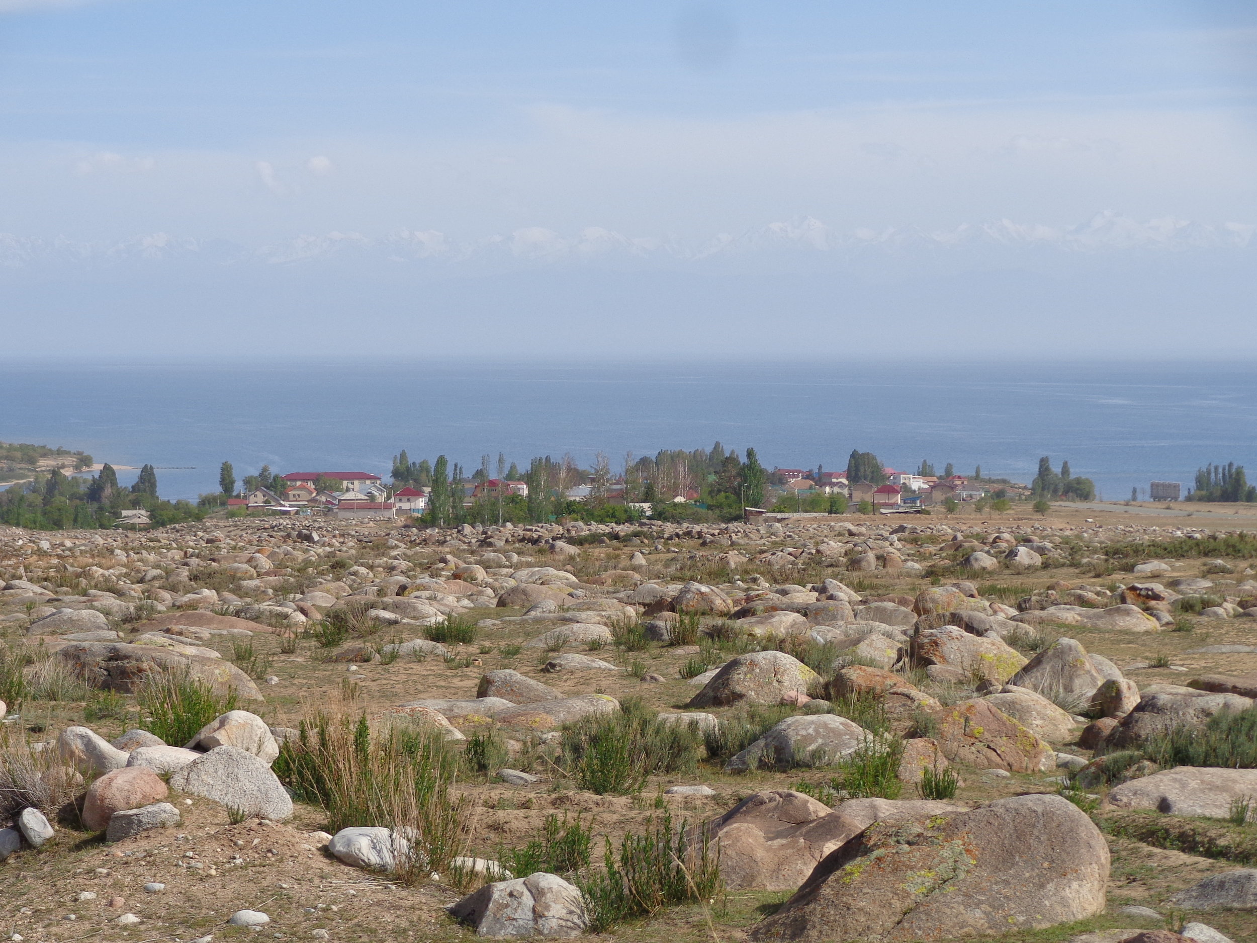
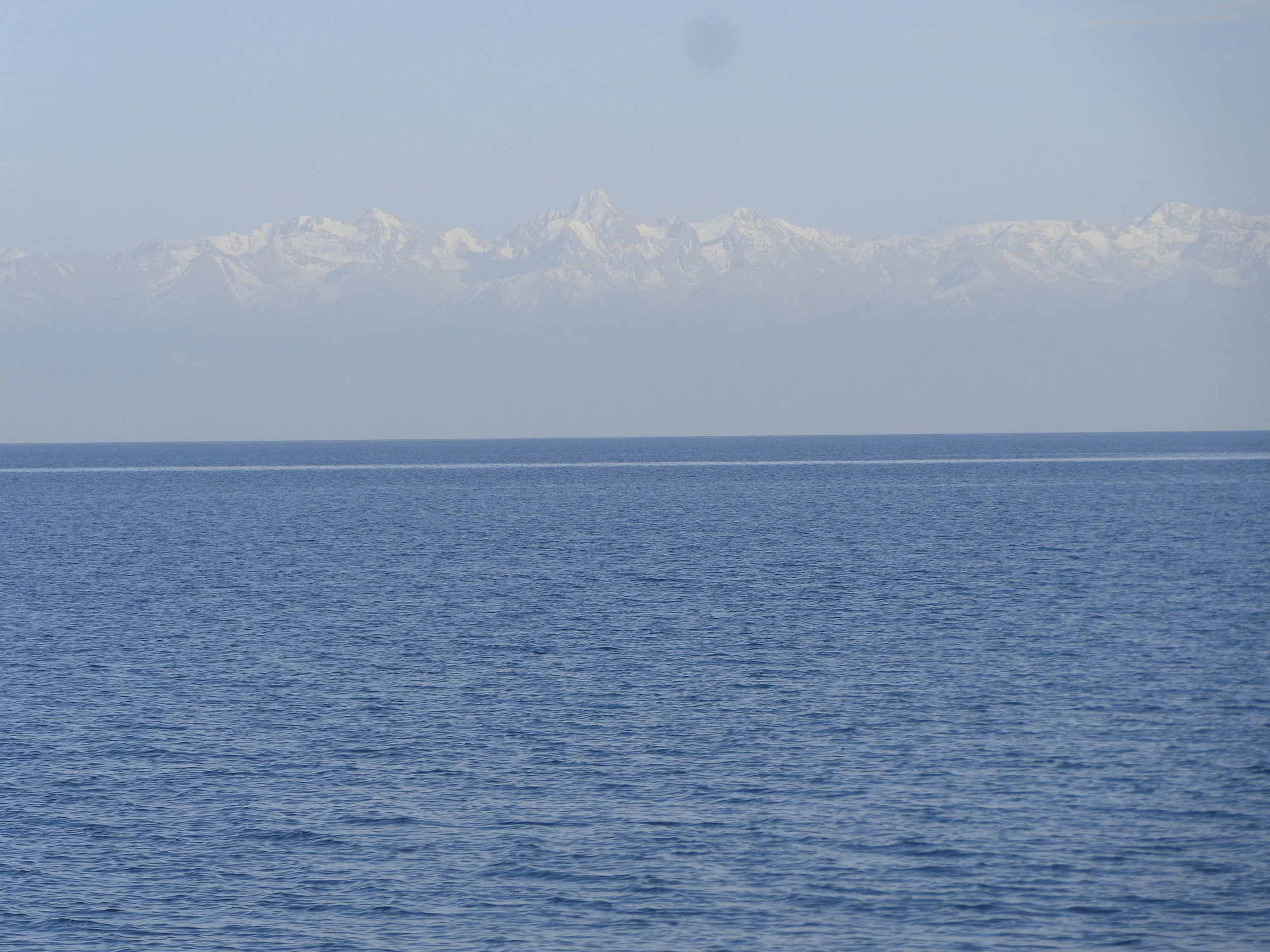
Central Asia is an area of high mountains, vast deserts, treeless grassy steppes, and intense farming where the rivers run.

If you want to learn more, come along for the trip.  I’ll take it in the order that we traveled it.  This trip was from May 27th to June 25th, 2018.  It was another OAT trip (Overseas Adventure Travel – our go-to travel company).

We had lots of surprises on this trip and I’m sure you will enjoy some of them.

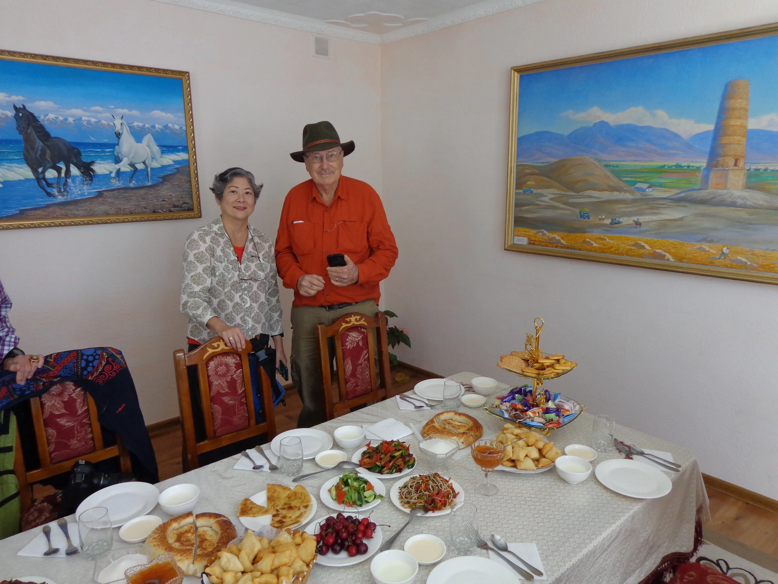
I went on this trip with my wife, Vicky, my brother-in-law and his wife, Pete and Nora, and our long-time good friends Ron and Patty. A rousing good time was had by all.


Here are a few highlights along with the photos.

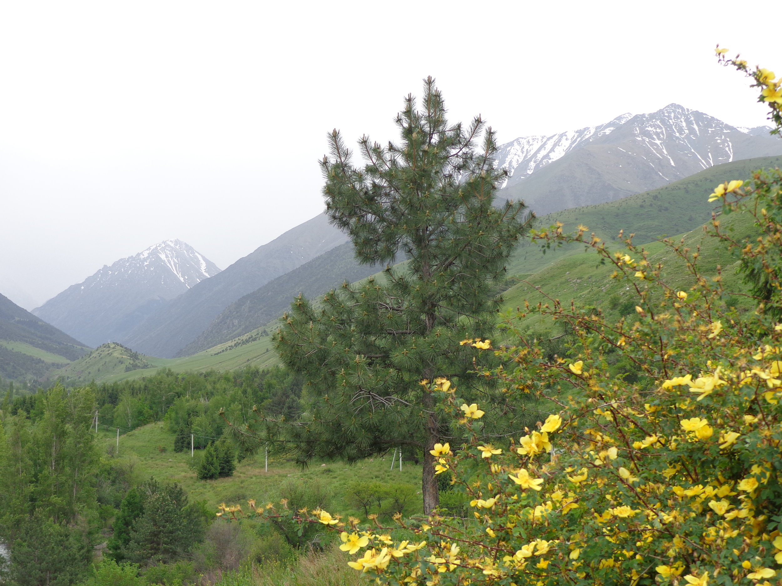
This photo was from a hike we took in Kyrgyzstan.  It was in Ala-Archa National Park and a very fun outing.

DSC03404.JPG

Kazakhstan is where apples originate as confirmed by DNA evidence, we were told.  They are very proud of their apples.

DSC03715.JPG

Ashgabat is the capital of Turkmenistan and must be seen to be believed.  This was probably the biggest surprise of our trip.

DSC04050.JPG

Uzbekistan had many of the major trade cities of the great silk road, and also had many mosques and madrassahs. 

DSC04870.JPG

Over 90% of Tajikistan is mountainous and we traveled over three mountain ranges on this day – and had all four seasons of weather.

DSC07425.JPG

Assalomu aleykum (Peace be upon you)

Mapping the Trip

Hi all,

For those who want to follow this trip on a map, you can do that.

Central Asia.jpg

1.     We started our trip in Bishkek, Kyrgyzstan.  Bishkek is in the far north of Kyrgyzstan and is on the map.

2.     We then drove east to Lake Issyk-Kul which is the large lake due east of Bishkek.

3.     Next we drove to Almaty, Kazakhstan.  Almaty is right above Lake Issyk-Kul but we had to drive almost back to Bishkek to get around the mountains.

4.     Then we flew from Almaty to Ashgabat, Turkmenistan.  Ashgabat is on the southern border of Turkmenistan and also on the map.

5.     From Ashgabat, we flew due north to Dasoguz, Turkmenistan.  That was our last flight until the end of the trip.

6.     The rest of our time in Central Asia, we moved around by bus.  This was what I would call the heart of the trip.  We were in the thick of the main artery of the old Silk Road.

7.     We drove from Dasoguz, Turkmenistan North to Nukus, Uzbekistan.

8.     We drove from Nukus southeast along the Turkmenistan border to Khiva.  Khiva is not on the map but it’s near Urganch which is on the map.

9.     We drove from Khiva to Bukhara along a southeast heading.  Bukhara is called Buxoro on the map.

10. We then drove from Bukhara northeast to Samarkand which is on the map.

11. From Samarkand, we continued northeast to Tashkent in northeast Uzbekistan and on the map.

12. From Tashkent, Uzbekistan, we drove south to Khujand, Tajikistan which is on the map in the far north finger of Tajikistan.

13. From Khujand, we drove south to Dushanbe, Tajikistan over some incredible mountain roads.

We drove about 2,250 miles across central Asia.

From Dushanbe, we flew to Istanbul, Turkey and then home.

Bishkek, Kyrgyzstan

Bishkek is the capital of Kyrgyzstan and its largest city at just under a million people.  The Tien Shan mountain region covers over eighty percent of the country with its highest mountain peak at 24,406 feet.  So, much to our delight, we were commonly treated to snow-capped mountains in the background whether we were in town or out in the country.  Bishkek itself is between 2,100 and 2,700 feet elevation so descriptions on getting around town involve upper and lower Bishkek.

Bishkek does not have a long history as a city, only back to about 1826.  The city was originally a part of the silk road network connecting Tashkent and Lake Issyk-Kul.  Russia has been the major influence since about 1862 and Russia ran this area plus Kyrgyzstan eventually became one of the USSR’s 15 entities.  You can still see lots of Soviet era housing in town.  The city has wide boulevards and marble faced public buildings.  The city enjoys innumerable large street trees and lots of city parks.  Streets have small irrigation channels on both sides to water the trees.  Our local guide said Bishkek has 15 million trees or 15 trees for every person in town.  Our guide said that part of Bishkek used to be a swamp and that the trees play an important part in keeping the ground water in balance and were planted for just that purpose.

Kyrgyzstan broke free from the USSR in 1991 and changed the city’s name from Frunze to Bishkek.  All five central Asian countries have struggled somewhat since breaking free of the USSR but I think all five are making good strides towards finding themselves.  Leadership of the countries seems to have given them some problems, but what country doesn’t have that problem.

Our first stop in Bishkek was to check into the Golden Tulip Hotel (first photo).  For some reason, I felt like I was checking into a partner hotel of the Best Exotic Marigold Hotel (if you’ve seen the movie).  I was unsure if we would be checking out, but of course, we did three days later.  It was a nice hotel and very centrally located for our touring.  The second photo is a view of town from our hotel window.  Who knew?

DSC03311.JPG
DSC03432.JPG

You can see two government buildings in the third and fourth photos.  The marble facing gives them away.  These buildings are in Central Square.  The first building is the Department of Agriculture and I’m not sure about the second building.  But a big surprise was all the flowers and roses in both Bishkek and all of central Asia.  You can see the street divider in the fourth photo is all roses, and a really lot of roses.  We eventually were told by one local guide that roses were the favorite flower of Muhammad.  I’d never heard that before but at any rate, central Asia has lots of roses. 

DSC03330.JPG
DSC03339.JPG

On the religious front, central Asian countries are secular.  By denomination, they are overwhelmingly Muslim.  But to give you an idea, we were in central Asia during Ramadan and we never once heard a call to prayer.  In some places, we were surrounded by mosques but never heard a call.  To that front, I would also have you notice the last photo which is a Russian Orthodox church.  We saw both Russian Orthodox churches and Jewish synagogues on our travels, though of course, mosques were by far what we saw the most.

DSC03370.JPG

Russian Monuments

Bishkek is similar to other cities in Kyrgyzstan and central Asia in terms of its dense population of monuments.  All former USSR countries that we have visited have also been similar in this aspect.

Whether this is a key Russian form of propaganda or just the Russian sense of public art, I’m not sure, but all former USSR countries seem to have a large number of monuments with many of them party and war related.

Bishkek was no exception as we saw statues and monuments galore in the city.  I’ll just give a glimpse of them in this posting but they were everywhere in the city.

This is the Monument of Revolution of Kyrgyzstan.  It is right on a main boulevard in the city’s central square area.  The Kyrgyz people are pushing away the darkest part of the old elite that ruled the country to create a better future for their children and generations to come. (or something like that).  The protestors that inspired this depiction ended up being shot and killed.  This monument stands right across a small side street from the Presidential office building.

DSC03341.JPG

This is a statue of Lenin, pointing to the “happy future”.  While it is in a nice location, it used to be located in a much better location in the central square.  The Kyrgyz moved it to here but didn’t get rid of it.  The central Asian countries still have many Russian citizens and still have important ties to Russia for trade and investment, so they have not gotten rid of most of the Russian statutes, just changed their locations to less prominent places. 

DSC03346.JPG

Nora and Vicky are at the Victory Monument in Victory Square.  It’s dedicated to the Allies victory over Nazi Germany in World War II.  It has a statue of a woman, representing wives and mothers, waiting for their husbands and sons to come back from the war.  It also has an eternal flame.  The overall shape of this monument was made to resemble a yurt.  The central Asians still like to maintain visible forms of their nomadic ancestry.  There was no fighting in central Asia during world war two, but Russia forced millions of central Asians to fight in the war and they suffered heavy casualties.

DSC03353.JPG

These two Russians are Karl Marx and Frederick Engels.  They are in a beautiful park area and right across the street from the old KGB building.  Who knows, maybe they were wired for listening.

DSC03349.JPG

This was not my best photo as I never saw the front of this monument.  This is Mikhail Frunze who was a Bolshevik and revolutionary leader who was born in Bishkek.  He lived mostly in Russia and was closely related to Lenin.  He was so famous during the Soviet era that this city was called Frunze, only to be changed to Bishkek after they broke free of the Soviet Union.

DSC03345.JPG

Bishkek Lunch

Bishkek is quite a modern town with lots of restaurants, bars, and coffee houses.  With all the large street trees, many places provide very nice dining, both indoors and outside.  Questions about the food on our trips are often times my most frequent questions, so here goes with our first lunch in Bishkek. 

The street at this restaurant is in the background in the first photo but you wouldn’t really know it due to all the trees and bushes.  This is the outside dining area.  It has water misters for the heat and it was around ninety this day so they are spraying.  It has lights for night time and lots of plants and flowers.

DSC03323.JPG

We ate inside (2nd photo) but it almost looks like we were outside with all the glass windows and indoor and outdoor plants.

DSC03318.JPG

I think every meal came with fresh-baked bread and commonly, we were served two or more different kinds of bread.  Our salad was very crisp and fresh.  It was hard to determine all of the ingredients but certainly this salad included red cabbage and beets, plus some carrots, onions, squash, and more items.

DSC03320.JPG

The main dish came piping hot in tin foil.  It was a fresh fish with vegetables including tomato, eggplant, zucchini, peppers.  We also had olives and other things on the plate that were not hot.  It was all very good.

DSC03321.JPG

Dessert was a cream-cheese and honey stuffed crepe with a fresh made cherry sauce to pore over it.

DSC03322.JPG

Ala-Archa National Park

We drove about thirty minutes outside of Bishkek to get to Ala-Archa National Park.  It’s an alpine national park with the park entrance at about 5,000 feet elevation but the park extends upwards to peaks over 16,000 feet.  The whole park is around 77 square miles.  It’s part of the Tian Shan mountain range.  The park has over 20 glaciers and around 50 mountain peaks.  The park also includes the Ala-Archa River gorge.   

We only hiked a bit over a mile up the trail but it was cool and refreshing weather and felt good to be in such beautiful surroundings.  The first photo was taken near the park entrance, so about the 5,000 foot level. 

DSC03396.JPG

Looking up some of the gorges, like in the second photo, it looked like it would be challenging hiking.  Much of the ground looked like it might be unstable, though there are trails to the higher elevations.

DSC03400.JPG

Mountain peaks in the park are 16,000 foot or more and stay snow-covered all year long.

DSC03406.JPG

Nora is testing the river temperature in the fourth photo.  That blue color denotes that the river comes from glacial melt.

DSC03407.JPG

The last photo was hiking back down the canyon.  You can see that the valley below was clear with mostly blue sky.  We weren’t looking forward to going back to the heat of the valley.

DSC03413.JPG

Burana Tower

We drove perhaps an hour from Bishkek to the Burana Tower, in the Chuy Valley.  This was the site of the ancient medieval city of Balasagun, established at the end of the 9th century.  As if all the warring marauders didn’t do enough damage to central Asia, they also have had some large earthquakes, which is what ruined this area.  All that’s left is part of the tower, some grave markers, some earthworks, and remnants of a castle and three mausoleums.  They also have a small museum that has artifacts found here.

The Burana Tower (minaret) has a history, at least in stories, but it used to be 148 feet tall.  It got knocked about in half by a 15th century earthquake.  The Russians did some renovation of it in the 1970’s and it stands at 82 feet tall today.  This was typical of many of the central Asia historic sites.  Either marauders, like Genghis Khan, or earthquakes destroyed most of what was really great about this area in ancient times in terms of buildings and structures.

Today, most of this site is just empty land as you can see in the first photo.  Vicky and Patty are standing much closer to the tower in the second photo.  The metal stairs and railings were added by the Russians in the 1970’s renovations.

DSC03454.JPG
DSC03451.JPG

Balbals were there in abundance as you can see in the last three photos.  Balbals are Turkish gravestones from when the Turks roamed central Asia centuries ago.  The oldest of the balbals are estimated to be from the 6th century.

DSC03452.JPG
DSC03456.JPG

Vicky liked the balbal in the last photo.  My guess is because the guy was bald and had a mustache, and who could complain about that.

DSC03458.JPG

Kyrgyzstan Roads

We drove Kyrgyzstan roads for maybe eight or ten hours and I find driving to be a great learning experience, all by itself.  I never spend time driving in other countries without feeling like I learned some things.  I just can’t help myself when it comes to these road trips, so I’ll share a few of my favorite photos from Kyrgyzstan road trips.

Kyrgyzstan is really a quite modern country but there were regular reminders of their nomadic past.  Kyrgyzstan is also no Mongolia, where we’ve traveled, but we did have numerous encounters with animals on the roads, like in the first photo.  This is about half the goats in their herd and there were a couple more cowboys on the crew.

DSC03524.JPG

Traffic was not much of a problem but we did have some slow-downs at times on drives.  But when the scenery looked like this, who cared? 

DSC03443.JPG

I have traveled in our New England states and seen pie stands along the road where you take a pie and leave them the money.  We saw the same thing in the countryside around Bishkek, except that they were selling mare’s milk.  Yes, milk from a horse which is called Caamaa.  Of course we purchased some and drank it.  I will say this for their Caamaa, it’s much better than the mare’s mile we drank in Mongolia.  This mare’s milk tasted sour and smokey.  I happen to like sour and smokey and again, it was much better than in Mongolia.

DSC03421.JPG

We passed and were passed by the parade in the fourth photo.  It was a wedding party and they were driving to their reception.  As it turned out, we ended up at the same museum where they had their reception.  The date was June 1st, which happened to be our 44th wedding anniversary.  Vicky mentioned that to some of the uncles of the newlyweds and the next thing we knew, we were drinking vodka shots….and then more vodka shots.  Happy days!

DSC03532.JPG

Signs are interesting and difficult in central Asia.  This area has had so many languages at various times.  Plus, some parts of the culture were translated from different languages and often, they use a different alphabet than the alphabet of the language.  An example of this is the various central Asian languages that use Cyrillic in their signs.  But for the most part when driving, they use signs that don’t need words to describe the correct legal driving information.  However, that is not always the case.  In the sign in the last photo, I have no idea what we were supposed to do or to not do, but I was really hoping we were in compliance because it looked like if we were in violation, we would be shot.

DSC03431.JPG


Drop the Goat

We drove from Bishkek to the resort area of Cholpon-Ata on the shores of Lake Issyk-Kul for a two day stay.  This was an outing in the Lake Issyk-Kul area.  While Kyrgyzstan is a modern country, it still has farming areas and those areas still feel a strong connection to their past nomad days.  I suppose it’s like rodeos in the US, even though we don’t have very many true cowboys left today.

We were treated to a game of “drop the goat” which is the Kyrgyz national sport.  The game almost had an air of watching Genghis Khan and some marauding Mongolians swooping in to raid and pillage a village.  It’s sort of like nomad polo, only with a dead goat for the ball.  The goat gets killed and beheaded right before the game begins.  That part is like a spiritual ritual.  The goat is like the ball or the puck or whatever it is that you use to score points.  I’ll walk you through the game with my photos.

First, you can see the two teams in the first photo.  In this game there were five players on either team.  The game, however, can be played with many more players on a team, even many dozen on each side.

DSC03465.JPG

But first, they demonstrated several other games.  Each team takes turns trying to pick up some small objects on the ground at a full gallop.  This is the second photo.  After this, they had some sort of one-on-one wrestling on horseback where each rider tried to pull or push the other rider off his horse.  I know these are different games but perhaps they use them like warmups.

DSC03467.JPG

The Drop the Goat game began when the referee dropped the goat on the ground.  The dead goat weighs usually between forty and seventy-five pounds, so it’s not an easy pickup.  And as you can see in the third photo, a player doesn’t just get to ride up and pick up the goat.  Players from both teams are creating interference for their team or trying to block the other players away from the goat.  It reminded me a lot of a rugby scrum, only on horseback. 

DSC03474.JPG

When a player finally does pick up the goat, then he gets attacked from all sides by opponents trying to rip the goat away.  His own team tries to fend off the opposing riders.  You can see some of this action in the fourth photo.  But eventually, someone from one team drops the goat into a large cylinder, perhaps three feet high and twenty feet across, that has a much smaller container inside it.  The goat must end up in the small container inside the larger container to count as a point.  It’s not easy to toss a sixty pound dead goat, so the player really has to get close and the opponents don’t make that easy.

DSC03477.JPG

The winning team gets the goat for a feast to their triumph.  The last photo concerned me.  I hadn’t realized that Vicky wasn’t sitting next to me when I saw her down with the players.  I wasn’t sure if she was congratulating the yellow team on their victory or trying to steal the goat.

IMG_2092.jpg


Kyrgyz Family Meal

We had a meal in the Cholpon-Ata area in some people’s home.  While Kyrgyzstan is a reasonably modern, not all areas have restaurants that meet the standards of our tour company.  We had several meals in family’s homes because OAT had worked out a deal with them to feed us, much like a restaurant.  This was the first of those meals.

Their home was out in a rural area where lots of farming was being done.  We drove through several layers of streets to get to this home.  I would say that this home was nicer than most in the neighborhood but not by a huge margin.  I put in the first photo for several reasons.  First is to show that they live in a modern home.  It has nice gardens with flowers and fruit trees.  But look to the right of their home and you can see their yurt.  It is in perfect order and looked like it gets regular use.  These Kyrgyz hold tight to their nomadic past.  I’m not sure what they use the yurt for, but perhaps sleeping outside on warm nights.

DSC03487.JPG

Pete (Vicky’s brother) and Nora are standing in the dining room in the second photo.  I found the pictures on the wall telling as well.  On the left are two horses and again, the Kyrgyz hold to their nomadic past.  The photo on the right is the Burana Tower where we had visited the day before.  Again, these folks hold to their past history.  You can see how the table was set on our arrival. 

DSC03489.JPG

The third photo is a closer look at some of the food on the table when we arrived.  We had pastry filled with meat, fresh-picked cherries, pizza (or something remarkably similar), a garden fresh salad of tomatoes, cucumbers, peppers, and lettuce, a warm noodle salad with lots of peppers and other vegetables, a plate of cooked vegetables including tomatoes, zucchini, eggplant, peppers, etc., fresh-baked bread, homemade apricot jam, a different stuffed pastry, yogurt, fresh cream, and several other things including cookies and candies.

DSC03491.JPG

The fourth photo is a horrid photo but this was the main dish.  I forgot to get a photo until it was almost gone but it was noodles with meat. It’s a bad photo but it was a good dish.

DSC03494.JPG

Music at meals was quite common as the central Asians seem to be quite musical.  At this house, the owner’s three granddaughters provided the music.  Considering their ages, they were quite good and both sang and played.  It was very nice for us as this was a long trip and we were missing our own grandkids.

DSC03496.JPG

Petroglyph Open Air Museum

One stop in the Cholpon-Ata area was just across the road from Lake Issyk-Kul.  It was an open air museum that featured a large field of rocks, many with petroglyphs carved onto them. 

The first two photos are just to orient you.  The first is looking at the lake with the snow-capped mountains behind it.  You can see a portion of the rock field.  The second photo is just 180 degrees from the first photo.  Again, you can see the extensive rock field and the mountains behind which also have some snow on them.  They have more snow than you can see but we were just too close to them.  Also, the other side of those mountains is Almaty, Kazakhstan, our next stop.

DSC03500.JPG
DSC03505.JPG

Our local guide described the petroglyph in the third photo as the “Mona Lisa” of the museum.  After touring the whole museum, I couldn’t argue with him.  

DSC03512.JPG

The last two photos are just two more petroglyphs of the dozens that we saw.  Some were quite impressive.

DSC03509.JPG
DSC03510.JPG


Golden Eagle Hunter

Another stop in the Cholpon-Ata area was to meet a golden eagle hunter.  This area of Kyrgyzstan is famous for their golden eagle hunters.  Kazakhstan and other parts of central Asia also have this tradition.  It goes back to their nomad days and their survival as a means of acquiring food and furs in the harsh winter months.  Today, this is no longer essential and this tradition is fading away, but there are still some expert hunters who are determined to keep the practice alive.

Other people train falcons and hawks but the Kyrgyz train golden eagles.  They consider the golden eagle to be the most powerful, intelligent, and lethal hunters and they can kill rabbits, foxes, lynxes, and even wolves.

You can see the gentleman we met in the first photo, along with his golden eagle.  He is a fourth generation eagle hunter and his son worked with him on this day.  It will take three to four years before the eagle and hunter are ready for a successful hunt.  It also takes up much of the hunter’s time to work with his bird.  The eagle he’s holding is about one year old.  Catching a wild eagle or taking a fledgling from the nest might be the toughest part of the whole operation. 

DSC03537.JPG

We each got to take a turn holding the eagle.  You can see Vicky and Nora in the next two photos.  Vicky looked like she was holding one of our grandkids.  I’m not sure if Nora was just giving the eagle a hug or if she was trying to keep it calm as a herd of cattle passed. 

DSC03539.JPG
DSC03541.JPG

Then we got a live demonstration.  An eagle in the wild hunts for its food every day, so the eagle hunter’s do as well.  The eagle hunter went up the ridge about two hundred yards with the eagle and on a signal to his son, his boy let a rabbit loose, right near us.  The eagle got to the rabbit very quickly but then the rabbit got away (fourth photo) and started running between our legs.  (No photo of this as I was dancing around to avoid the eagle)  It didn’t take the eagle long to catch it (fifth photo) but it was an exciting bit of time.  We then got to witness some of their bonding time as well as the hunter feeding the eagle to reward it for its work catching the rabbit, though he didn’t feed it the rabbit that it caught.

DSC03560.JPG
DSC03564.JPG


Lake Issyk-Kul

We stayed at a resort on the shores of Lake Issyk-Kul.  I was not expecting to see a lake such as this one on our trip to central Asia.  You can see out and across the lake from where we stayed in the first photo.  Issyk-Kul is the world’s second largest alpine lake as it sits at 5,279 feet elevation.  The lake is surrounded by mountains that are snow-capped all year long but the lake never freezes.  Issyk-Kul in Kyrgyz means “hot lake”.  There are some hot springs in the area but the lake felt very cold.  This lake is 113 miles long by up to 37 miles wide and has an area of 2,408 square miles.  The lake is reaches a depth of 2,192 feet.  To stand on a pier out in the lake and look down, it looked just like Lake Tahoe to me.  It was incredibly clear water.

Something like 120 rivers and streams flow into Lake Issyk-Kul but the lake has no outflow.  Since it has no outflow, the lake is saltish, or at least that’s the word our guide used.  It’s nowhere near sea water but it is slightly saline.  Our guide said it had excellent fishing in the past but due to overfishing, the government has put a two-year moratorium on fishing the lake.  Our guide said if not for the moratorium, we would see lots of fishing boats out on the lake. 

Historically, some Chinese travelers wrote accounts of visiting here as early as the first century BC.  This was also a popular stop on the silk road.  In more recent times, Russia used the eastern end of the lake as a military base.   

DSC03517.JPG

Standing near the lake and looking backwards at our resort, you see the second photo.  The mountains behind are also snow covered but not as high and not as much snow.  The units in the photo are single family units.  We stayed behind them in the hotel at this resort.   

DSC03623.JPG

The third photo was taken near the west end of the lake.  Again, more snow-covered mountains in the background.  Driving along the lake, we would see small developments like this separated by areas of vacant land.

DSC03585.JPG

Speaking of driving, the road along the lake was receiving a major renovation or upgrade.  Sometimes we were driving on a dirt road and sometimes on a finished road.  But the most interesting was what you see in the fourth photo.  When the road was in mid-process but not finished and they didn’t want anyone to drive on it, they put rocks, as in thousands of rocks, both on the road and along the edge of the road so discourage people from using the road.  I can’t imagine how many people and how much time it took to both put all those rocks down and then to pick them up again to restart the work. 

DSC03629.JPG

Our tour company again wouldn’t use restaurants here, so we ate in another person’s home.  Her name was Goula.  We had fried cauliflower, fresh baked bread, tomatoes, cucumbers, lettuce, meat pies, beef stew soup, Apna beer, and honey cake and tea.  It was another fine home-cooked meal.

DSC03593.JPG


Kyrgyzstan Cemetery

On this day, we drove from the Cholpon-Ata area of Kyrgyzstan on the shores of Lake Issyk-Kul to Almaty, Kazakhstan.  On the map, it looks to be about twenty minutes apart.  It’s not, however, because of a large mountain range between the two.  It’s the mountain range that separates the two countries at this point.  So we had to drive almost all the way back to Bishkek to get a road with a pass over the mountains.  It ended up being a long driving day.

Our guides worked hard to break up the long driving days with somewhat frequent stops.  In this case, we stopped right on the main roadway to see a cemetery.  We were locked out but could see over the fence rather easily.  We found their cemetery to be quite interesting as you can see in these photos.

As you can see in most of the photos, it was actually quite scenic with the snow-covered mountains in the background.  They must have buried people here over a long period of time because there was a wide variety of gravestones and monuments.

DSC03631.JPG
DSC03640.JPG
DSC03633.JPG

You may notice them in the first, third, and fifth photos, but I took a specific picture of one in the second photo.  Many burial monuments were yurts.  In the second photo, it looks like the person was just buried under the pile of dirt, but in his or her yurt.  Again, this goes back to their nomadic past which they want to carry into their afterlife.

The fourth photo shows just how old part of the wall is around this cemetery.  It looks to be rather ancient.  There is also an opening in this section but our guides said we shouldn’t enter the cemetery.

DSC03642.JPG
DSC03632.JPG

We enjoyed looking at the cemetery so much, our guides had to guide us back onto our bus.


Halk Hakydasy Memorial Complex

One of our first stops touring Ashgabat was the Halk Hakydasy Memorial Complex or “People’s Memory”.  It’s located in the southwest part of Ashgabat.  The complex memorializes three different things: the people killed in the 1948 Ashgabat Earthquake, World War II, and the heroes of the motherland for other Turkmen battles (if I understood everything correctly).  There is also many other things going on here and it was all a bit overwhelming.  It has a museum but the museum was closed.  I’ll point out some other things with my photos.

This complex was completed in October 2014 but the main monuments were previously located in central Ashgabat, so they were relocated to this location.  The complex is huge.  It occupies 160 acres and could probably hold well over a million people.  We, however, were the only people here, along with a few guards and gardeners.  We could take all the photos we wanted here and at the various monuments we visited.

The first photo is from where we entered this complex.  Our bus dropped us off near this entrance.  The five red marble towers on the right side in the photo are the World War II monument or The Great Patriotic War, 1941 – 1945.  On the left, you can see just a portion of a curved marble wall with the history of Turkmenistan on it.  For perspective, I believe that the marble towers are over 88 feet tall.

DSC03795.JPG

Turning to the right from the first photo, I took this photo of the earthquake monument.  It’s a mighty bull whose horns are chopping into the earth.  I believe that this is based on an ancient legend.  My guess is that since they have had large recorded earthquakes here dating back to before Christ, it was a good legend to explain the quakes.

DSC03796.JPG

I’m looking straight ahead in the third photo, between the WW II monument and the earthquake monument – to the third monument here.  This, I believe, is the monument to mothers and the heroes of the motherland of other Turkmen battles.  You can also see some more of the curved red marble wall with more history of Turkmenistan on it.   The fourth photo is a close-up of this third monument.  It had an eternal flame as part of the monument.

DSC03807.JPG
DSC03809.JPG

The last photo is from the third monument, looking back at the other two.  This helps you see the width of the main area of the monument, but not the length.  I would say that this photo only shows about half the length of the main platform.  Vicky is walking on the left and any other people here are either part of our group or guards.

DSC03810.JPG


Kyrgyzstan Farming

We drove Kyrgyzstan roads to get to our various tour stops.  But for me, it was an excellent opportunity to observe some of their farming practices.  Agriculture comprises about 20% of Kyrgyzstan’s GDP but about half of their total labor force.  While only about seven percent of the land involves heavy agriculture crops, some 45% can sustain some amount of pasture for livestock.

Agriculture has high hurdles to overcome after Russian control.  Land had to be redistributed which is never an easy task.  Families who farmed before Russian control may now get their land back but not know how to farm.  Russia took an area with all sorts of crops and orchards and vineyards and tore it all out to have central Asia just grow cotton for the USSR.  Now, these countries have to replant all the crops that they want and have loved since the dawn of time.  It all makes for a long and difficult road but from what I could see, these countries are making good progress.  Also, cotton takes lots of water and all the cotton dried up several rivers such as the two that used to feed the Aral Sea – now going dry.  So now water ownership and distribution are also major issues in these countries since they are now separate countries and not just all part of the USSR. 

The first two photos are just to give you a glimpse at two different agricultural areas that we visited.  They were growing a variety of crops and also had some animals grazing.

DSC03459.JPG
DSC03462.JPG

The third photo is to show the water canals that the Russians installed.  Our guides were very clear that any time we saw the concrete lined irrigation ditches, they were from the Russian times.  There were lots of concrete irrigation ditches.

DSC03643.JPG

The fourth photo shows the value of irrigation and the starkness of this area without irrigation.  It might also be worth noting that the rivers, lakes, and oasis areas were where the silk road went.  It might have alternately been called the “water road” since there would have been no trading through this area without the water spots.

DSC03644.JPG

The last photo was approaching the Kazakhstan border.  This posting marks the end of our time in Kyrgyzstan.  We loved our time in Kyrgyzstan.

DSC03658.JPG


Almaty, Kazakhstan

Kazakhstan is the world’s ninth largest country and the largest landlocked country in the world.  It’s about the size of western Europe.  About 60% of the country’s GDP comes through the oil and gas industries and Kazakhstan also has lots of mineral wealth.  On a side note, while Kazakhstan is rich with oil and gas, we were told that 15% of their energy comes from windmill farms and we saw some driving into Almaty.  It is a very fiscally sound country.  Officially, Kazakhstan is a democratic, secular, constitutional republic but the government is in strong control of everything.

There are only about 10 urban areas in Kazakhstan with the rest being small towns and nomadic areas.  Some 80% of Kazakhstan is steppes, like where the nomads lived.  Kazakhstan has very low population density.  They also have very low tourism so far, mostly because of poor infrastructure in terms of what the rest of the world expects when they travel.  Probably for such reasons, we were only in Kazakhstan for two days.

Our tour of Kazakhstan was very atypical because we mostly visited Almaty.  Almaty is the largest city in Kazakhstan by a wide margin with around 1.8 million people.  It is Kazakhstan’s most cosmopolitan city.  Almaty was the Kazakh state capital from 1929 until 1997, under Russia.  In 1998 the capital was shifted to Astana, far to the north.  But Almaty remains the major commercial and cultural center of Kazakhstan.

Settlements in Almaty date back to around 1000 BC and of course, it was on a silk road trade route.  While those days are long gone, people must still be doing a lot of trading of something here because the traffic was horrendous as you can see in all these photos.

We spent such a short time in Almaty and Kazakhstan, I tried to take lots of photos.  This batch is from our bus ride into town.  These are all moving-bus-through-the-windows photos but they will still help paint a picture of what we saw.

The first photo was just the highway into town.  I was beginning to wonder if we were going to make it.  Traffic wasn’t just heavy, it was chaotic.

DSC03661.JPG

The mountains on the north side of Lake Issyk-Kul are the same mountains that are seen here, on the south side of Almaty.

DSC03663.JPG

When I saw the Ritz-Carlton building, I knew we weren’t out on the steppes.

DSC03666.JPG

The fourth photo just shows some of the architecture and cranes still building more buildings.

DSC03667.JPG

The last photo shows some housing units.  You might be able to see lots of satellite dishes on the roofs.

DSC03672.JPG

Welcome to Kazakhstan.


Almaty Food

We might have only been in Almaty for two days, but we managed to eat some great meals.

Dinner our first night was at the Kishlak Restaurant.  You can see Vicky, Pete, and Nora at our table.  The restaurant was cosmopolitan but the Kazakh’s are still in touch with their roots.

DSC03673.JPG

The next photo was our salad.  It was tomatoes, cucumbers, peppers, white onions, and dill with other spices.  It was delicious.

DSC03674.JPG

Our main dish was salmon with cooked vegetables of tomatoes, eggplant, and peppers.  I don’t know where the salmon was from but it was excellent!

DSC03675.JPG

The next two photos are from lunch the next day at the Caravan Restaurant.

The fried salad looked just like the vegetables from last night’s main dish, with the addition of mushrooms.

DSC03705.JPG

Our main dish was BBQ chicken with tomatoes, fried potatoes, and a fresh cream sauce (for dipping?).

DSC03706.JPG

As you can see, we were not suffering when it came to meal time.


Touring Almaty

This was our first morning of touring Almaty.  All of these locations were a short walk from each other.  It was very overcast and rain was predicted but it was a nice morning of walking and touring.

The first photo is in Panfilov Park.  Almaty had some beautiful parks with lots of statues, big trees, wide walkways, flowers and roses and the parks were very nice places to visit.

DSC03680.JPG

Zenkov Cathedral is the second photo.  It’s a 19th century Russian Orthodox church and the fourth tallest wood building in the world.  Unfortunately, the outside was undergoing a major renovation as you can see in the photo.  But you can still see the front of the church and you can see photos of it on the right side of the construction wall.  We went inside the cathedral and it was in the middle of a service.  We were still able to walk around inside which was very interesting but no photos and it was very crowded.  Still, I’m glad that we got to go in and see and hear some of the service.

DSC03681.JPG

The third photo is part of a war monument and you can see the eternal flame towards the middle of the photo.  This monument honored multiple wars and conflicts.

DSC03688.JPG

The fourth photo is also part of the war monument and is a World War II monument.  This statue is called “Feat” and features the faces of soldiers from all 15 of the (at that time) Soviet republics.  We doubted the count but after we walked all the way around this statue, we finally came up with the fifteen number of faces.  Some of them are on the sides and back.

DSC03690.JPG

The last building is the Kazakh Museum of Folk Musical Instruments.  It’s a 1908 wooden building designed by Zenkov, the famous cathedral architect and designer of the Zenkov Cathedral in the second photo.  We toured the whole museum and I must say that they have some incredible musical instruments.  It has over 1000 instruments in 60 different instrument categories.  As I recall, I counted some 64 strings on one stringed instrument.  The variety of instruments was very impressive.

DSC03691.JPG

Almaty and Kok-Tobe Hill

We are still touring Almaty but now it’s after lunch and it’s raining off and on.  The first photo is the Monument of Independence or the Golden Warrior Monument.  It’s dedicated to Kazakh independence.  It stands in Republic Square and the monument depicts Kazakhstan’s rich history.  It stands 91 feet tall but it was raining really hard at this point.

DSC03699.JPG

Our next adventure was a trip up to Kok-Tobe Hill.  This is one of Almaty’s main city landmarks.  The hill tops out at about 3,900 feet and offers views of the entire city and surrounding areas.

As we were taking the tram ride up the hill (2nd photo), we could see the fog rolling in and up the hill.  We had our doubts about what we might see from the top.

DSC03711.JPG

I hopped off the tram and ran to the railing to take the third photo.  Literally, in about another minute or so, the entire city disappeared in the fog or clouds.

DSC03712.JPG

Almaty means “city of apple trees” or “rich with apple” or something like that.  They claim scientific DNA evidence that all apples in the world developed from apples right here in the Almaty area.

DSC03715.JPG

The top of Kok-Tobe Hill is a popular recreation area with all sorts of food, rides, games, statues, and so on.  One of our group actually rode the Ferris wheel but I’m not sure why.

DSC03717.JPG