Are you ready to go to Arctic Alaska?

Are you ready for our Arctic Alaska Adventure?

This trip was from August 31, 2019 to September 11, 2019.

Assuming yes, this was both fun and adventurous. The photos will probably have much more appeal than all my play-by-play comments. For the photos, I’m deeply indebted to my son, Andrew, for all of his great photos. He is really a great photographer and he also has a pretty great camera. April, my daughter-in-law, and Vicky, my wife, also contributed photos for this blog. If you review it, I’m sure you will agree that there are some great photos and some good insights into Arctic Alaska and the two national parks.

This trip started out as a continuation of our goal to visit all the “natural” National Parks (a Ken Burns term).  We started this two years ago when there were 59 national parks but two more parks have been approved in the last two years, so now there are 61 national parks.  Our son Andrew and his wife April decided to join us on our visit to Arctic Alaska so this became a family vacation as well.  Andrew took over the logistics and he added a trip farther north than the Gates of the Arctic and Kobuk Valley National Parks.  He booked us to Kaktovik to try and see polar bears.  This turned out to be an incredible trip for all of us and I’m sure you will be surprised by some of it and enjoy it all. 

Our National Park goal:

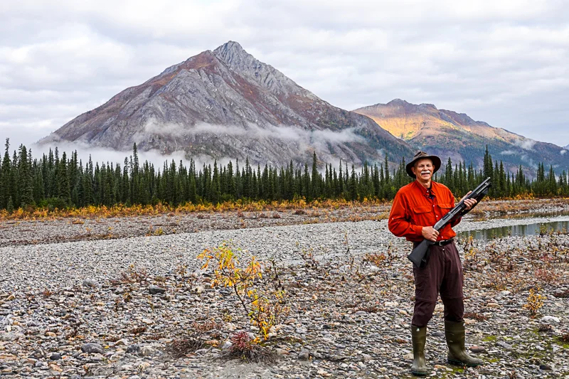
Vicky and I added a goal of going to all of the U.S. National Parks in 2017.  I suppose you could call this a “bucket list” item, but we don’t.  We just plan to go see them all.  We have now visited about half of them.  But visiting the two national parks in northern Alaska above the Arctic Circle with no roads to them, no facilities, no signs, no trails, no nothing but wilderness was our highest hurdle.  These two parks are the two least visited national parks.  But we have now been to both of them.

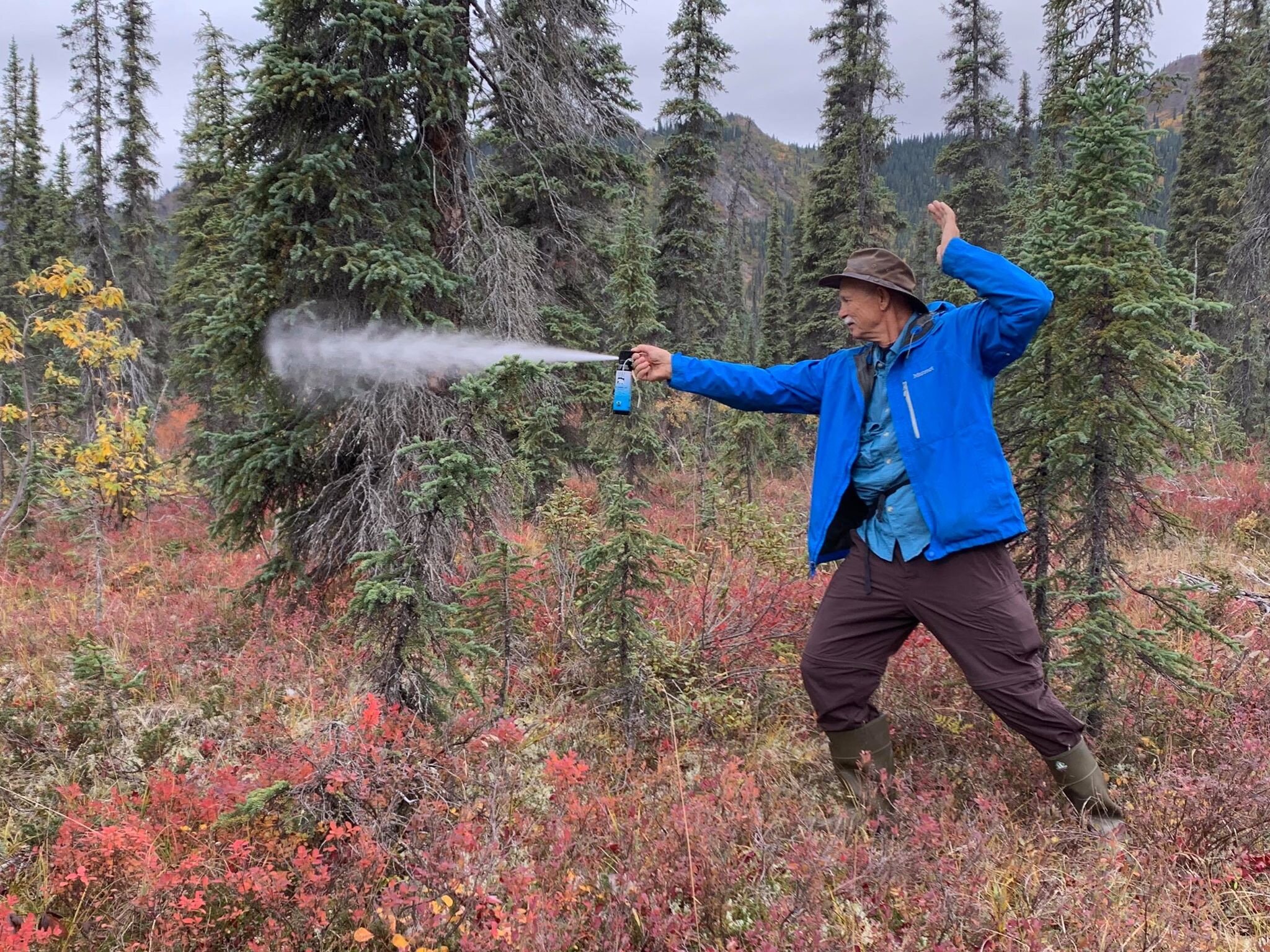
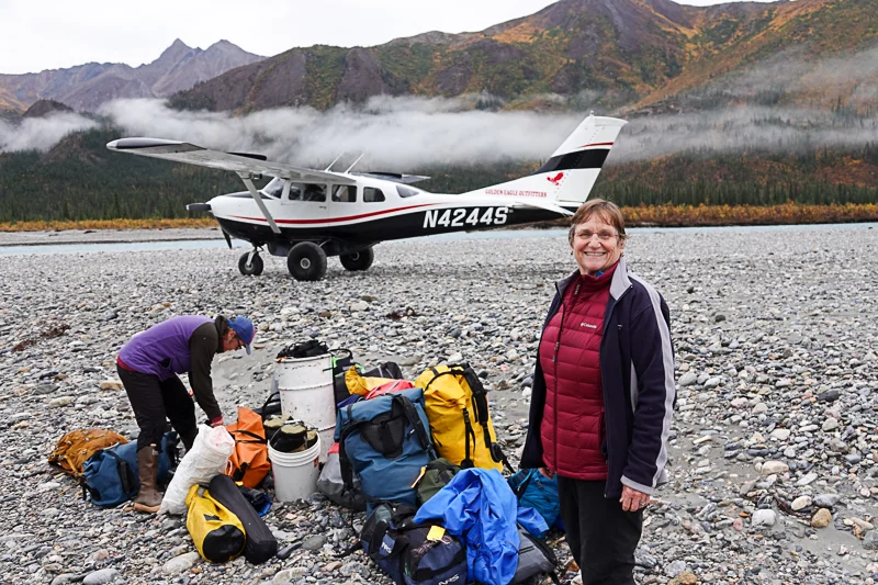
This trip was almost all above the Arctic Circle and included ten plane rides with five of those flights being in very small bush-wheeled planes.  As we landed in Kotzebue, our guide gave us the weather forecast which was rain for the next ten days.  But neither rain, clouds, fog nor mosquitoes kept us from having a great time in far northern Alaska.

In case you aren’t sure if you might be interested in this trip, I’ll include some photos to give you a small idea of what we experienced.

About the photos:

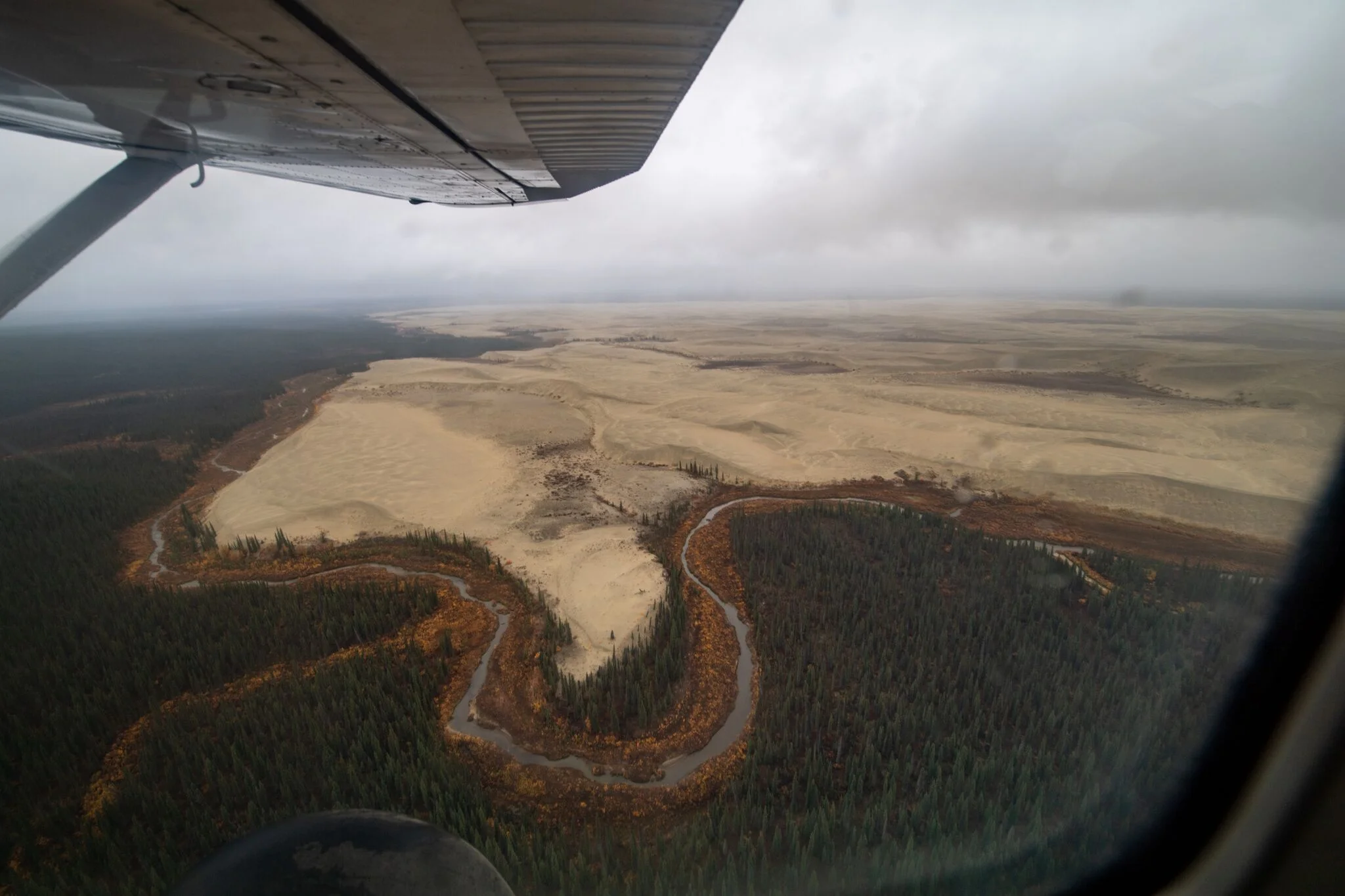
1.     This was flying into Gates of the Arctic National Park, from Kotzebue

001-DSC03709.jpg

2.     This looks out from our camp at Gates, along the Ambler River

002-DSC03823.jpg

3.     Was it really fun camping on sand dunes in Kobuk for three days?

003-DSC04555.jpg

4.     Seeing the Northern Lights was a bonus treat for us

004-I9ftijmQ.jpeg

5.     We had 105 polar bear sightings in Kaktovik, here are three of the bears

005-DSC05486.jpg


Anchorage to Kotzebue

Our Arctic Alaska Adventure included ten plane rides, mostly on very small planes.  Here were our flights:

1.     San Francisco to Anchorage

2.     Anchorage to Kotzebue (above the Arctic Circle)

3.     Kotzebue to Gates of the Arctic National Park

4.     Gates of the Arctic to Kobuk Valley National Park

5.     Kobuk Valley to Kotzebue

6.     Kotzebue to Cape Krusenstern National Monument

7.     Cape Krusenstern back to Kotzebue

8.     Kotzebue to Kaktovik (on the northern edge of Alaska)

9.     Kaktovik to Fairbanks (below the Arctic Circle)

10. Fairbanks to San Francisco

We all know that Alaska is a huge state.  Most people only visit the southern portion of Alaska.  So because we visited the far north and because so much more can be seen from the air, I expect to make quite a few posts from photos taken from our plane rides.  This will be the first of my aerial posts from this trip.

We spent most of this trip above the Arctic Circle.  The land consisted of arctic tundra, alpine tundra, boreal forest, and lots of permafrost ground.  I enjoyed seeing so many different biomes and plants.  I had to do some studying at the visitor centers that we visited to try and understand some of what we had seen on this trip.

These photos are from our commercial flight from Anchorage but as we were nearing Kotzebue, which is about 33 miles above the Arctic Circle.  I believe that we are seeing arctic tundra and permafrost ground.  Permafrost is ice mixed with soil and rock.  It can be from inches thick to thousands of feet thick.  At high latitudes, this layer can stay frozen at some point in the ground.  In summer, the top portion of the permafrost will melt but the frozen portion below will prevent the water from filtering into the ground.  This causes the water to pool on the surface creating boggy habitats and more lakes than you can count.  You can see this in the first three photos and especially in the third photo.  Aside from the rivers in the photos, I think this explains the rest of the surface water.

006-DSC03515.jpg
007-DSC03516.jpg
008-DSC03517.jpg

The next two photos are coming into Kotzebue, Alaska.  This is arctic tundra territory.

009-DSC03522.jpg
010-DSC03525.jpg

You can see most of where we went on the attached map.  Kotzebue is just above the arctic circle on the west coast.  Kaktovik is not on the map but it is on the northern coast in the Arctic National Wildlife Refuge about two-thirds of the way from Prudhoe Bay to Canada.  The two national parks, a national preserve and a national monument that we visited are there, in yellow.

alaska map.jpg

The last map is more specific regarding each place that we visited on this adventure.

73533136_10109952996467091_5386846921509830656_o.jpg

Kotzebue, Alaska

Kotzebue was the real starting point for our Arctic Adventure.  Kotzebue lies about 33 miles north of the Arctic Circle on a sand spit at the end of the Baldwin Peninsula.  Kotzebue Sound is where the Noatak, Kobuk, and Selawik rivers empty into the sea.  Kotzebue is on the west coast of Alaska and was a trading location for the native Alaskans for hundreds of years.

Kotzebue today has around 3,500 people with about 70% of them being Inupiat Eskimos.  It is in the Northwest Arctic Borough (an Alaskan borough is like California county) and is the borough seat and largest community of the borough as well as the economic and transportation hub of the borough.

You can see most of Kotzebue in the first photo, taken from a plane on one of our flights into Kotzebue.  We stayed in the Nullagvik Hotel which is the large blue and white building in the bottom center of the photo.

011-DSC04946.jpg

The next photo is from our hotel looking across town.  I thought that Kotzebue looked pretty good considering its location and the weather and transportation.

012-DSC03531.jpg

We had dinner one night at Little Louie’s.  One pizza was a Reindeer Pizza and was very tasty, as was the Chicken Bacon Ranch pizza.  No complaints about the meal as everything was very good.

013-DSC03573.jpg

The cemetery (below) was sort of in the middle of town and just there without any boundary lines or information.  I would have liked to know some history about it.

014-DSC03574.jpg

Our best visit in Kotzebue was probably the Northwest Arctic Heritage Center which is run by the National Park Service.  It also serves as the Visitor Center for Kobuk Valley National Park.  I included this photo instead of one from the front with a sign, just because it made something click for me about Alaskans.  I heard lots of complaints about federal rules and regulations from Alaskans.  I saw the signs for handicap parking and car pool parking but of course, the parking lot was empty.  We were there early Friday afternoon but there were only two other people in the center, also tourists.  We looked at all the displays and watched part of a movie.  The center included a lot about the cultural heritage of the region.

015-DSC04830.jpg

Kotzebue to Gates of the Arctic National Park

This was our flight from Kotzebue to Gates of the Arctic National Park.  We flew in two small bush-wheeled planes.  One plane had three seats and one had four seats and that included the pilot’s seat.  Andrew and April went in the three-seater and Vicky, Emilie (our guide), and I went in the four-seater, each of us with a pilot of course.  We flew with the Golden Eagle Outfitters.  I saw their logo at the hanger before we left – and hoped that we had made a good choice for our air taxi. (first photo)

016-DSC03687.jpg

Our flight took an hour and twenty minutes.  We flew at 2,000 feet high most of the time but higher when we had to clear some mountains in the Brooks Range.  We only had one major bump and drop on the trip, as we went through a mountain pass.  Other than that it was pretty mundane until time to land, but that comes later.  

I will include many photos of this flight as the scenery changed and we saw some remarkable sights on our flight.  I was surprised by much of the topography.  I thought that I would see more forests and I didn’t expect to see so much water.  

These first photos are between Kotzebue and Kobuk Valley. We are not yet to the higher mountains of the Brooks Range. Other than that, I cant say too much about these photos.

017-DSC03555.jpg
018-DSC03692.jpg
019-DSC03696.jpg
020-DSC03702.jpg

We had some rain during the flight and hence some rainbows as well. In the next photo, you can see Andrew and April literally flying over the rainbow as we progress into the Brooks Range mountains.

021-DSC03706.jpg

The degree of fall color was also a surprise to me.  As we progressed into the Brooks Range, the color was almost overwhelming at times, like in the next photo.

022-DSC03711.jpg

Scenery such as the next photo was fascinating though I am not sure about the technical classification, other than to guess it was mostly permafrost ground.

023-DSC03719.jpg

The rivers began to turn the colors of glacial melt and the trees began to distinguish themselves between evergreen and deciduous trees such as the next two photos.

024-DSC03723.jpg
025-DSC03726.jpg

The Brooks Range Mountains stretch across northern Alaska from west to east for about 700 miles and extend into Canada’s Yukon Territory.  The Brooks Range is some 126 million years old so these mountains are not steep and sharp but more rounded and smooth.  The highest peak is Mount Isto which is 8,976 feet high.

You can see some mountain photos in the first, second, and fourth photos below. The third photo below is a valley between some of these mountains.


026-DSC03733.jpg
027-V6ms_v7Q.jpeg
028-DSC03740.jpg
029-Xawm3idQ.jpeg

The last photo is the Ambler River and our pilot is looking for a place to land our plane.  While the scenery is beautiful, I was also curious about where we were going to land.

030-DSC03753.jpg

Landing in Gates of the Arctic

Our pilots made four or five passes over the braided Ambler River before deciding exactly where to attempt our landing.  I wasn’t worried but I will say that I was curious about it.  Our planes had big soft wheels but the gravel bars in the river didn’t look all that smooth to me.  Some of the river rocks were large enough for me to see how large they were from our plane.  Our plane landed first and my son Andrew took the first photo.  This is a good view of the ‘braided’ Ambler River and our landing location.

031a-_DSC53392 (202).jpg

If you look at the second photo, we landed coming from the direction in the photo.  We could only have cleared the stream by a few feet to start our landing.  The planes turned around by the time of this photo but the pilots were looking at their ‘runway’ and clearing rocks away for their departure.

031-DSC03759.jpg

For our part, we were really excited to be on the ground and in Gates of the Arctic National Park.  In the third photo, you can see some smiling faces. (my daughter-in-law, my son, and my wife)

032-DSC03761.jpg

We had to pack up all of our gear from the gravel bar and portage it to the hillside where we would make our camp.  I don’t know what our packs weighed but I was glad that it was going to be a short hike to our camp.

033-DSC03768.jpg

We only had to cross a small branch of the river.  It was shallow but the ground was very uneven, the water ice cold and flowing quickly.  Andrew thought it best to use hiking poles.

034-DSC03771.jpg

 We still had our smiles as we all crossed the creek to get to camp.

035-DSC03775.jpg

Setting up Camp

Our first order of business was actually to get prepared to deal with Grizzly Bears.  Our guide issued each of us a can of bear spray on a belt which we wore the entire time we were in both parks.  The can came on a belt which we put on over our pants.  I felt like a gunslinger from the old west.  First, however, she had each of us take a turn at spraying a can so that we would have a good idea of the distance and spread of the spray.  You can see Vicky taking her turn in the first photo and me in the second photo. Touche’.

036-DSC03779.jpg
74604684_521160735371842_5944213348726865920_n.jpg

Next for us was setting up our sleeping tents.  You can see our tent in the next photo.  Our tent is on the left and Andrew and April’s is on the right.  We placed our tents a good distance from the camp tent to be well away from all food and odors.

037-DSC03782.jpg

Our camp tent is in the next photo.  You can also get an idea of where we were camped.  This is taken from the gravel bar in the river.  Our sleeping tents are out of the photo to the right.  Our camp tent had the camp stove and food table and other assorted gear.  When it rained, we ate our meals inside the camp tent.

038-Nf_jZmoQ.jpeg

On a side note, our first hike was up the ridge that is on the left side of our camp in the above photo.

You can see our view from in front of the camp tent in the next photo.  You can also note that it was a short distance from where our planes landed. 

039-rdrZY11A.jpeg

All of the ground was permafrost.  The top was extremely soft and covered with mosses, lichens, liverworts, and all sorts of plants, and perhaps more than anything else, with blueberries.  Most of the red colored plants are blueberries which still had plenty of berries on them.  The point of the last photo is that my chair toppled over, due to the very soft ground.  But it was like landing on a twelve inch foam mattress, hence the smile on my face.

040-cwWHGXRg.jpeg

Hiking to a Ridge

We set up camp, ate lunch, and promptly went for our first hike.  Emilie, our guide, suggested that we hike up to a ridge that was just behind our camp.  She thought it would be perhaps a four hour hike.  We made the hike but we didn’t get as far as expected.  To give a brief quote from my journal, “We needed three machetes and three guys to swing them”.  But that wasn’t all.

There are no trails in these parks and the vegetation is dense.  The ground is boggy with mud holes and small streams.  We never found a single game trail to follow.  The ground itself was amazingly soft and had tussocks.  I would say that nearly the entire surface of the mountain was like a giant sponge or a foam mattress.  Our boots would sink down with each step somewhere between two and twelve inches.  So we were fighting the underbrush above and struggling with the ground below.  I would not call it unpleasant, just hard work.  For the most part, we each made our own trail as it was not feasible to try and follow each other.  Each step involved decisions and none of us ever made the same ones.

In the first photo, you can see our starting area.  It looked dense but not really too difficult.  I was not too far in front of Andrew when he took this photo but you can barely see my blue coat in the middle of the photo.  April was really in a nice opening in the second photo.

041-Ac39CMpQ.jpeg
042-4KKvpgPg.jpeg

The third photo is not a good photo but I have a story.  This is me taking a photo of my left boot.  Yes, it’s out of focus.  But you might be able to notice that my foot is about twelve to fifteen inches below the surface of the ground.  Our feet just disappeared into the ground each time we took a step.   

043-DSC03787.jpg

I happened to be behind April in the fourth photo.  We covered quite a bit of ground just like this.  We only generally knew which way we were going.  Shortly after this photo, I looked ahead and April was on the ground.  I didn’t see her fall but it happened to me several times.  A big branch would push back but my feet wouldn’t give and over I would go.  At any rate, I caught up to April and she just said, “I live here now; forward my mail”.  I understood.

044-DSC03792.jpg

The trekking got easier as we got up towards the rocky ridge.  But even then, as you can see in the last photo, it was still not easy hiking.  April and I were coming up but still working hard.

045-adnAOI3g.jpeg

Making the Ridge

It took us over an hour to reach the start of the lowest ridge and about two and a half hours to get up to where we had some great views.  I was so surprised that even most of the rock areas of the ridge and most of the down trees were also covered with several inches of mosses, lichens, liverworts and the like.  This was a wet, soft, spongy environment.  In the first photo, all the vegetative growth in the bottom of the photo is growing on top of the solid rock ridge.  You can see the ridge ahead and the steep north side doesn’t have vegetation but the rest does.

046-M5PBZ8SQ.jpeg

The second photo is looking back down to where we had hiked to get up to the ridge.  Of course, you can’t tell our exact routes that we took but it was through just such forest.

047-tdZszhAw.jpeg

You can see what two and a half hours of hiking got us in the third photo.  April is smiling and she earned that smile.  My understanding is that most hiking in this wilderness area is done either above tree line or along the rivers.  It is obvious why that is the case.  It’s just too much work and energy to hike through the brush with no trails.

048-EniosTuw.jpeg

Andrew took a nice photo of me as you can see in the fourth photo.  At that point, I was ready to sit and take a rest.  I was sitting right on the rock ridge and yet you can see that I was also sitting among plants, and most of them were blueberries.  Sitting was very easy as the ground made it seem like I was sitting on a pile of cushions.  

049-rW75_rdA.jpeg

The last photo is another great photo.  Andrew got me lagging behind the group.  I took a very different route to the higher ridge so I was a bit behind.  But I love this photo.  If you look straight down the ridge to the two highest evergreen trees standing up, we were camped right behind them, only right on the river.  Gates of the Arctic is a beautiful park.

050-u4ySMlQA.jpeg

Micro Landscape

I read stories about people hiking in Gates prior to our trip there.  Many of the stories that people told focused on how hard it was to hike and that they could only hike maybe six miles a day through the boreal forest and tundra.  Those stories emphasized “that there were no trails” but they never really said why it was so hard to hike here.  They never discussed the forest floor.  From my perspective, less distance was more fascinating in Gates.  I felt like the slower I hiked, the more I enjoyed it and the more I got to see of it.

There was a lot of beauty in this park but we didn’t have to hike any great distances to see it.  All we needed to do was to hike slowly and look down at the ground.  It’s hard to explain so of course, I will include some photos.  The ground was covered with plants to a depth of from several inches to over a foot of soft spongy ground.  But it was so beautiful.  The colors and textures and the vast array of plants was almost overwhelming to me.  And remember, this is above the Arctic Circle…where I thought everything was usually frozen. 

These photos were all taken looking down at the ground.  I may have squatted down a bit to get a few of them, but mostly I just aimed the camera down and snapped the picture.

Just go slowly through the photos, closely looking at each one, and enjoy the ground-cover in Gates of the Arctic National Park.  It felt sacrilegious to step on the ground.

051-DSC03859.jpg
052-DSC03844.jpg
053-nFl31sNg.jpeg
054-DSC03856.jpg
055-DSC03860.jpg
056-DSC03928.jpg
057-DSC03853.jpg
058-DSC03845.jpg
059-DSC03952.jpg
060-DSC03858.jpg

Animal Evidence

Why ‘animal evidence’ and not animal photos?  Because we never saw a mammal in the parks until our last lunch and then we only saw one red squirrel.  So basically we saw no mammals.  My guess is that the park is so large (bigger than Belgium) and surrounded by even larger wilderness areas that the animals just detected us and went the other way.  I expect that they just steered away from us because they could.  We only saw a handful of birds like three crows, a ruffed grouse, and a grey jay.  No, the two national parks were not animal excursions.

But, we did see plenty of evidence that there are animals here and that there were some here recently.  We saw evidence of bears, caribou, moose, and Dall sheep.

April found what looks to me like a leg bone in the first photo.  All of our sightings were in areas of the river and the least dense forest.

061-DSC03881.jpg

The second photo is a caribou track and we had the ability to check on them with our reference materials.  That looks like a very large caribou.

062-DSC03872.jpg

A series of bear paw prints is in the third photo.  The fourth photo is a single bear paw print.  These look to be reasonably large bear prints but it’s hard to say for sure.  It’s good that the bears might have been large because that would mean that they were not cubs which means that Mama bear might not be so aggressive with no cubs around. 

063-Ti7MVDPg.jpeg
064-DSC03977.jpg

The last photo is just a horn that was lying about.  We saw a number of antlers on the ground on our hikes.

065-DSC03999.jpg

Hanging Out Time

What did we do in our free time?  You must remember that the days are very long in summer above the Arctic Circle.  Daylight is most of the day.  It never really got completely dark.  That gave us plenty of time to hike, eat, and then do whatever we felt like doing.  Here’s a few photos of us on our free time.

Picking blueberries was one of my favorite things to do and we were completely surrounded by blueberry plants.  We would have survived until everything froze just from the blueberries.

066-DSC04025.jpg

Andrew is skipping rocks in the Ambler River in the second photo.  We had plenty of flat rocks to choose from.

067-DSC03923.jpg

We really enjoyed our evening campfires in Gates.  Yes, it’s evening even though it’s still very light out.  We had to have our fires out on the gravel spit so we had to keep our big rubber boots on to cross the creek.  But there was plenty of driftwood out there so no shortage of fire wood.  We would read, sing, play games, and I even read some Robert Service poems.

068-DSC03832.jpg

Our weather forecast upon arrival was ten straight days of rain.  It rained every day but usually some very minimal amount of rain each time.  But when it did rain and we were in camp, then we just went inside our camp tent and waited out the rain, like in the fourth photo.  The game is Bananagrams.

069-DSC03995.jpg

Vicky is sketching in the last photo.  She managed to sketch on multiple occasions this trip.

070-Mx8u1b-w.jpeg

Camp Meals

We ate quite well when we were out camping in the parks.  Emilie, our guide, did all the cooking and she made some excellent meals.  I think cooking is one of her specialties.

Our first breakfast in Gates is in the first photo.  We had Kodiak pancakes with blueberries and raspberries baked inside and yogurt, maple syrup, and pecans on top.  We also had fresh coffee, bacon, and grapes.

071-DSC03835.jpg

Lunch on our second day was out on the gravel spit during our long hike that day.  We had dark chocolate, smoked salmon, dried mango, cashews, chocolate balls, Gouda cheese, crackers, creme cheese, and chocolate bark.  I commend Emilie for providing such a balanced meal which really helped keep up my energy level.

072-DSC03887.jpg

Our second breakfast in Gates is in the third photo.  We had bagels, salmon, yogurt, blueberries, grapes, and fresh coffee.

073-IMG_8240.jpg

Breakfast in Kobuk Valley is in the fourth photo.  We had croissant French toast which was stuffed with cream cheese and covered with raspberry sauce, plus bacon and coffee.

z-DSC04422.jpg

It was raining harder than usual at lunch time on our last day in Kobuk Valley.  I suggested we hike into the woods to get some protection from the trees.  We did that and ate in a beautiful and densely carpeted place that looked like some leprechauns must be living there.

075-DSC04569.jpg

Why no photos of our dinners?  Good question.  I guess I was just too hungry and too tired by dinner to think about taking photos.  But our dinners were very good.

Q & A on Gates of the Arctic NP

I’ve been asked most of these questions more than once about Gates of the Arctic NP, so I will post the questions and answers for all.

Questions

1.     Were Mosquitoes a problem?

Answer: yes and no.  Yes, there were a lot of mosquitoes and we had to swat them away sometimes and hit them on our arms and hands.

But NO, not one of us ever got a single mosquito bite, so we really couldn’t complain about them.  We also encountered quite a few small gnats. Remember, this trip was in September.

ON a Side Note: ‘Caribou Trails’ newspaper which we read in Alaska had some interesting bits on caribou.  Amongst them were that scientists estimate that Alaska has 950,000 caribou weighing 230 million pounds.  They also estimate that Alaska had 17 trillion mosquitoes weighing 96 million pounds.  They said that caribou can lose 4.4 pounds of blood to mosquitoes each year.  Luckily, we didn’t lose any blood to mosquitoes.

2.     Did you Fish and were there lots of fish in the river?

Answer: no and no.  We decided that we did not have enough time to fish since we planned to hike and take thousands of photographs.

And no, we never saw any fish in the rivers or streams and the water was crystal clear.  I’m not sure why we never saw any fish in the rivers.

I know that Alaska has tons of fish, but again, we were north of the Arctic Circle.  Most fishing in Alaska that I hear about is in southern Alaska.

3.     Was the Boreal Forest really hard to walk in or are you just old?

Answer: Yes, the boreal forest was really hard to walk in (Gordon) due to soft spongy ground, dense undergrowth, and no trails.

And there wasn’t another 69 year old in the wilderness that could keep up with me.

4.     Was it really cold?

Answer: no, it really wasn’t cold.  Daytime highs were about 55 degrees F and night-time lows were in the mid to high 40’s.  It was warm for September in the Arctic.  We were told that we were really lucky with the warm weather.  And even when it rained, we never got very wet and never got cold.  We were well prepared for this trip.  At night, I never did get inside my sleeping bag, I just more or less used my sleeping bag as a blanket.  But we slept in our tents as it rained quite a bit at night.

5.     How often and how much did it rain?

Answer: It rained every day but never very much.  From my journal at the end of the first day, “it rained about ten times today but I probably only got 87 drops of rain on me”.  That was an exaggeration, but not by much.  Most of the real rain was at night.  During the day, it was usually just extremely light rain for short periods of time.  The rain never changed our schedule or kept us from doing anything that we wanted to do, like hikes.


Hiking the River Channel

Our big hike on our second day in Gates was along the river channel.  It was so much easier hiking on the gravel bars and we still got great views.  We also discovered different things than we found up the side of the mountain.  This hike was almost five hours long and we ate lunch while on our hike.

We hiked in a northeast direction and we only hiked on the mountainside a short distance before we entered the river.  You can see where we started on the river in the first photo.  From here, we hiked clear down to the other end of this valley to where you see the two mountains come down to the valley.

076-DSC03866.jpg

It may not look like it was too exciting hiking in the river channel, but it was.  The second and third photos give you an idea of our views but there were lots more.  We saw quite a few animal tracks in the sand including bear, moose, and caribou.  The rocks were also great to see as we walked and we found jade, serpentine, agate, quartz, and many more.  The weather was also always changing as you can see in the first two photos, not taken very long apart.  We also had to wear our rubber boots as we were regularly crossing streams in the braided Ambler River.  You can see where we ate our lunch in the fourth photo.

077-foG5GDHQ.jpeg
078-DSC03861.jpg
078-IMG_8227.jpg

Each of us wandered our own path along the river.  Sometimes I would look around, like in the fifth photo, and discover that I was on the other side of the river braid from Vicky, Andrew, and April.  That came with spending lots of time looking down at the ground for rocks, plants, prints, and scat. 

079-DSC03894.jpg

If you go back to the first photo and look down to the other end of the valley, the last photo is taken from that point at the far end of the valley.  The river turns the corner and goes to the left.  It looks very similar down there and into the next canyon.  Because the river turns sharply at that point, multiple braids of the river come together.  You can actually see this in the water as you can discern the different colors of the different streams.  I still think that the color of the streams was perhaps my favorite physical attribute of Gates.

080-DSC03909.jpg

Up Mount Bosworth

We asked our guide several times what a certain mountain that we saw was named.  She told us that most of the mountains in Gates of the Arctic do not have names.  We fixed that problem for one mountain.  Vicky had not joined us for our hike the first day and we wanted her to experience climbing in the boreal forest in Gates.  So at the end of the river valley, we turned to our left and hiked up the hillside.  The brush there was not nearly so dense but it was still work for us.  There was still plenty of brush and the ground was still mostly very soft and spongy.

You can see Vicky starting up the hillside from the river in the first photo.  Again, most of the low red bushes are blueberries.

081-DSC03945.jpg

April and Andrew were following us up the mountain in the second photo.

082-DSC03937.jpg

On this ridge, we actually hit some areas that were largely rock and not so completely covered with plants.  You can see this in the third photo.

083-DSC03961.jpg

Vicky is nearing the summit of Mount Bosworth in the fourth photo.

084-DSC03949.jpg

April was the one who actually had the idea to name this low mountain Mount Bosworth.  In the fifth photo, April is celebrating having summited Mount Bosworth.  And yes, the ground there was super soft and spongy so very comfortable for lying down.  Andrew is in the sixth photo, sitting on the pinnacle of Mount Bosworth and enjoying the view.

084-Vqc7zl7g.jpeg
084-73390739_666183563905776_8997850970658439168_n.jpg

We took a different route coming down from Mount Bosworth but again, coming down was always much easier because we could better see which direction had less brush.

085-DSC03963.jpg

More Micro Photos

Once again, the ground that we crossed over on our hike up to Mount Bosworth was stunning.  We all spent quite a bit of time just looking down at our feet and the ground beneath us.

The first photo is not straight down but outwards a bit.  The colors and textures in such a small area never ceased to impress me.

086-DSC03917.jpg

The second photo is a micro photo.  The plant in the center would fit easily in the palm of my hand.  But again, the intricate colors and textures…

087-oY2i4Oeg.jpeg

I took the third photo because this is actually a few down trees.  You can still see a few bits of the tree’s bark.  But the trees are being overrun and covered by the plants.

088-DSC04014.jpg

Another down tree is in the fourth photo.  I’m not sure what those plants are but I was impressed with them.  You can see that this trunk will eventually disappear from sight as well.

089-DSC04015.jpg

One more time in the fifth photo.  I saw April’s boot disappear into the ground and asked her to stop while I took this photo.  She took a step and the ground just swallowed up her foot.  The ground was not very wet so our boots never got muddy.  It was just soft and spongy.  Our boots didn’t disappear into the ground on most steps but it was not unusual either.  Most of the time, our boots went down just a few inches but we could still see them. 

090a-DSC03789.jpg

The green stuff in the last photo was quite intriguing.  This is a small area but not a super micro photo. 

090-DSC03791.jpg

Hiking Back to Camp

This was our hike from Mount Bosworth back to our camp.  We wandered along in the forest on the side of the mountain for about half the distance before finally going back down into the river.  We were always looking to discover something new. 

I saw the cave opening in the first photo as we were still about halfway up the mountain.  It looked like a perfect resting place for a bear.  I didn’t stay long enough to find out.

091-DSC03970.jpg

We saw a large open area from high up the mountain on our hike the first day.  It was north of our camp so on our way back this day, I decided to go inland and investigate it to see just why there was such a large meadow-like area within the boreal forest.  It was not really like a meadow.  It was all permafrost ground that had heaved over and over.  The ground was tussocks and holes.  It looks reasonably flat in the photo, from the length of the summer grass.  But it is all holes and mounds.  If you look closely, I look to be about five feet tall.  That’s because I’m actually standing on the bottom of the ground and not on the tussocks or raised portions.  My feet are down below the grasses in the photo.

092-5A_z-b7g.jpeg

It started to rain rather heavy so we headed back to the river.  We just bundled up and hiked back to camp.  You can see us making our way in the third photo.

093-DSC03986.jpg

Andrew looks to be defying the rain to try and discourage him in the fourth photo.  It looks like another John Muir moment.  We had quite a few of those on this trip.

094-DSC03987.jpg

The last photo is where we left the river for the forest to make our way back to camp.  I was amazed that in the rain and fog and overcast, the rivers still looked very blue.

095-DSC03989.jpg

Leaving Gates

After two nights in Gates of the Arctic National Park, it was time for us to leave.  Our guide called the hanger by satellite phone and our planes were slightly delayed due to the rain and clouds.  But we ate breakfast and broke down our camp in preparation for leaving.  We got lucky in that it had started raining the prior afternoon and rained throughout most of the night, but the rain stopped and the sky lightened up as we were preparing to depart.

I’m packed up and heading for the gravel bar in the first photo.  I hated to leave all those blueberry plants next to our tent which is most of the low red plants in the photo.

096-DSC04032.jpg

We were smiling when we got to Gates and we were still smiling when we left Gates as you can see in the second photo.

097-DSC04033.jpg

Emilie, our guide, asked us to help “clear the runway” before the planes arrived.  You can see me clearing the runway in the third photo.  The runway was between Andrew, April, and myself.

098-DSC04035.jpg

One of our planes is coming in and just clearing the Ambler River in the fourth photo. 

099-DSC04041.jpg

We had a great time in Gates but we were ready to move on to the next leg of our adventure.

100-DSC04046.jpg

Noatak National Preserve

Our flight was supposed to be from Gates of the Arctic to Kobuk Valley National Park.  But we had a problem.  Not long after we departed from Gates, Emilie realized that she had forgotten to retrieve our water filter.  It was hanging in a tree by the river and she just hadn’t packed it.  She said that we needed to go back for it but that our pilot did not want to land there again, especially with all the added weight.  I asked what that meant.  She said that the pilot suggested dropping us off in the Noatak National Preserve because he knew of a much better landing place there.

The Noatak National Preserve is perhaps the United States last remaining complete river system that has not been altered by human activity.  It is 6.5 million acres or 10,265 square miles.  It borders both Gates of the Arctic NP and Kobuk Valley NP, which is why we were flying over it.  It has Grizzly bears, black bears, wolf packs, moose, caribou, and a fabulous river system.  Noatak has no roads or buildings or anything else.  It’s another huge wilderness area.

I told Emilie to go ahead and drop us off.  She said that it would probably only take about twenty minutes or so for them to go back to Gates and retrieve the water filter and come back and pick us up.  I told her that we would be fine.  Of course, I said in an earlier blog that we made ten flights on this trip, but with this one, Vicky and I actually made eleven flights.

Upon learning that we were to be dropped off, I began looking for our landing site.  You can see in the first photo that it didn’t look much different from looking for our previous landing spot.

101-DSC04058.jpg

Vicky and I are in Noatak in the second photo and watching our plane take off without us.

102-DSC04061.jpg

We walked around and found some interesting things, such as a probable bear print in the sand which you can see in the third photo.  It looked pretty big to me.

103-DSC04070.jpg

When we got dropped off, the bear spray had already been packed for our flight.  The shotgun however was readily accessible.  Emilie asked me if I would feel comfortable taking the shotgun, just in case we needed it for protection.  I said sure and she handed it to me.  I planned to keep the shotgun in its case but after seeing the bear print, I decided that I would rather inspect the shotgun for functionality at my leisure rather than with a grizzly bearing down on me.  I was ready for anything.

104-DSC04065.jpg

You can see our plane coming back to pick us up in the last photo.  We enjoyed our short visit to the Noatak wilderness area.  Then it was on to Kobuk Valley National Park.

105-DSC04073.jpg

On an aside, we at least knew what was happening and had some protection.  Andrew and April got dropped off in Kobuk Valley and their pilot took off.  They expected us to land within a couple of minutes.  So they had the same alone time as we did, only they had no idea what had happened to us.  Plus, they didn’t even have any food or protection.  I think I prefer what happened to Vicky and me.

Noatak to Kobuk Valley National Park

Once we got picked back up in Noatak, we continued on with our flight to Kobuk Valley National Park, our next stop.  Our flight had some clouds and rain but we also had some beautiful views.  This flight was only about 45 minutes long.  These are just airplane photos from our flight.

I would guess that at least the first two photos are over the Noatak National Preserve.

106-DSC04088.jpg
107-DSC04094.jpg

The next two are either over Noatak or over Kobuk Valley.

108-DSC04107.jpg
109-DSC04111.jpg

The fifth and sixth photos are some of the sand dunes in Kobuk Valley National Park as we approached our landing site.   

110-pEi2Z1Yg.jpeg
110-DSC04118.jpg

The last photo is just one of Andrew and April, who were very relieved to see us arrive in Kobuk Valley.

111-DSC04126.jpg