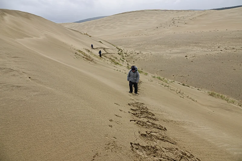
Setting up Camp in Kobuk Valley NP

Kobuk Valley National Park, along with Gates of the Arctic, are the least visited national parks.  Kobuk Valley is larger than the state of Delaware.  The park itself is over 1,750,000 acres.  The Kobuk Sand Dunes are a small part of the park and cover about thirty square miles.  The sand dunes are a relic of the last Ice Age and are located on the southern bank of the Kobuk River.  So while the dunes are not necessarily typical of the park as a whole, it was nonetheless the part that we wanted to visit.  The sand dunes are surrounded by boreal forest, much like we camped in at Gates of the Arctic NP.

We set up camp in Kobuk Valley the same as in Gates except that everything was sand and we didn’t have to cross a stream to do it.  Flat ground was easy to come by but we still had to pack our baggage a short distance from where we landed.  I suppose that it was about forty yards or so from our landing site to our camp tent and that much again to our sleeping tents.  You can see us packing the short distance in the first photo.

111-DSC04132.jpg

Andrew and April had their tent near ours and you can see them after setup in the second photo.  I chose the third photo to be at a distance on purpose.  It gives a better understanding of our situation on the dunes.  Our sleeping tents are on the left.  Our camp tent is the larger tent to the right.

112-DSC04135.jpg
113-71543906_10109709359133261_883412225178468352_o.jpg

Photos may make things look warm with all the sand but it was about the same temperature as in Gates except that there was nothing to block the wind. 

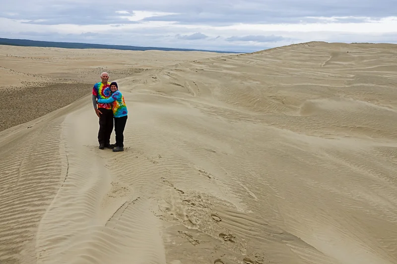
I’m enjoying a cup of coffee the next morning and Andrew and April are up and about in the following photo.  We were bundled up pretty well during breezy times.

114-DSC04408.jpg
115-DSC04419.jpg

On a side note, if you look just to the left of me or A&A in the photos and on the right side of the camp tent, you can see a white metal barrel.  That’s where we kept all the food.  It was completely bear proof.

Our First Kobuk Valley Hike

After setting up camp, it started to rain so we ate our lunch inside the camp tent.  As we finished lunch, the rain stopped and we started off on our first hike in Kobuk Valley.  We hiked for over three hours and had a great time. 

It was a short distance to the river so we walked there to start our hike.  You can see April and the river and notice that the sun had already come out.  Changing weather was a constant in the parks.

116-DSC04150.jpg

We walked along the creek to the point of the second photo.  At that point, the creek turned away from us and we turned inward towards the vast spaces of the sand dunes.

117-DSC04168.jpg

I believe that this creek is called Ahnewetut Creek.  It was a small creek with one part of the channel being somewhat deeper than the rest, like maybe a foot deep.

You can see that there was no right or wrong way to go on these hikes.  We just followed our noses and sometimes aimed at something that we thought might be interesting to see.

118-DSC04246.jpg

You might also be able to notice that as the afternoon progressed, we began to take off some of our layers of clothing.

119-DSC04281.jpg
120-DSC04297.jpg

Wolf Tracking

Emilie, our guide, caught up to us at some point on our first hike and asked if we had noticed the wolf tracks that we had just passed.  We hadn’t but we went back the short distance to see them.

You can see some of the first prints in the first photo.  You can also see the size of the wolf’s paw print in the second photo alongside of Vicky’s hand.  I would judge it to be a big wolf from its print.

121-72700844_10109709356438661_4658162533847269376_o.jpg
122-DSC04218.jpg

We decided to follow the wolf on the hope of getting to see it.  You can see the trail in the third photo and it was not hard to follow.  We followed this wolf for probably a mile and a half to two miles, maybe further.  At some point, we saw a second set of wolf prints and we followed that wolf for some time as well.  It was actually somewhat exciting.  As we cleared each rise in the sand, we would look out with the hope of seeing the wolf, though we never did see the wolf. It wasn’t hard but it was fun to do the tracking.

123-IMG_8262.jpg

Andrew is tracking in the fourth photo and the whole group is going down the dune in the last photo, hot on the wolf’s trail.

124-DSC04231.jpg
125-DSC04228.jpg

We eventually gave up on catching up with the wolf and moved on to more interesting things that we were passing.

Wind Blown Sand Art

Should anyone think that it must have been dull to walk over so much sand, they would be wrong.  The wind was almost a constant in Kobuk Valley on the sand dunes.  The wind was therefore constantly creating art in the sand.  You can probably notice some wind-blown sand art in almost every photo from the dunes.  I’m just going to include this one post specifically highlighting the wind-blown sand art.  There will be lots more but just as part of showing other things from our stay here.

Just like in Gates of the Arctic NP, we found that it was much better to walk slowly in Kobuk Valley.  The sand, the plants, the animal tracks, and the views, they were all highlighted by a slower pace.

The first photo was truly a dramatic look at what the sand and wind create in this park.  We saw plenty of such art on our walks.

126-72670890_10109709357721091_7794629282982002688_o.jpg

On a fairly flat section of the sand, the second photo struck me as a real work of art.  It’s not a black and white photo but it somewhat looks like it.

127-DSC04455.jpg

The third photo is a real WOW photo, which usually means that it’s one of Andrew’s photos, and it is.

128-72062092_10109709357107321_2129860125874192384_o.jpg

We walked a lot of ridges in the park and they were usually dramatically contrasted, from one side of the ridge to the other like in the fourth photo.

129-71829370_10109709352930691_3011947911987593216_o.jpg

Plants got into the art world along with the sand and wind as you can see in the last photo.

130-DSC04649.jpg

Sand Dune Sliding

Sand dune sliding was definitely the most fun that we had in Kobuk Valley.  We didn’t slide down all the dunes but we probably slid down at least six or eight. It was not as exciting as it might have been if we had brought something to slide on to make the ride faster.  We mostly slid on our bodies but we tried other techniques as well.  It was an added bonus to this trip to be able to act like I was ten years old again.

April is in the first photo and conducting a very traditional butt slide down the face of the dune.

131-DSC04322.jpg

Andrew is doing a head-first chest dive down the dune.  That actually worked quite well for him. He got up good speed and generally made it all the way to the bottom in one slide.

132-DSC04327.jpg

Vicky is near the end of her slide in the third photo.  I included this to try and give a sense of how high the dunes and how far the slide.

133-DSC04334.jpg

I’m doing the full stride gallop in the fourth photo, which I like to refer to as the ‘no sand down the pants’ method.

134-72704389_10109709358190151_5450767657055813632_o.jpg

I’m not sure what to call the last photo: buttocks art?

135-DSC04336.jpg

Wildlife Evidence

Once again, we saw almost no wildlife, as in mammals in Kobuk Valley National Park.  We saw a few birds but mostly we just saw lots of evidence that wildlife abounded in this park.  The sand dunes are surrounded by the same boreal forest that we encountered in Gates of the Arctic.  So it makes sense that an animal that was walking to or from an area and could cross the sand, it would be much easier walking and take them much less energy.  You already saw the wolf prints, which was our major sighting.

Bear scat is in the first photo.  It was not super fresh but not too old either.  We encountered this in the river area.

136-DSC04592.jpg

Moose scat is in the second photo.  We saw much more moose evidence and it too was mostly in the river areas.

137-DSC04593.jpg

We found lots of bones scattered across the dunes, like the one in the third photo.

138-DSC04678.jpg

Wolf scat is in the fourth photo.

139-DSC04193.jpg

Dall sheep is the smallish scat in the fifth photo and it was scattered all across the dunes.  By sightings and volume, Dall sheep must be here in the largest numbers.

139-DSC04399.jpg

Our lone mammal sighting is in the last photo.  Can you find it?  This was after lunch in the boreal forest during a rainstorm.  It’s a red squirrel.

140-72703588_10109709354377791_685342167576608768_o.jpg

Flowers and Colors

Standing and looking out over the sand dunes, there did not appear to be any color, except along the river.  But by walking slowly, we discovered flowers and colors.  This was a surprise as I never expected to find flowers growing in the sand dunes in September in the Arctic.  I was also surprised by some of the colors of small plants growing in the dunes.  These are some examples by way of some micro photos.

The flower in the first photo was one of my first discoveries on our very first hike.  It made me aware that there was lots more to these sand dunes than meets the eye.

141-DSC04163.jpg

The red and purple grasses and low growing plants were not in abundance but not rare either.  I loved both colors.

142-DSC04175.jpg

I don’t know if the flower or the broad-leafed plant surprised me more but again, flowers in September in the sand dunes of the Arctic.

143-DSC04202.jpg

The reddish plant in the fourth photo was a plant that had turned color with the fall, or at least that would be my guess.

144-DSC04464.jpg

There isn’t much left of the flower in the last photo but I’m sure in was a beauty.

145-DSC04611.jpg

Second Big Kobuk Hike

Our second day in Kobuk Valley had us taking a very long hike.  We hiked from 10:30 am to 4:00 pm.  We hiked about 8.5 miles and over 21,000 steps.  Our initial goal was to hike to the highest sand dune in the whole of the Kobuk Sand Dunes.  Our guide told us about it and steered us in the right direction.  But over the course of the day, we reached the tops of many dunes and slid down a bunch of them as well.  It was a great hike with wildly changing weather and incredible skies.

The first photo is near our camp and the highest dune is out of the picture to the right.  I have another reason for showing you this photo.  If you look at this first photo, it looks like a beautiful morning, which it was.  But right after snapping the first photo, I took a couple of steps forward and snapped the second photo.  I zoomed in on the top of the dune ridge when I had the dark mountain fully in the background.  The first photo gives very little indication of how much the wind was blowing and how much sand the wind was picking up and sending airborne.  Our time in the Kobuk Valley sand dunes was great but I generally felt a bit ‘sandy’ while we were there. 

146-DSC04427.jpg
147-DSC04428.jpg

You can see in the third photo that we didn’t slide down all the dunes.  We hiked up and down dunes all day that day. 

148-DSC04444.jpg

We had to cross the Ahnewetut Creek to get to the tallest dune.  The creek was not hard to cross.  It was mostly just a few inches except for the deepest channel which was about a foot deep.  The water was quite cold.

149-72952189_10109709351049461_2453324833174323200_o.jpg

It was really beautiful with all the fall color along the creek and later in the boreal forest.

150-DSC04482.jpg

Up to the Peak

Hiking away from the creek was still a nice color hike for a short while.  The fall color in the dunes just struck me as unusual but I really enjoyed it.

151-DSC04487.jpg

You can see how far from the creek we have come in the second photo.  We decided to hike straight up the ridge line.

152-DSC04505.jpg

By the time of the third photo, it just seemed like the dunes needed an injection of color.  We couldn’t compete with the fall colors but we gave it the old college try.

153-DSC04516.jpg

We are standing on top of the highest dune in the fourth photo.  Looking around, it wasn’t very much higher than a lot of other dunes.

154-72074137_10109709353334881_4801476938155687936_o.jpg

Hiking down, we figured we could take the slow way or the fast way.  Yep, we took the fast way.  Andrew eventually caught up and passed April with his belly slide technique.

155-DSC04546.jpg

Heavy Rain and Lunch

After sliding off the highest dune, it started to rain.  It started raining lightly but then it just kept increasing.  It happened to be lunch time, so we had a decision to make.  I said that we should hike into the boreal forest and try and get some relief from the trees to block the rain.  That’s what we did and it was a great stop for us.

We are entering the forest in the first two photos.  The color was again remarkable.  I kept going until I got to an area of larger trees with some canopy to block the rain.

156-DSC04566.jpg
157-DSC04573.jpg

We stopped at the place in the third photo and ate our lunch.  The forest floor was like a giant sponge but really not wet, just deep and soft.

158-DSC04570.jpg

The last two photos are on our way back out of the forest after lunch and after the rain stopped.

159-DSC04565.jpg
160-DSC04578.jpg

Hiking On

We opted to hike back across the creek to continue on our afternoon of hiking.  We were soon past the fall color brush and back onto the big open sand areas.

161-DSC04597.jpg
162-DSC04604.jpg

I stayed near the creek to take a few more photos and had to catch up.  In a very short time, I was quite a ways behind the group.  You can see Andrew in the third photo down in the dune canyon.

163-DSC03562.jpg

I felt like I needed to include the fourth photo, just to show that we had to hike up lots of dunes too.  There was no way to easily get to the tops.

164-DSC04663.jpg

Thanks to Emilie, our guide, we had snacks so we stopped to rest and refresh a bit in the last photo.

165-DSC04656.jpg

More Dune Sliding

I didn’t keep track of how many dunes we slid down but it was probably six to eight times.  I know that I didn’t get tired of it, though hiking up the dunes was a chore sometimes.

We liked this dune so much that we hiked up twice and slid down it twice.  It was steep and fast sliding.

Vicky must have taken these photos.  I think she felt like she had hiked up enough dunes for one day.

166-DSC04626.jpg

Each of us had our dune technique, which we changed occasionally.  April got going surprisingly well for a butt slide.  Andrew always topped out with speed on his chest dive.  I was just happy running wild and crazy.

167-DSC04629.jpg
168-DSC04633.jpg
169-DSC04636.jpg

After it was all over, two slides that is, you can see the results.  They include some slide changes during a run and some flopping and falling if you know how to read the sand. 

170-DSC04642.jpg

Lest anyone worry that we scarred the dunes this way, the wind would wipe our tracks away in a day if not less.

Kobuk Valley NP to Kotzebue flight

Our planes were scheduled to pick us up in Kobuk Valley at 9:00 am.  Andrew’s and April’s plane got there about 9:45 am.  Our plane didn’t arrive until 10:30 am.  The weather was stormy and raining lightly and we spent the time waiting in our camp tent.  As we finally climbed into our plane and before takeoff, I got out my camera.  Our pilot, a rather opinionated fellow and pretty sure he was always right, told me to put my camera away.  He said the weather was bad and I wouldn’t be getting any photos this trip.  I didn't put my camera away and he told me two more times to put it down that I was just wasting my time.

As Vicky, or anyone else who knows me can tell you, I didn’t follow his orders and put my camera down.  I kept my camera handy and kept a sharp eye out during our flight. 

You can see the results of my camera work during this flight from Kobuk Valley back to Kotzebue.  I also got plenty of rainbow photos but chose these for the different looking landscapes that we passed.

Leaving Kobuk Valley National Park

Leaving Kobuk Valley National Park

172-DSC04719.jpg
173-DSC04761.jpg
174-DSC04777.jpg
175-DSC04817.jpg

Cape Krusenstern National Monument

By the time that Vicky and I had gotten back to Kotzebue from Kobuk Valley, Andrew had already booked us for a flight to the Cape Krusenstern National Monument.  Cape Krusenstern is another undeveloped wilderness area north of Kotzebue on the Chukchi Sea.  It’s got lots of coastline, large lagoons, narrow ponds, sandy and gravelly ridges, and a region of permafrost with only low growing plants and shrubs.

This area is also an archaeological preserve with evidence of perhaps as many as 9,000 years of human habitation.

This was another Golden Eagle Outfitters flight but this flight only took about twenty minutes.  We took the same two planes that we took to and back from the parks with the same pilots.

176-73539252_2609313139355380_2567073172243349504_n.jpg

Our short flight still provided some interesting aerial views.  You can see some ‘Icy Polygons’ in the second photo.  These are linked ice wedges that create geometric patterns on the tundra.  The Arctic continued to fascinate us.

177-GRsY2ZhA.jpeg

Our landing strip was very near the coast and the plants were very small and short but as we walked inland the plants got taller and woodier as you can see in the third photo.  

178-DSC04876.jpg

The ground looked relatively flat but it actually fluctuated up and down by several feet.  We crossed small streams and boggy areas like where April is in the fourth photo. 

179a-DSC04875.jpg

We didn’t find any archeological evidence of human remains but we found plenty of bones and antlers as we walked across the plain.

179-DSC04925.jpg

The land looks pretty flat in the last photo but where are Vicky’s boots? 

The tundra was full of hummocks so it was more mounds and holes walking.  It was not hard to walk there but we had to pay some attention to our steps.

180-DSC04885.jpg

Musk Ox and a Grizzly

Our flight to Cape Krusenstern was primarily to get a look at some Musk Ox.  A musk ox (or muskox) is an Arctic hoofed mammal noted for its thick coat and its strong musky odor emitted during the rutting season by males, hence its name.  Musk Ox live primarily in Greenland, the Canadian Arctic, Siberia, the Scandinavian Peninsula and Arctic Alaska.  My understanding is that the musk ox were introduced into Alaska to help sustain the people living there with a year round food source.

Musk ox are one of the Arctic’s oldest living species and were once a contemporary of the wooly mammoth and the saber-toothed tiger.  How’s that for ancient.   

We were not allowed to get too close to the musk ox.  We walked across the spit of land until we found a group of about 20 musk ox.  They were just grazing.  We photographed them for about 45 minutes.  I got some good photographs but the three included here are all Andrew’s photos.  His long lens worked much better.  They are a strange looking animal.  While I would have liked to get closer, I didn’t really want to get too close as the musk ox looked rather imposing.

181-vL270duw.jpeg
182-72669888_10109795584886161_7197088131110141952_o.jpg
183-ixL9R0EQ.jpeg

We made our way back to our planes, crossing a creek and taking lots of micro photos as the ground was truly beautiful with all the colors and textures.

184-DSC04927.jpg

On our flight back to Kotzebue, our pilot spotted a grizzly bear in the preserve.  He circled around and going lower did a wing-dip to give us a chance for a photograph.  Andrew’s pilot saw us and he circled around as well.  Andrew got much better photographs than I did and you can see one of his in the last photo.  This was our only grizzly bear siting on this trip.

185-72381808_10109795595844201_6174054533547687936_o.jpg

Kotzebue to Kaktovik

We flew from Kotzebue to Kaktovik on a charter flight that our pilot described as “a three-hour, no bathroom flight”.  Our plane was a Cessna Caravan 208B and it was just us and the pilot.  The flight had about an hour of fog or clouds but otherwise mostly clear viewing for about two hours. We flew over parts of the Kobuk Valley National Park, the Noatak National Preserve, the Brooks Range Mountains, and the Arctic National Wildlife Preserve.

These photos are from this flight.  I am not sure exactly where each was taken but I’ll give my best guesses.  The first photo was most likely over the Noatak National Preserve.  I loved the different colors of blue in the waters in this photo.

186-DSC04951.jpg

I’m guessing the second photo is part of the Brooks Range but I don’t know why the mountains were blue.

187-DSC04955.jpg

The last three photos should all be over the Arctic National Wildlife Preserve.  This is in the North Slope and getting close to Kaktovik and the Beaufort Sea and Arctic Ocean.  It’s easy to see why there are no roads up there.  This is where all the Arctic Alaskan oil comes from.  We flew over the oil pipeline which is located right next to a river. 

188-DSC03582.jpg
189-DSC03587.jpg
190-DSC03590.jpg

Arriving in Kaktovik

It was no shock arriving in Kaktovik as we had done our homework on the place.  It’s the only town in the Arctic National Wildlife Preserve.  It has about 250 people.  Kaktovik is 120 miles past the end of the road, which is in Prudhoe Bay.  The town is on Barter Island just off the coast but it doesn’t have any bridges so it’s just the island.  Kaktovik was the third leg of our main stops on our Arctic adventure. 

The first photo is darn near the entire town with just a few buildings outside of the photo on both sides.  If you look at the left side of the photo, the lowest house on the bottom of the left side is where we stayed.  It’s a relatively large house with two storage units on the lower side.

191-DSC03592.jpg

Pretty much the entire airport is in the second photo.  There are no buildings, only some fencing and a wind flag.  It’s basically just a large flat gravel area.  Our local guide, Don, pulled right up to our plane to pick us up along with our luggage.  There wasn’t much wasted effort on transferring our luggage from the plane to the bus.  Don remodeled an old school bus into his bear-viewing bus which he calls the “Blue Bird”. 

192-DSC03595.jpg

Why are we sitting in the back of the bus in the third photo?  Because that’s where the big lounge chairs were.  It was like sitting in my living room and watching for bears.  Of course, later on we would climb up on top of the bus for better viewing and photos.

193-DSC04976.jpg

Don and Nora Jane, his wife, live in the house in the fourth photo.  It was very comfortable and as close to the action as I cared to be.  Don did our guiding in his bus and boat and Nora Jane did the cooking for us.

194-DSC05263.jpg

Our view from their house is in the last photo.  We saw lots of polar bears come out of the water from their house.  But the bears didn’t come out on the near side, but rather the far side on the sand spit.  But we could still see them with our naked eyes coming out of the water and walking towards town.


195-DSC04981.jpg

Welcome to Kaktovik,

Polar Bears

I will be making multiple posts about the polar bears.  This will just be the first of them.  I had never seen wild polar bears before this trip.  My understanding about both polar bears and about polar bear viewing on this excursion proved to be mostly wrong.  I’ll explain some of that. 

Polar bears live in the Arctic.  They are the largest and most powerful carnivore on earth.  Adult males can be over 8 feet long and weigh 1,600 pounds.  They have no natural predators and no fear of humans, making them highly dangerous.  Their sense of smell is so good that they can sniff prey up to ten miles away.  They are powerful swimmers and have been seen swimming over 60 miles off shore.  Our local guide said that bears have been seen swimming for ten days straight.  Plus polar bears walk at about 3 miles per hour but they swim at 6 miles per hour or faster. 

My vision for sightseeing the polar bears was boating along the coast and out to sea watching ice flows for bears.  Nope.  There was no ice.  We did not see any ice anywhere in the Arctic, except for some snow areas high in the Brooks Range mountains.  So, since there were no ice flows for the bears to walk searching for seals, they were all in town.  I just received the November issue of Alaska magazine and the feature article is “Kaktovik: Life in the Village of Polar Bears”.  According to his article, Kaktovik and Barter Island has about 80 bears roaming four miles of coastline.  In our four days, we sighted bears 105 times but we know that we saw some of the same bears multiple days, so I suppose that we saw almost all of the Barter Island and Kaktovik area polar bears.

Kaktovik is on the edge of Barter Island.  Barter Island is surrounded by lagoons which have sand bars that shield it from the Beaufort Sea and the Arctic Ocean.  We spent all of our boat time watching for polar bears in the Kaktovik Lagoon and the Jago Lagoon.  We never went out to sea.  Most of the time the bears were on sand or gravel bars on the edge of the lagoons.  We also saw bears swimming from one side of a lagoon to another side of the lagoon.  We also saw bears coming into town.  We saw bears at night while we were watching for the Northern Lights.  We saw bears from our house while eating meals or lounging about.  We went to Kaktovik just hoping to see bears but we never expected to be so overwhelmed by the numbers of bears in this area.

Most of our bear viewing was done from our guide’s boat. (first photo)  It was great for our purposes.  We could get out on the front, the back, or sit inside in complete comfort and warmth.  Don was a registered guide and he really knew his stuff. 

196-DSC05522.jpg

We got photos of bear prints in the sand but Don would not let us get out of the boat to take photos of them.  He said it was against the rules.  The only reason that I wanted to do that was to show comparative size, like my foot to a bear’s foot.  For that, you can look at the second photo.  This is from the Alaska Magazine November 2019 issue.  A polar bear’s paw can be close to 12 inches across.  So thanks to Alaska magazine for showing the picture that I wasn’t allowed to take.  This will also give you a much better understanding of why polar bears are such great swimmers.   

197-IMG_4338.jpg

We saw groups of polar bears each day out in the lagoons.  The largest groups were seen on our two whole days in Kaktovik.  On our third day, we saw at one time (drum roll please) 27 polar bears!  You can see a small grouping in the third photo.  But that big bear in the back laying down, that might later on have proved to be three bears.  We had to keep changing our count as a big mama bear would get up to reveal two cubs under her.   

198-DSC05035.jpg

The fourth photo will give you the idea that while we were out in the lagoons searching the sand bars and lagoons for bears, we were right next to Kaktovik.  You can also see the Brooks Range mountains behind town, an added bonus.

199-72740069.jpg

I included the last photo because I think that when we got to this spot, we thought we could see four bears.  Quite a bit later, we came to learn that we were actually seeing maybe twelve bears.  You can see some unwinding of the bear piles.

200-72277104.jpg

Anthropomorphism

I have known dogs and cats that seem to “talk” to me with their expressions.  But I never thought of any bear as being so expressive, that is until we spent four days watching polar bears in Kaktovik.  You’ll have to bear with me on this post.

Follow the photos with the captions:

“Hey, trying to sleep here”

“Hey, trying to sleep here”

“I have GOT to go on a diet”

“I have GOT to go on a diet”

“You talkin’ to me?”

“You talkin’ to me?”

“I said I want BACON; not more seal”

“I said I want BACON; not more seal”

“Mom said not to go down there”

“Mom said not to go down there”


Kaktovik

Kaktovik is the ancestral home of the Kaktovikmiut, a branch of the Inupiat Eskimos, going back at least 11,000 years.  Today, Kaktovik’ s population is still about 88% Inupiat.  Kaktovik was a traditional fishing place but the area offered many sources for subsistence including caribou, moose, Dall sheep, and whales.  Even today, the village maintains its Inupiat Eskimo traditions to the extent that it can.

Kaktovik only became a tourist destination for viewing polar bears early in this century.  The people of Kaktovik expressed very mixed feelings about the tourist polar bear viewing business.  Some people don’t like it since many tourists just fly in for the day, view the polar bears, eat their own lunch that they brought, and leave, which does not benefit the town’s economy.  Others, like us, stayed four days.  But the town is definitely gaining a reputation as you can see in the first photo.

206-DSC05224.jpg

The largest building in town, by far, is the Harold Kaveolook School which is in the second photo.  It offers education from pre-school through grade 12 plus adult basic education.  Our guide told us that the large portion of the building on the left side is the “new gymnasium”.  Yes, their school in a town of 250 people now has 2 gymnasiums.  I guess you have to spend that oil money somehow and education and community benefits are probably the best way.  I just had to go inside and take a look.  You can see the inside in the third photo.  I had a chat with the coach.  At the time, he was coaching their cross-country team.  Most of the students were running around on the upper level.  They have to run inside the gym rather than outside, despite it being a gorgeous day, due to the presence of the polar bears in town.

207-DSC05242.jpg
208-DSC05243.jpg

We heard that the Waldo Arms Hotel was the best hotel in town, so we had to go and take a look.  They only have two hotels in Kaktovik.  The Waldo Arms in in the fourth photo.  We toured it which didn’t take too long.  I photographed their food menu which you can see in the last photo.  I thought that the prices were pretty good considering where we were in the world.

209-DSC05231.jpg
210-DSC05232.jpg