Green Market

Visiting  a market is always one of my favorite tour stops and our visit to the Green Market in Almaty was no exception.  They had fermented mare’s milk, fermented camel’s milk, and fresh-squeezed pomegranate juice for starters.  They had plov which is a fried rice dish with vegetables and meat, Korean salads, and whatever else you wanted to drink, eat, or buy.

I love the first photo.  For all of you who follow my travel blog, you probably expected a photo like the first one.   I didn’t buy a head but they looked good and a few looked like they were smiling.

DSC03745.JPG

The cheese sellers are always another favorite of mine like in the second photo.  Buy as much or as little as you want to buy.

DSC03740.JPG

The fruits looked great and they used interesting stacking techniques which I suppose is “marketing”.

DSC03728.JPG

They had as much if not more dried fruits than fresh fruits and also nuts and seeds for sale. 

DSC03738.JPG

Each type of meat had its own section, along with signs that indicated the animal.  This was the section for horse meat.  That’s not a surprise for a nomadic culture.

DSC03733.JPG


More Green Market

We are still visiting  the Green Market in Almaty.

I love the colors in the spice sections.  I’m also no longer surprised by the number of hot pepper spice sections that they have in warm countries.

DSC03746.JPG

They had sections for dried flowers.  We have several in our garden.  I think you can put together your own teas with them or use for flavors when cooking.

DSC03747.JPG

These are pickled vegetables of all sorts.  I think the bottles on top were some types of salsa or something.

DSC03743.JPG

The fourth photo was medicinal herbs and tinctures.

DSC03737.JPG

In the back of the Green Market was an all-Chinese goods section.  It had everything from clothing to kitchen goods to cosmetics to you name it.

DSC03742.JPG

7 Treasures Restaurant

This was our last dinner in Almaty.  It was at the Seven Treasures Restaurant.  In the first photo, this was our little group that traveled together: our good friends Ron and Patty, Vicky, and Pete and Nora.  It was really great to have our own small group within the group.  We also had music during drinks and salad and you can see the musicians in the second photo.

DSC03753.JPG
DSC03752.JPG

The third photo is our Greek salad which was very fresh and delicious.

DSC03754.JPG

Dumplings and sour cream was another course as you can see in the fourth photo.  We were served both meat dumplings and vegetable dumplings.  Dumplings were not an uncommon food on this trip.

DSC03755.JPG

I’m skipping to dessert which was a seven-layer sponge cake with butterscotch sauce.  Very good. 

DSC03756.JPG

This will be goodbye to Kazakhstan as we flew to Turkmenistan in the morning.


Ashgabat, Turkmenistan

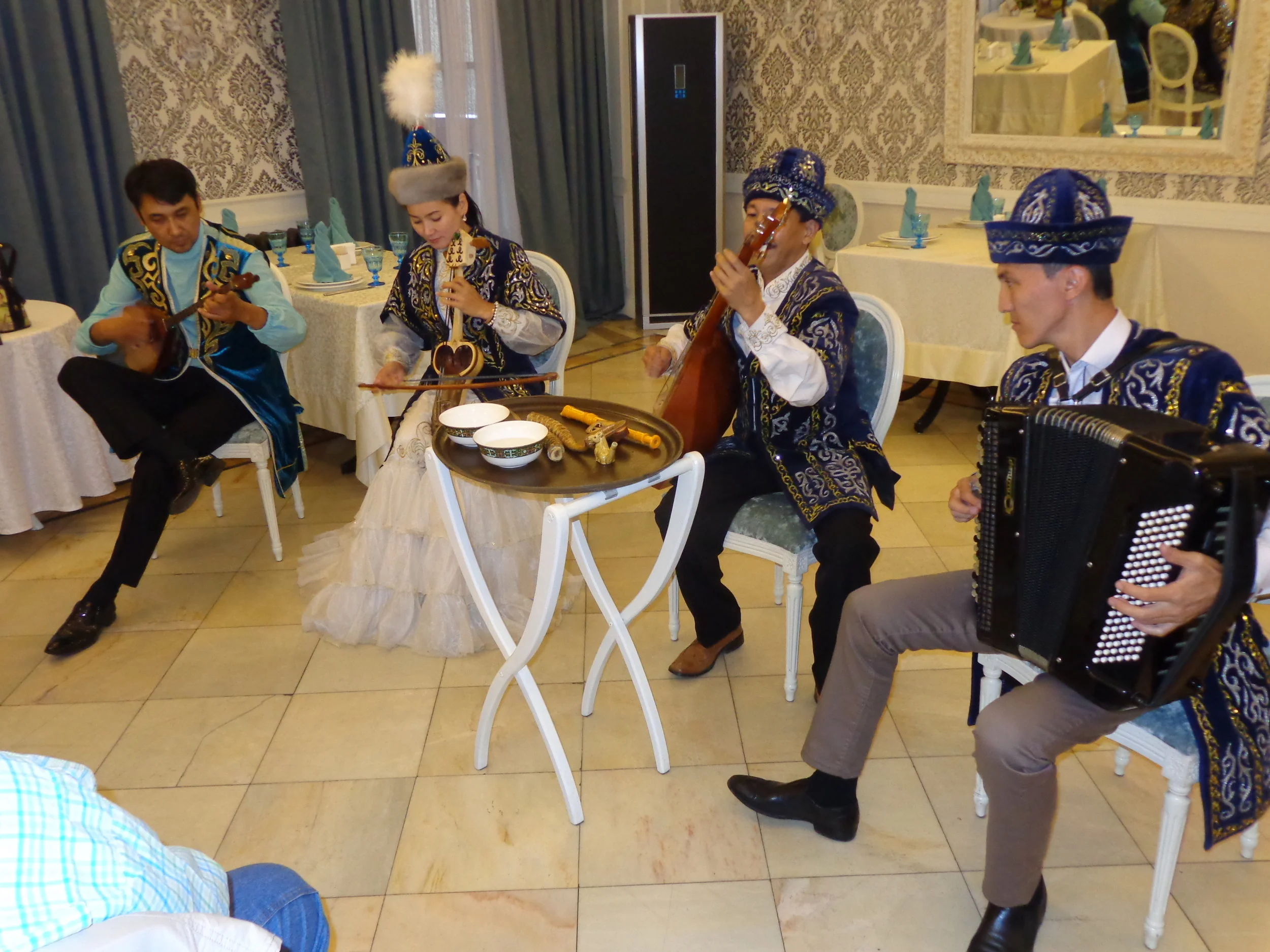
I could list 20 things about central Asia that surprised me.  I don’t know in what order I would put most of the 20 things, but I know what the number one biggest surprise was: Ashgabat!

Ashgabat was one of the biggest surprises in all of our world travels.   

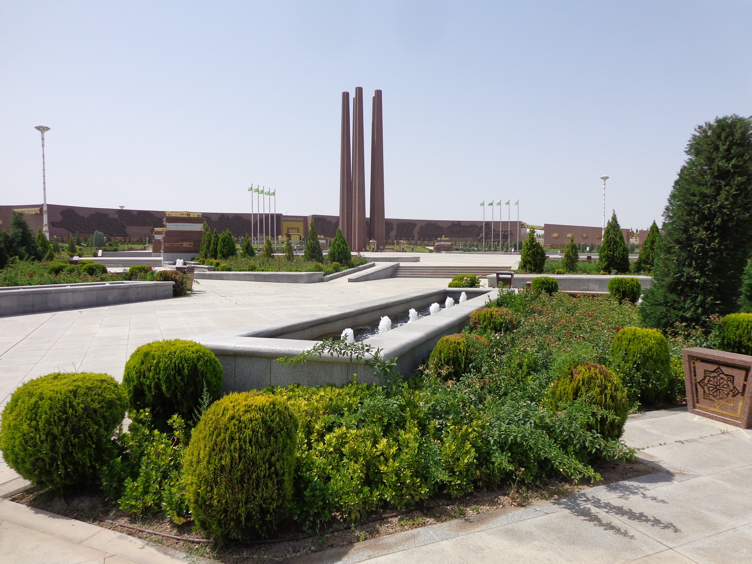
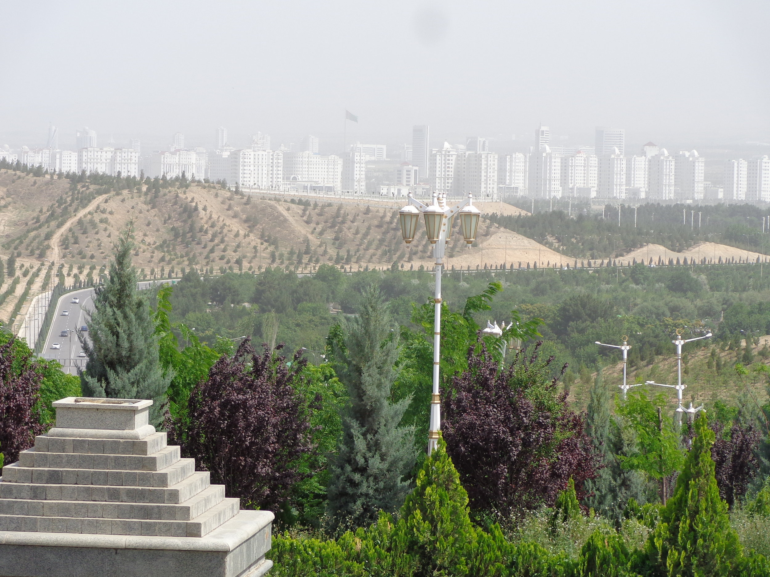
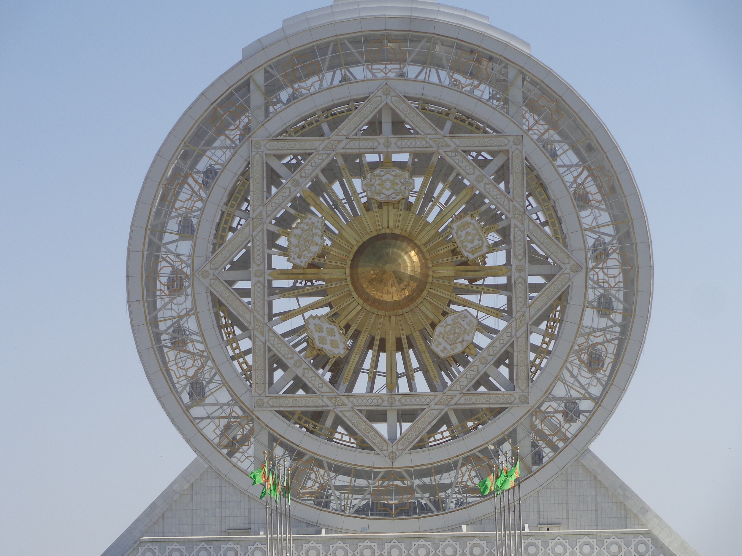
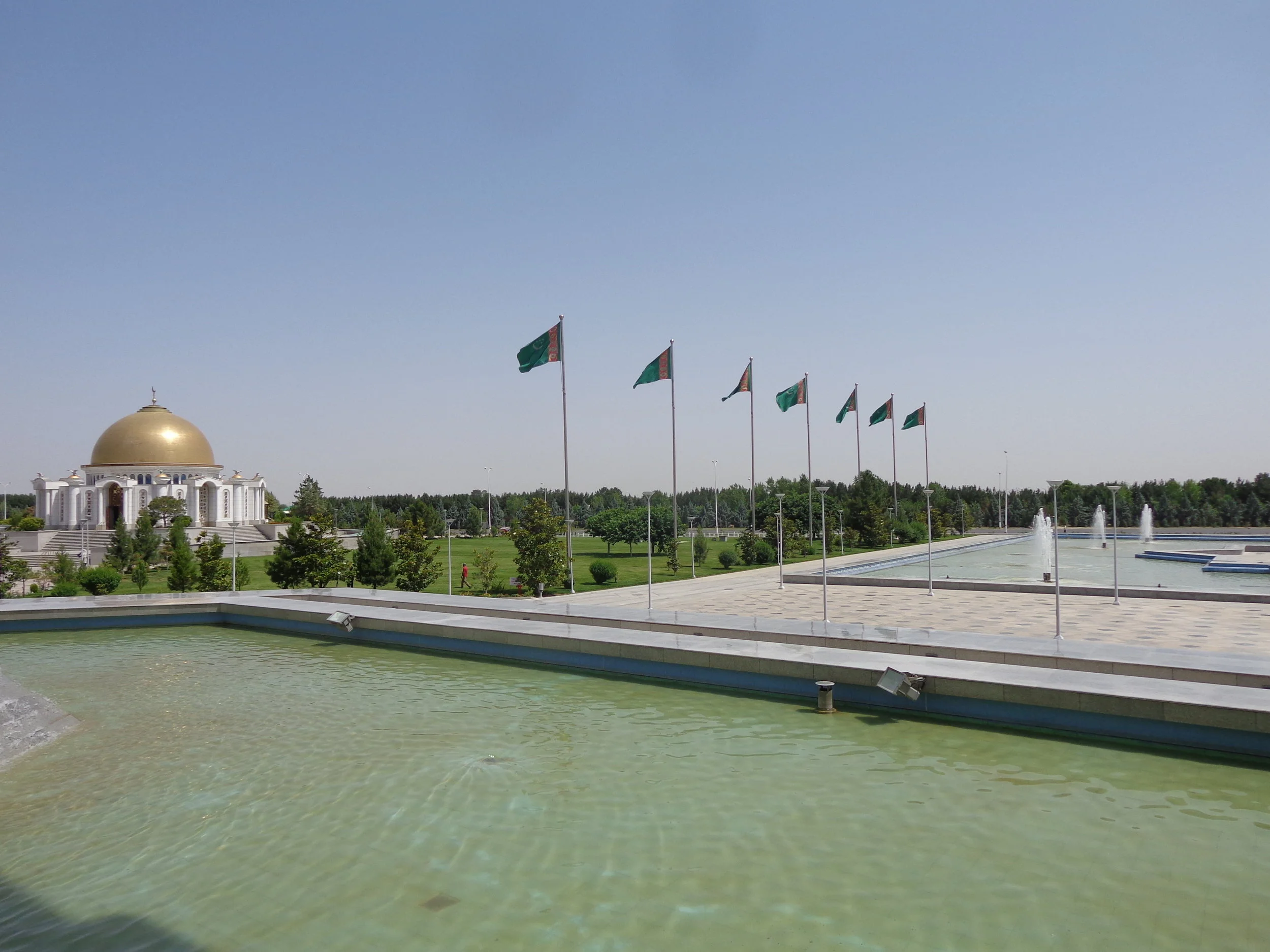
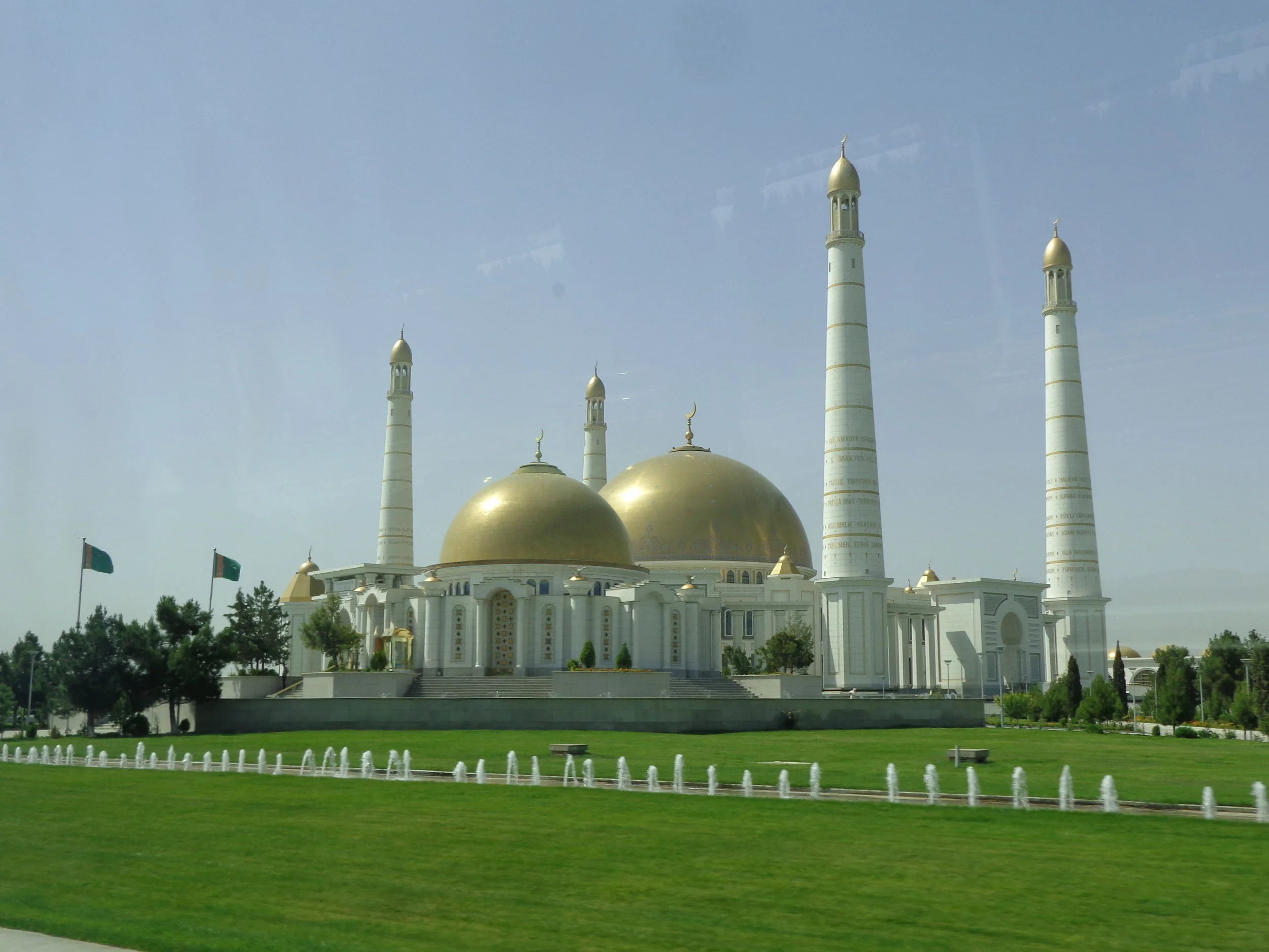
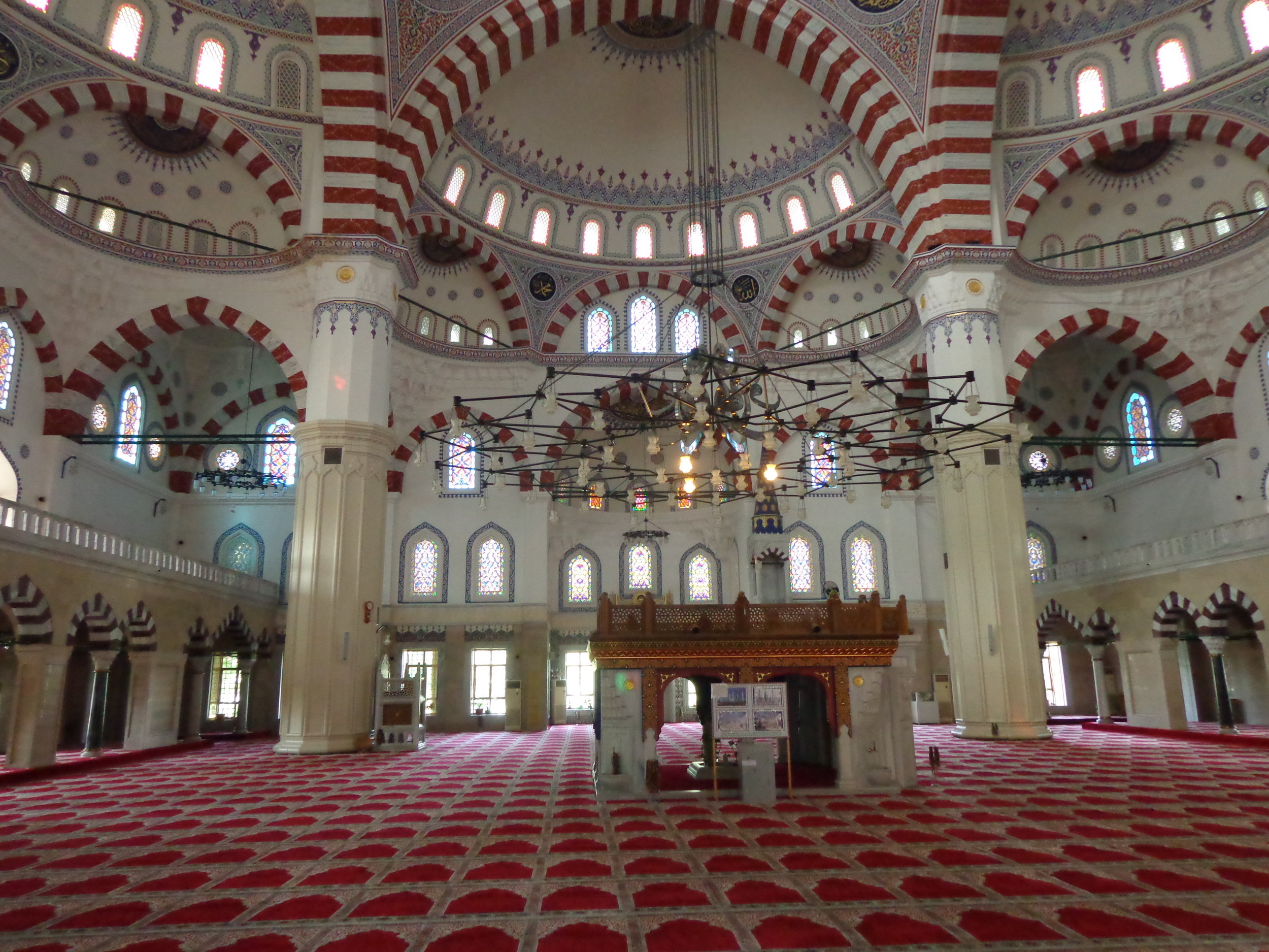
I’m not even sure where to begin with all of what was so surprising about the city of Ashgabat because almost everything about it was surprising.  I suppose the first thing is just the sight of it.  You come along the old silk road with all the dusty roads and desert areas and aged cities and then you get to Ashgabat.  Ashgabat must be the white marble capital of the world.  The second most surprising thing was that there were almost no people.  After three days here, I came to the conclusion that Ashgabat is really just a giant movie set; it’s not actually a real city at all.  I’ll take you through our visit here but it will really be hard to explain it and I’m sure you will all have questions that I probably won’t be able to answer.

First, some background, Ashgabat is the capital and largest city of Turkmenistan.  It sits between the Kopet-Dag mountains and the Karakum Desert.  Ashgabat is about nineteen miles from Iran.  It claims to have over a million people in the city but I doubt I saw more than a few hundred people – and many of them were maintenance or garden workers.  Also, Ashgabat was formerly called Ashkhabad, Askhabad, Ashkabad, and Poltoratsk.  The city was founded in 1881 as a Russian military outpost.  From 1924 to 1990, it was the capital of Turkmenistan, USSR.  In 1992, they adopted the Turkmen version of the city’s name, Ashgabat, as they had become the independent nation of Turkmenistan.

How did it get to be, well: Ashgabat?  As I understand it, a major earthquake in 1948, the Ashgabat Earthquake, wiped out the entire city and killed some 110,000 people.  Stalin never owned up to the extent of this and only reported 14,000 deaths since natural disasters didn’t strike the USSR.  At any rate, the Russians rebuilt Ashgabat in their typical Soviet style.  But in 1991, Turkmenistan gained independence as the USSR collapsed.  Its leader, Turkmenbashi (leader of the Turkmen) immediately bulldozed the city and started a major construction plan to usher into the world “the golden era of Turkmenistan”.  You can see the results in these photos and more to come.  It’s a white-marbled, golden-domed, wide-boulevard, manicured gardens, lavish water features, fancy street-lighting, neon-lit at night, monument-filled, over-the-top extravaganza!  But where were all the people?

Turkmenistan is the seventh “least” visited country in the world with only about 7,000 tourists a year.  They don’t need tourist dollars as they have enough natural gas and oil to do just fine.  They also have very strict (and bizarre) visa rules and you must go with a guided tour, so they don’t make it easy to visit.  How bizarre with the visa?  You have to apply to apply for a visa…and that’s not a misprint!  You must apply to be able to apply.  One tourist on the previous OAT trip was not granted a visa and she had to skip this portion of the trip.  I don’t know why.

I was standing by the side of the road to take a photo.  Our guide asked what photo I wanted to take.  I said just the street with the light standards.  He said why don’t you just go stand in the middle of the street, no one is coming.  So I did.

DSC03868.JPG

These are just photos of buildings on our tours, to give a small sense of the city of Ashgabat.

DSC03769.JPG
DSC03837.JPG
DSC03867.JPG

Visitors are not allowed to take photos of any government buildings, which I think is many of the buildings in town and all the buildings in this photo.  Right after I took the fifth photo, Vicky and I walked forward along the sidewalk on the right side of the photo.  As we got passed the first building on the left (in the photo) and started to walk across an open area, I was yelled at by two policemen.  I went over to them and held up my camera saying no photo?  They indicated with each building that I pointed to that I could not take photos.  We said thanks and proceeded across the opening.  (I believe that the Presidential Palace was the next building on the left).  After we crossed the open area, we were yelled at by three soldiers with rifles behind the open iron fence in the photo.  They indicated that we needed to go back to our hotel, or at least that was the direction they waved their guns.  You probably shouldn’t be seeing many of the photos that I include, but hey, I couldn’t tell one building from the next one.

DSC03770.JPG


Grand Turkmen Hotel

We stayed at the Grand Turkmen Hotel in Ashgabat.  It was quite a nice hotel and we were well cared for during our stay.  You can see Vicky in the first photo after we checked into our hotel.

DSC03763.JPG

The next two photos were taken from the balcony at the end of our floor in the hotel.  I think that the second photo is the Presidential Palace and compound.  The third photo is just to the right of the second photo.  My understanding is that these are all government buildings but none had any names or indications of such on them.  All the people that you can see in the photos were workers of some sort.

DSC04049.JPG
DSC04050.JPG

The fourth photo is right behind our hotel.  It is a monument with ten Akhal-Teke horses marking ten years of independence for Turkmenistan.  There was also a golden statue of their president.  I took this photo on a walkabout on our own.

DSC03774.JPG

The fifth photo is between the fourth photo and our hotel.  There was plenty of intensive landscaping in Ashgabat and quite a few gardeners working to keep everything perfect.  I found a lot to like with their landscaping.

DSC03773.JPG

I’m confident that I was not supposed to take any of the middle three photos, at least.  There were not, however, any signs designating them as government buildings.  I just thought they were good photos.  You can also see more of central Ashgabat in the background of the second and third photos.  All were white-marble buildings.


Ashgabat QUIZ

It’s time for a Quiz.  This will hopefully help you understand some of our wonderment about Ashgabat.


1.     This is a bus stop.  Question: what did I find most unusual about their bus stops?

DSC04046.JPG

2.     Question: where (in a general traffic term) is this monument located?

DSC04075.JPG

3.     Question: what is this structure?  (never mind that the walkway up to it could hold hundreds of thousands of people)

DSC03866.JPG

4.     Question: what is this building and what is its main function?

DSC04223.JPG

5.     Question: what is the function of this space, seen in this photo?


DSC04213.JPG

You could probably search online and find some of the answers but I would recommend you have some fun, and just guess.

Prior to going to Ashgabat, I can assure you, I would not have guessed any of these correctly.

The answers are in the next post.


Ashgabat Quiz Answers

I hope you had some fun with my Ashgabat Quiz.  I just wanted to give you a better idea of just how crazy we found Ashgabat.

  1. This is a bus stop.  Question: what did I find most unusual about their bus stops?

Answer:  The bus stop has Air Conditioning!  I never heard of an air conditioned bus stop before and would never ever have guessed that such a thing existed.  Most of the ones with air conditioning are in central Ashgabat.


  1. Question: where (in a general traffic term) is this monument located?

Answer: In a Roundabout.  We saw several incredible monument-like structures located just in regular traffic roundabouts.  They were dedicated to things like wheat growers or cotton growers or some industry.  I’m uncertain about this one though I thought it looked a bit like a clove of garlic.


  1. Question: what is this structure?  (never mind that the walkway up to it could hold hundreds of thousands of people)

Answer: It is the world’s largest indoor Ferris wheel.  We visited here and I will make a post from here.  And of course, it is also air conditioned.


  1. Question: what is this building and what is its main function?

Answer: This is the Palace of Happiness or the Wedding Palace.  It’s a high-end wedding palace.  It can register 7 pairs of newlyweds at a time.  It has three celebration halls, seven banquet halls for weddings, dozens of shops for wedding dresses, wedding car decorations, jewelry rentals, photo and beauty salons and a restaurant.  On a side note, we had dinner here one night and I’ll make a post from that dinner.


  1. Question: what is the function of this space, seen in this photo?

Answer: This is a pedestrian underpass.  It was near the front of our hotel and for pedestrians to cross under the street.  It was 30 feet wide, white marble, clean enough to eat off the floor, had lighting and security cameras.  It had everything but people using it.  Vicky, Nora, and I just couldn’t resist giving it a whirl.


More People's Memory Complex

We are still at the Halk Hakydasy Memorial Complex or “People’s Memory” Complex.  Our bus drove us up to the top of the complex but we opted to walk down to meet the bus at the bottom of the stairway entrance.  In the first photo, I’m standing at the back of the main complex area where the three memorial’s stand, looking back towards central Ashgabat.  As you might be curious, the rocket-ship shaped building on the ridge across from the complex entrance is a twenty story, five star luxury hotel. 

DSC03812.JPG

In addition to the three main memorials, the museum, the wall of history and perhaps some other things, this complex features many water fountains, flower beds, lawns, paved paths, benches, highly decorative lamps, and the entire complex is lit up at night as well.  You can see some of this in the second photo.

DSC03806.JPG

I stood on the right side of the stairs, going down, to take the third photo.  This is looking back at central Ashgabat.  If you notice the tall flag in the third photo, it was the tallest flag in the world when it was built.

DSC03814.JPG

In the fourth photo, I looked off almost perpendicular to the stairs.  There, you can see an example of the paths and water features and lawns and gardens and benches and lights.  It really looked like a delightful place to be, especially since it was over 100 degrees.  The people in the photo are gardeners.

DSC03817.JPG

The last photo is at the bottom of the stairs where we picked up our bus.  Looking back up you can see all three of the major monuments.  The WW II monument is in the center, the earthquake monument is on the left behind the fourth light standard from the top, and the motherland monument is on the right between the third and fourth light standards from the top.  There were over 300 steps.  Yes, I counted them.

DSC03818.JPG


Arch of Neutrality

Another early stop touring Ashgabat was the Arch of Neutrality or Neutrality Monument.  Turkmenistan adopted an official policy of neutrality, as a neutral country, so this monument celebrates their neutrality.  The monument was built in 1998.  It’s marble covered, 246 feet high, and shaped like a rocket.  It’s also topped with a gold statue of the president at that time, Saparmurat Niyazov.  His statue rotated throughout the day so that his face was always basking in the sun.

You can see the arch in the first photo.  You may also notice that soldiers stand at attention at the base of the monument.  We, however, were the only people at the monument.  We were well guarded.

DSC03823.JPG

Standing near the main area of the monument and looking off to either side, you can see extensive landscaping with lawns, trees, extensive water features, walkways, benches, lighting for night, and more.  You can see this in the second and third photos.  As you see the water feature in the third photo, there must have been dozens just like this one.  The landscaping area was laid out like a grid with repeating patterns of walkways, fountains, trees and so forth. 

DSC03822.JPG
DSC03825.JPG

The fourth photo is just another arch photo but from off to one side between the arch and the intricate landscaping.  I thought it interesting that their arch of neutrality was shaped like a rocket.

DSC03826.JPG

In the last photo, you can see our bus on the left side.  Not only were we the only people at the arch, we seemed to be the only people in that entire part of Ashgabat.

DSC03821.JPG


Ferris Wheel

The world’s largest indoor Ferris wheel is a real head scratcher.  Evidently, the current President of Turkmenistan likes to set records.  In 2012, they finished erecting this complex which contains a completely indoor, and air-conditioned, Ferris wheel.  It is claimed to stand at 154 feet high with a diameter of 187 feet. Those dimensions seem odd to me.  The Ferris wheel has 24 six-passenger cabins.  It’s a Guinness World record holder.  It was not open when we visited so we did not have a chance to ride it.  Our guide said it costs one dollar to ride.  He also said it’s very busy on weekends.  We were the only people there when we visited.

The complex also contains the Alem entertainment center with a bowling alley, cinema screens, a restaurant, and a planetarium.  It costs $90 million dollars to build.  I guess if you’ve got it, flaunt it.

The first photo was taken from where we parked the bus which is on the curb of the street.  The next two photos were just taken as we approached the Ferris wheel.  You can see the passenger cars around the outside in the third photo.

DSC03866.JPG
DSC03865.JPG
DSC03869.JPG

I included the fourth photo because if you go off to either side of the main walkway up to the Ferris wheel, there are acres and acres of lawns and trees and paths and water fountains and lighting.  It’s a magnificent place.

DSC03871.JPG

The last photo was from here but in the opposite direction and from where our bus parked.  If you crossed that mountain in the background, you would be in Iran.  It’s that close.

DSC03872.JPG


Old Nisa

Our first excursion outside of Ashgabat was towards the southwest.  We visited the UNESCO site of Old Nisa.  Old Nisa was built in the third century BC and it was destroyed in the third century AD by the Persians.  Old Nisa was the capital of Parthia.  In that period, the Parthian Empire was a world power.  Our local guide said that Old Nisa was a rival to Rome for control of the Near East.  Today, it’s one of Turkmenistan’s most significant cultural sites.  

In the first photo, we are just inside the high defensive earthen outer wall.  The city had two ponds for water and one can be seen directly in front between the outer wall and the inner wall.  It’s dry now and there is another such pond on the left of the walkway in the photo.

DSC03882.JPG

Vicky is just inside the inner wall and to the right of the main entry.  During part of the time, Old Nisa was a palace, an imperial residence, and had a large concentration of temple buildings.  The fortress walls were 25 to 30 feet wide at their base and were strengthened by 43 rectangular towers.  Archeological excavations have been going on here for 70 years.  Much has been learned about the ancient Parthian Empire.  All good artifacts have been removed to museums and the only remaining ones are just broken pieces.

DSC03886.JPG

I’m not sure to what degree corridors and wall such as in the third photo are original or have been reconditioned.  Of course, most of this area was all under a roof originally.  And while this place has had many excavations, it’s almost all still completely exposed to sun, wind, and rains.  This is evidently not a priority for the President of Turkmenistan. 

DSC03902.JPG

The pillar bases in the fourth photo supported the roof of this building which was the stronghold room.  The room was 65 feet in diameter.  There were four such columns for support of the roof.  Other rooms included the treasury, storerooms, and a huge wine warehouse.  The wine warehouse was empty.

DSC03900.JPG

The last photo shows some of the unfinished and refinished wall sections.  In addition, the mountains behind in the photo are the divide between Turkmenistan and Iran.  At Old Nisa, Iran is probably less than 10 miles away.  Iran used to be Persia which is who destroyed Old Nisa.

DSC03889.JPG

Southwest Ashgabat

We got outside of Ashgabat city a couple of times.  We didn’t get to stop at any ordinary places, so I took some bus photos just to be able to show some more normal parts of Turkmenistan.  These were from our trip to Old Nisa.

The first photo is just a street running perpendicular to the road we were driving.  It looked pretty good.  Everything seemed neat and clean.  They do have light standards but not the fancy ones like in central Ashgabat.

DSC03913.JPG

The second photo is also just off the main road.  We saw quite a few areas that looked like this.  Our guide said the green-roofed areas were “old Ashgabat”.  I presume that means post-earthquake, so maybe built in the 1950’s or later.  It also probably means the sections of Ashgabat that were not bulldozed.

DSC03911.JPG

In many of these housing areas on the edge of Ashgabat, people seemed to have gardens and fruit trees and grape vines around their houses.

DSC03957.JPG

In the fourth photo, we are back in town but on the outer edge.  These are apartments.  They could be Russian built but if so, they have been slightly upgraded.

DSC03974.JPG

The fifth photo is closer to central Ashgabat but not to the white-marbled area.  The apartments here were even nicer.  They have a bus stop but it’s not air conditioned.

DSC03978.JPG


Turkmenbashi Mosque and Mausoleum

We were on our way back to Ashgabat from Old Nisa when we stopped in at the village of Gypjak, home of the Turkmenbashi Ruhy Mosque and Mausoleum.  It stands about thirty minutes west of Ashgabat and is the largest mosque in Central Asia.  Turkmenbashi was the name given to himself by Turkmenistan’s first president.  His real name was Saparmurat Niyazov.  The mosque was built from 2002 to 2004 and opened on October 22, 2004.  The name means the mosque of Turkmenbashi spirituality or something like that.  The complex was built by a French company, Bouygues.

I’ll start with some real attention-getters.  The mosque cost 100 million dollars to build.  The complex is about seven square miles or 4448 acres.  The mosque is 180 feet high, the golden cupola is 165 feet in diameter, the minarets are 299 feet tall (91 meters), and the mosque can hold 10,000 worshippers for a service.  We were the only people there this day, outside of guards and gardeners.  There is an underground parking garage under the mosque which can hold over 400 cars.  The mosque has nine entrances beneath arches.  This mosque is on the Turkmen 500-TMT banknote.

We could not take photos inside either the mosque or the mausoleum.  Inside the mosque, the huge praying hall has white marble columns and a richly painted celestial blue dome.  The floor is heated when necessary and covered with a huge handwoven Turkmen carpet.  I found each praying spot to be a minimum fit for me as I had to scrunch up to fit in the allotted space.  I would also add that the carpet looks brand new, so I don’t think it gets much use.

Next door to the mosque is the Turkmenbashi Mausoleum.  Turkmenbashi died two years later and his mausoleum was ready for him.  His mother and two brothers are also buried near him in their own sarcophagi.  All three of them died in the 1948 earthquake in Ashgabat.  Turkmenbashi evidently got up early on the day of the earthquake and went outside for a walk, which spared his life.

The first photo is the mosque in a photo taken about half way from the street to the mosque on the main entrance way.

DSC03948.JPG

The second photo is the mausoleum, taken from the front of the mosque.

DSC03935.JPG

Vicky and I are on our way to the mosque from the mausoleum which we visited first.  One of the nine entry arches is behind us.

DSC03929.JPG

The fourth photo was also taken from the front of the mosque.  I wanted to show some of the grounds and water features which are everywhere in abundance.

DSC03942.JPG

The last photo is from the bus.  I included it just to show the immensity of the grounds including lawns, trees, lighting, and water features.

DSC03919.JPG


Independence Monument

This is the Independence Monument.  We stopped here after going to the Turkmenbashi Mosque.  We were told that the monument’s design was inspired by traditional Turkmen tents and the traditional headgear worn by Turkmen girls.  I suppose that the base section looks like a yurt and the section above it could be a girls headgear but on first sight, it sure looked like a fancy “plunger” to me.

This monument is to commemorate 20 years of independence for Turkmenistan.  If you remember the monument behind our hotel with the ten Akhal-Teke horses, that was for ten years of independence.  Claiming independence from the USSR did not seem too important at that time as they only declared their independence right before the final collapse of the USSR, but it seems to have been important ever since that time.

The total monument is 387 feet tall, but the significance lies in parts of it.  For instance, the main tower is 91 meters tall (299 feet) because they declared their independence in 1991.  The whole monument is on about 21 acres of land, so very large.  There is lots of other significance to parts of the monument.  For instance, the base is a pentagon and there are five entrances to the monument, one for each province in Turkmenistan.  A province is like one of our states.  Turkmen statues guard each entrance.        

The first photo was from where we parked the bus.  After visiting the monument, I determined that this was not the main entrance but this was where we started.  See if on first view, you don’t see a fancy “plunger” like I did. Maybe I’ve just been in the sewer business too long.

DSC03985.JPG

The next photo is just much closer and you can get a closer look at a couple of the statues of Turkmen warrior heroes that guard each entrance.

DSC03995.JPG

I was near the monument and looking out in the third photo.  You can see some of the intense landscaping with water features, paths and benches, and fancy light standards.  The buildings in back are not part of the monument, just part of central Ashgabat. 

DSC04003.JPG

The fourth photo is similar to the third.  You can see the intricate the landscaping around the statues, a huge water fountain feature (though water turned off on this day), and more of Ashgabat in the background.

DSC04004.JPG

Our guide told us a long story about the guy (statue) in the last photo.  It had to do with having his sons shoot arrows and where the arrows landed was where their land or home or something would be, to extend the family’s territory.  It was a long but interesting story.  You can also see a couple of guards on the right side of the photo.  We were the only people at this monument with the exception of the guards and garden workers.

DSC04008.JPG


More Independence Monument

We are still at the Monument to Independence.  After entering the monument (prior post), we then walked to this section.  This is another entry point to the independence monument and I believe that this is the main entrance.  I’m not sure why we didn’t enter from here but it didn’t matter.  

In this photo, the main monument is behind me and we are walking down to what I believe is the main entrance point to the monument.  You can see more of central Ashgabat in the background.

DSC04012.JPG

I suspect that this is the main entrance because from this entrance, you first see a golden statue of Turkmenbashi (Saparmurat Niyazov), their first President.  You can see the independence monument behind it on the right.

DSC04017.JPG

This is just a close-up of one of the five-headed eagles which were all over this monument.  Again, I believe that the five heads are for Turkmenistan’s five Provinces.  The eagle is standing on a two-headed snake but I can’t remember the significance of the snake.

DSC04015.JPG

This was one of the garden crews that we saw at this monument.  The temperature was over 100 degrees but as you can see, they covered up to avoid the sun.  This was true for both men and women workers.  They are hand weeding.

DSC04009.JPG

This is the street in front of the monument where we parked our bus.  Not a lot of traffic.

DSC04020.JPG

Ashgabat Food

I suppose it’s time for another food posting.  We ate very well in Ashgabat.  This posting will be from multiple meals.

The first two photos are from lunch at the Altyn Cinar (Goat Platter) Restaurant.  There was one other couple eating in this restaurant while we were there.  The first photo was our “Russian salad”.  It was quite a mix of vegetables and olives and eggs and it was very good.  At this restaurant, the main part of the meal was cooked on our table as you can see in the second photo.  We didn’t do the cooking.  Someone came and put on the beef and chicken kabobs and vegetables and then came back to turn them and eventually to serve them to us.  The guy sitting next to Vicky was our local Ashgabat guide.  He was very nice and spoke excellent English.  He was evidently an overachiever in school and in high school qualified for a year studying abroad.  He was placed in a small town in south Texas.  Yep, the U.S. of A.  I told him that technically, Texas was not a part of the United States.  When he laughed, I knew I was in trouble because he even understood my sense of humor.  Dessert was a fruit bowl.

DSC03789.JPG
DSC03793.JPG

The third photo was our main course for dinner at another restaurant.  The meat was beef and the vegetables were really fresh and tasty.

DSC04051.JPG

The fourth photo was from another lunch.  I think everything is identifiable and it was all very good.

DSC04275.JPG

I added the last photo just for the heck of it.  This was late afternoon at our hotel pool.  It was 107 degrees and we were trying to maintain ourselves by eating chips and drinking beer.  I’m not sure why no one was in the swimming pool in that heat.

DSC03839.JPG

People and Parks

I don’t want to give anyone the impression that there were no people in Ashgabat.  Mostly, there were almost no people in central Ashgabat or the white marble areas.  We saw people in other parts of town.

The first photo was a park that our tour group visited and walked through.  You can see that it was a beautiful shady park and a great place to be on a hot day.  It was full of people and water and playgrounds and ice cream vendors.  I would have taken photos of many of the people in this park but every time I raised my camera in anyone’s direction, they looked nervous or upset, so I opted not to take photos of people nearby.  But rest assured, this park had lots of people in it.

DSC03830.JPG

I took the second photo from the bus since no one noticed me taking their photo.  Other parts of Ashgabat looked normal enough.

DSC04085.JPG

The third photo is also a bus photo.  This is how school kids dress in Ashgabat.  We saw many dozens of school kids, almost all wearing clothing very similar to this.

DSC04056.JPG

Inspiration Street and park were just across the road from our hotel.  Nora, Vicky and I went for a walk through the park and around a bit of town.  Vicky and Nora are on the right side while the other people are garden workers.  Remember, our hotel was in central Ashgabat. 

DSC04211.JPG

We adopted the locals decision to cover ourselves in the 107 degree heat to keep the sun off of us.  I guess it worked as we all survived just fine.

DSC04212.JPG

Hezreti Osman Mosque

We were driving out of town on this day when we stopped at the Hezreti Osman Mosque.  This mosque was a gift from Turkey and is very similar to Turkish mosques.  I never got the story of why Turkey gave Turkmenistan this mosque but they did.  Also, this mosque is, for some reason, not a practicing mosque and for that reason, we were allowed to take photos of the inside as well as the outside. 

From the first photo, you can see that this was not an insignificant donation from Turkey.  It’s a beautiful mosque.

DSC04057.JPG

After walking through the doors in the first photo, you get into the courtyard, which is the second photo.  Our group was alone in this mosque.

DSC04061.JPG

The third photo is just after entering the mosque itself.  If you look at the floor, each rectangle is the space for one worshipper.  I barely fit into a space but the carpet was luxurious.    

DSC04064.JPG

The fourth photo shows the position for the sermon to be given.  The last photo is just another from inside this mosque.

DSC04068.JPG
DSC04069.JPG


Seyit Jamal Shrine

This was a stop on a drive to the east of Ashgabat.  It’s the shrine of the Seyit Jamal Addin Mosque.  It’s a shrine because the mosque was destroyed by the 1948 earthquake.  I’m mostly including this post to show some specific damage caused by that 1948 earthquake since most everything else was cleaned up and rebuilt.

The mosque was built in 1456.  It’s about ten miles east of Ashgabat.  It was originally in the southern part of the old fortress of Bagabad in an extensive religious complex that included the mosque, a madrassa (school), and accommodations for pilgrims.  It was famous for its depiction of two great mosaic dragons high on the portal, as if guarding the central arch.  There was a long story that went with the dragons.  Turkmen researchers did their best to piece together the mosaic fragments from the dragons and that work is on display at the Museum of Fine Art in Ashgabat.  While it is now a shrine, it is a shrine to which local people still make a pilgrimage today.  It was a hot and dusty day but there were local people here with us.

The first photo shows the largest chunk of remains.  I include this to show several things but especially the thickness of the walls.  It had to take a big earthquake to knock over those walls.  While the outside was faced with bricks, the insides included lots of rocks and rubble.

DSC04093.JPG

You can see a photo of the mosque taken in 1947 by a Soviet archeological expedition in the second photo along with a piece of what is left today.

DSC04096.JPG

This mosque still draws many visits from pilgrims.  There are beliefs regarding several things such as if you crouch inside the tiny room beneath the dome, the faithful can gain relief from heart disorders.  Also, mud applied to a joint pain or a skin ailment and then dabbed on the wall of this holy place will take away the pain.  There were also things for children and I believe that’s why this woman was here with her daughter.

DSC04100.JPG

I was quite impressed with the tile in the fourth photo.  It was installed in 1456 and has been exposed since 1948 and it still looks beautiful today.

DSC04103.JPG

There are some buildings and a large courtyard adjoining this shrine and the shrine still draws many pilgrims.  The large courtyard is used to fortify the pilgrims with food and drinks.  I’m not sure what organization does this but you can see a guy starting a fire to prepare food.  The last photo only shows half the cooking pots in this open kitchen.

DSC04107.JPG


East of Ashgabat

This is east of Ashgabat when we went out of town on our way to a horse farm.  We didn’t have any stops at ordinary places.  I took these photos from our moving bus so I could show a little bit of more normal Turkmenistan.

We were not too many miles out of Ashgabat in the first two photos.  This area evidently had plenty of water and was heavily agricultural.  You can see a vineyard in the first photo with more of the green-roof housing behind it.  The green-roof housing is what passes for old housing in and around Ashgabat.  The second photo is an alfalfa field.  On this morning, the wind came up and there was quite a dust storm both in town and outside of town.  You can see the dust storm in the background of the second photo as it almost blocks out the mountains.  

DSC04081.JPG
DSC04090.JPG

The third photo is much further out of town.  It’s still an agriculture area but not as much water.  We saw several fields where two guys loaded up a truck like this, all by hand.  One guy was on the ground and one guy was on the truck.  The guy on the ground boosted the bales up and the guy on the truck pulled them up and stacked them.  It’s not how we do it at home but it looks like it works for them.

DSC04124.JPG

The last two photos are farther out of Ashgabat and are the Kara Kum Desert (Karakum).  Kara Kum in Turkic means Black Sand.  The dirt and sand below the top sand is evidently very dark.  The Kara Kum covers about 70 percent of Turkmenistan.  It’s one of the driest places on earth and the desert is about 500 miles from east to west and about 300 miles from north to south.  The Kara Kum is mostly rugged plains with dunes and sand ridges.  Plateaus, lowlands, and plains that reach the mountain foothills divide the landscape.  The ancient people were nomads.  Plants are sparse but as you can see in these photos, there are quite a few plants.  For that reason, I’m guessing that this area of the Kara Kum is one of the wetter areas.  Animals can graze these areas for feed.

DSC04126.JPG
DSC04182.JPG