
The Rope Road
If anyone were to ask me what was the single most impressive thing that I saw in Cape Verde, it would be the Rope Road, or the Estrada A Corda. That would probably be true for all of West Africa. This is a road that runs from Porto Novo to the northeast to Ribeira Granda, the administrative capital of Santo Antao. It's a national road and an incredible driving experience.
It's called the Rope Road because it winds around and back and forth like a rope and looks like a rope on the map. The whole road is somewhat over 22 miles long. Now that may not sound like much but wait until you hear the rest of it. The entire road was made with hand-laid cobblestones. They used approximately 15 million cobblestones, each an irregular shape, and each one laid by hand to make this road. It took 30 years to complete the Rope Road. It's a work of art.
The road traverses the island going from coast to coast but climbing up foothills to incredible peaks, passing lush forests, canyons, agriculture, a volcanic crater, and more incredible viewpoints than I could imagine. I will just take us from Porto Novo up to the top of the mountains. At the start, it might not look so spectacular, but just wait.

I'll point out several things in the next photo. We were just progressing up through the foothills but the lush forests up above were something new to us on the islands. You might also notice terracing for agriculture with rock walls. Plus, if you can see the corn growing, each stalk of corn is about three feet apart. Water is precious here in Santo Antao.

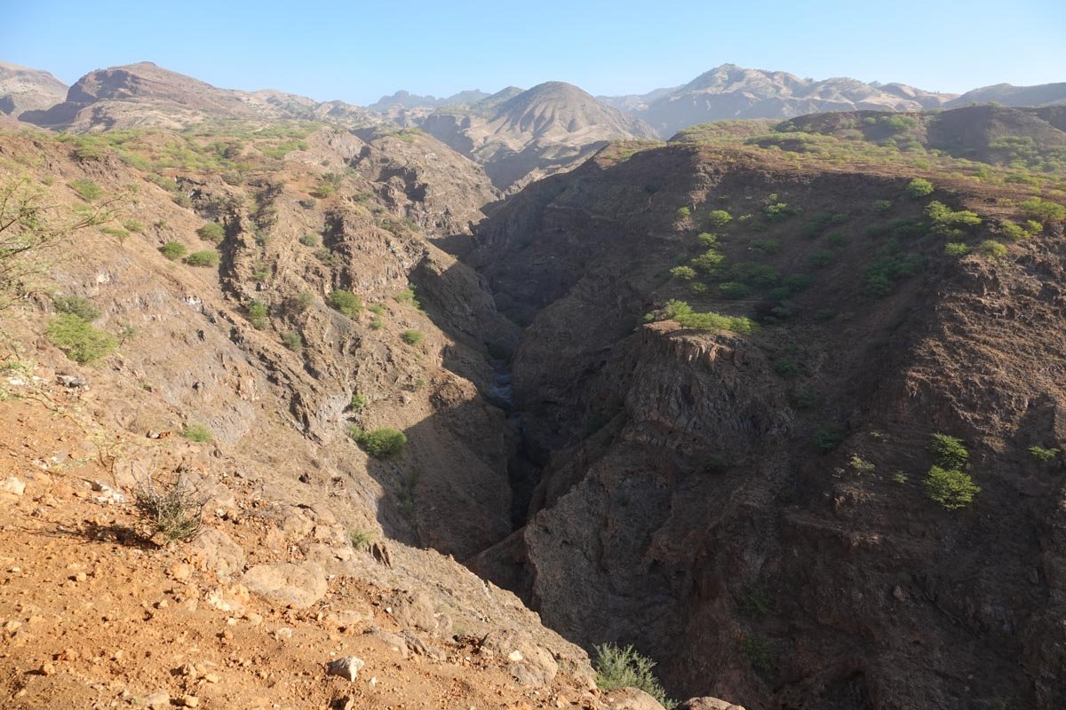
As we started passing canyons like below, I started to get a feel for why this road might be considered so spectacular.
And while I thought some of the canyons would have been difficult to put a road over, it was nothing like the mountains still ahead. And remember, this road was all hand-made. In the photo below, I'm standing on the edge of the road and the drop-off is equal to the mountains across from here.

And if the lower elevations don't appear to be so steep, the next photo will zoom in on the agriculture area in the bottom center of the above photo.

One of the key stops along the rope road was to see Cova-Paul-Ribeira da Torre Natural Park. It is in the Cova Crater, a volcanic crater that's about .62 miles across. The elevation of the crater is from about 1,300 feet to 5,200 feet. It features steep cliffs and deep river valleys. Cova Crater features lots of unique flora and fauna plus agriculture which we were told is mostly maize and beans. We spent quite a bit of time looking at the park from the road.

Continuing along the rope road, you can notice several things in the next photo. First, there is a lot of agriculture taking place, even at these high and steep elevations. Second, you can see many houses which makes it more evident why they needed to build the rope road. Third, you can see that we are still dealing with the Sahara sand but it's finally getting better.

The next four photos are all near what I believe was the high point of the rope road. The photo below is from the crest looking east, towards Janela. I would especially say to look at the ridge line and the sharpness of the peaks. Next, I would have you notice the steepness of the mountains and the depth of the valleys.

Below is a section of the rope road along this high point of the road. The drop-off on both sides is incredibly steep. We stopped here for a good while. At one point, I casually said to our local guide that a lot of good men must have died making this road. I fully expected him to pooh-pooh my comment, but he didn't. He immediately said oh yes, many men died making this road.

And now from this same section of the road, the next photo looks west, which is to the left in the above photo.

I walked down the road past where Vicky is above and took the last photo looking back towards where Vicky was sitting. The rope road is a handmade marvel.
