Mindelo, Sao Vicente Island

     We are now on Sao Vicente Island (Saint Vincent), our fourth island visit in Cape Verde. Mindelo is in the northern part of the island of Sao Vicente and is just across the channel from Porto Novo on Santo Antao Island. Mindelo is a port city with a large, natural harbor and was one of the most important harbors in the world for many decades. It was a key coal shipping harbor in the 19th century. Mindelo was founded as a settlement in 1793 by the Portuguese. The city is home to about 93 percent of the entire population of Sao Vicente and the second largest city in all of Cape Verde.

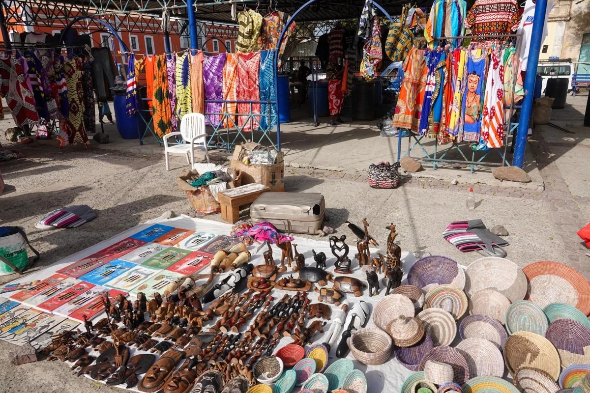
     Mindelo is one of the best-preserved colonial cities in Cape Verde and is Sao Vicente's capital city. It's a lively city and considered the cultural epicenter of Cape Verde. We saw lots of art galleries, music bars, importer-exporter shops, market buildings, open markets, a fish market, and a work area for their carnival celebration in an old police station.

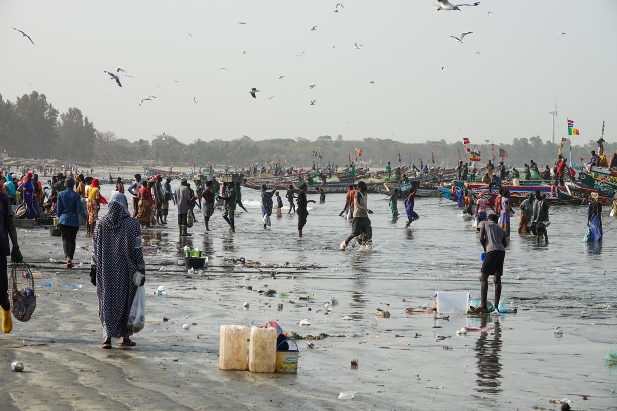
     The photos will give you an overview of the city of Mindelo. We started our first walking tour in the morning and the town was a little sleepy, but it eventually woke up.

Exploring Mindelo

     Both during our walking tour of Mindelo and in our free time in Mindelo after our tour, we poked our noses in quite a few places in the city. It's an interesting city and much more lively and inviting than most of the other cities that we visited. This post will be some of the places that we visited in Mindelo.

     We started in several markets. Below was the fish market but since we've seen many fish, fruit, and vegetable markets, I'll move on.

We visited Star Square or Independence Square in the central city. It had fruit and vegetable vendors but local crafts people and souvenir vendors occupied the most space.

We visited the National Center for Arts, Crafts, and Design. It was basically an art gallery and was quite extensive with at least two large buildings and a plaza between them.

We stopped for a drink and some snacks at Le Gout de Grills restaurant. It was upstairs overlooking the harbor.

Our local guide said that Mindelo has a very elaborate and pretty fantastic Carnival celebration every year. It's a combination of African, Brazilian, European, and Caribbean. We visited the preparation area which is on Beach Street and is the former location of the city's police department.

Mindelo struck me as a laid-back city where the people were pretty happy with their lives.

Mindelo was quiet when we arrived early in the morning but that didn't last. Well before we left, the streets and sidewalks were very busy indeed.

Hike to Farol Lighthouse

     On this afternoon, we drove along the coast to take a hike along the coast. Our hike was about one hour from the parking lot to the Farol Lighthouse and then another hour back. The whole trail was volcanic rock and right along the cliffs over the ocean. It was really hot since there was almost no vegetation. It would have been much more beautiful if we hadn't still had the Sahara sands following us. 

     Our guide strongly suggested that no one take this hike unless they are in excellent shape. I scoffed at the idea that they would even let us take a dangerous hike. The truth of it was that it did have some high steps but the real problem was lots of loose rock or gravel, sometimes on top of solid rock. That made some steps like stepping on ice. We got spread out on our hike and especially me as I stopped often to take photos. Still, I saw two of our fellow hikers take serious falls on their faces. It was not hard to do.

     In the first two photos, I'm about halfway out on the hike. The first photo is looking back to where we started and the second looks to the Farol Lighthouse, our destination.


The next two photos are just trail photos. Vicky still has on her pink hat. Looking down to the ocean, we could occasionally see manta rays and turtles come to the surface.

I included the next photo for a reason. Look at the woman in front of Vicky. Can you see how high she has to lift her leg in order to get up that high step. There were lots of high steps and while it was hard going up them, it was much more dangerous going down them, especially hitting loose gravel at the bottom.

You can see that we are approaching the lighthouse. We had to go up quite a way and then back down to the lighthouse. Then, we had to go back up again on the way back.

We reached the lighthouse and then had to climb up 50 steep steps to get to the top. We were told it was a glorious view, without the Sahara sand. I think we could have seen several other islands if not for the sand. Vicky is at the top waving.

Sao Vicente Drive

     On this morning, we took a drive around the northeast portion of the island of Sao Vicente. It was not a very exciting drive. The fact that it was both foggy and Sahara dusty didn't help the viewing. For much of the morning, we had close to zero visibility. But while it was not a great drive with nice viewing, I will still point out a few things that I found interesting. 

     We started our drive by going up to the top of a mountain called Monte Verde. On the way up, I managed some closeup photos of a farmer’s corn field. This was of interest to me because I've grown plenty of corn and seen plenty of corn fields. Corn is always grown in rows. I put 3-4 seeds per hill about twelve inches apart in rows that are three feet apart. With the lack of rain on Sao Vicente, farmers and gardeners are forced to plant their corn about one seed to a hill with each corn plant about 3 feet apart from each other, like below.

From the top of Monte Verde, I found another interesting discovery. They get very little rain, but they do get fog regularly from the ocean drifting up the mountain in waves. To capture this moisture, they put up screens. The screens intercept and capture the fog rolling past, it drips down, is collected, and funneled into a water storage tank. That's their source of water at the top. It's a very simple technology and it works. Vicky and a fellow traveler checked and the tank was full of water.

Our third visit was to Calhau which is a small fishing village on the eastern coast of Sao Vicente. It's another small fishing village and the sand beaches next to it are turtle nesting areas. You can see Calhau and some of the turtle nesting area below.

We also visited a loggerhead turtle rescue and recovery station. They help nurse injured turtles back to recovery, then put them back in the ocean.

Right next to our cruise ship in Mindelo was a beautiful beach. We were told that they had removed all the black sand and replaced it with white sand, which was very effective. We stopped here after our walk about Mindelo to check it out. You can see Vicky wading into the water wearing her blue shirt. We planned to come back and swim here in the afternoon but ran into a problem. The guards wouldn't let us into the port gate right next to the beach and our ship. They said it was a commerce entry. That meant we had to walk all the way around the port to get back to our ship. And after lunch, we didn't feel like making that long walk again on a hot afternoon.

This was the end of our visit to Sao Vicente Island.

Sao Filipe, Fogo Island, Cape Verde

     We are now on Fogo Island, the fifth and last of the Cape Verde islands that we visited. Fogo means Fire in Portuguese. Fogo is the youngest or newest of the Cape Verde islands and also the highest with its active volcano, Pico do Fogo, at over 9,000 feet above sea level. Fogo Island was discovered in 1460 and settled by the Portuguese between 1470 and 1490. With its high mountains, deep valleys, and coastal areas, it has a variety of climates. Fogo is a challenging place to live and subject to both drought and famine. 

     Fogo was the second island in Cape Verde that was settled, and Sao Filipe is the capital of Fogo Island and the second oldest town in Cape Verde. Sao Filipe (Saint Philip) is on the west coast of Fogo Island. We mostly visited the historic and colonial city center. Oddly enough, Sao Filipe did not receive a town charter until 1922.

     I found it very odd that this was the second oldest town in Cape Verde, established around 1480 and yet, it does not have a port. I thought every town established back in those days was established mainly because it had a good port. Oh well, what do I know. What I do know is that we had to travel from our ship to town by Tender boats.

These next photos of Sao Filipe will give an idea of the colonial, historic, colorful, and picturesque nature of the town. You will also notice some cobblestone streets.

I noted that Sao Filipe didn't have much of a port. The town is mostly on top of a plateau that is well over 100 feet above the sea. I found it odd to learn that in 1655, Sao Filipe was destroyed by Flemish pirates. They must not have had much of a defense. The next photo is from the old town looking down at the black sands beach.

I added the last photo to show the new construction on the top of the building on the right. This was like most of West Africa in that they built incrementally.

Driving towards Pico do Fogo

     We drove from Sao Filipe up the mountain toward Pico do Fogo, or Peak of Fire. It's an active stratovolcano with a peak that is 9,281 feet above sea level. The drive up was more interesting than I thought it would be. Practically the whole island of Fogo is part of the stratovolcano. It was another windy drive but well worth it.

     The first part of our drive was more interesting than I was expecting. You can see a glimpse of that drive below. It was obviously hilly but greener than I expected it to be.

But then we would dip into lower elevations and find ourselves in the midst of agricultural areas. Agriculture and fishing are the main industries on Fogo. I found the agriculture to be very much to my liking. You can see some papaya and banana orchards below. They grow lots of fruits and vegetables and are the only island in Cape Verde to grow coffee and have vineyards and wineries. We also saw mangoes, figs, gooseberries, corn, beans, squash, tomatoes, carrots, cabbage, broccoli, onions, pumpkins, and Congo beans. We saw cattle and goats and our local guide said that cows milk is for butter and goats milk is for cheese.

Back out in the open country, we passed small villages like below. I was not sure about their economics as I couldn't see much agriculture next to the villages and they were a long drive from the sea.

As we progressed up the mountain, the geologic outcroppings grew more dramatic, as you can see in the next two photos. Plus, if the Sahara sand was not still with us, you would be looking at the ocean just beyond the land below. You can also see a small portion of the winding road in the lower right corner.

The last photo is just one I took to show the steepness of the hills that we were driving. 

Pico do Fogo

Pico do Fogo is an active volcano. The last eruption of the main cone was in 1680 (behind us). However, subsidiary vents are still erupting with eruptions in 1995 and the most recent in 2014 to 2015. Each eruption has sent out waves of emigration from Fogo Island with the United States being a popular destination. Our local guide went on to say that ex-pats sending money back to Cape Verde is a large part of their economy.

Below you can see Pico do Fogo or the Peak of Fire which is an elevation of 9,281 feet high. The most recent eruptions are to the left of these photos.

Inside the caldera of the volcano is both bleak and dramatic. We spent several hours here and enjoyed every minute of it. We passed several different lava flows. Our local guide would point out each different one and tell us the year of the eruption and point out some of the havoc that it caused.

We also walked out on some of the lava flows such as below. It was extremely challenging to walk across such chaotic rock.

It was just a great feeling to be inside the caldera and so close to an active volcano that is no doubt going to erupt again before too long.

This is another view inside the Pico do Fogo caldera. The photo below is yet another of the prior eruption lava flows. This is perhaps the 1995 eruption.

Now we are coming to the eruption in 2014 to 2015 which was the most recent eruption. The road that we were driving was a victim of the last eruption.

The lava flow from the last eruption was still almost impassible to walk over without the threat of injury.

Vicky wants to know which way we go now?

In the next photos, we have traveled a substantial way around the main volcano. I also loved seeing the plants beginning to grow back and recover.

Cha das Caldeiras

     There is one small town located within the crater of the Pico do Fogo volcano and that is Cha das Caldeiras. The town has about 700 inhabitants and two main neighborhoods. The town sits at an elevation of 5,577 feet and the mountains on the west rise to 8,858 feet. The caldera itself is about six miles across and open to the east. We even came across some vineyards and a winery within the caldera and near Cha das Caldeiras.

     The volcanic eruption in 1995 destroyed several houses in the village but the eruption in 2014 to 2015 destroyed 75 percent of the town's buildings. Some of the town's people left town for better prospects. But others of the town's people consider the volcano like a "father." The latter people are staying and rebuilding the town. In this post, I'll show some of the destruction of the town and the lava flows. In the first photo, you can see that the lava traveled in different routes towards the town.

The lava didn't necessarily follow consistent routes and the town looks odd with lava here and there but not all in a line.

Now for a couple of photos where the lava reached some houses but didn't destroy them.

And now for some houses that didn't make it through the last eruption. The flat cement slab on the left was the roof of a house. In the subsequent photo, I get closer and if you look on the lower left, you can see a bit of the house below the roof line.

The next photo is another house that got covered over with a lava flow where you can just see the roof. The two smaller units are rebuilds since 2015.

Cha das Caldeiras getting rebuilt

     I want to move to a higher note on the small town of Cha das Caldeiras and show a bit of their rebuilding efforts. Our local guide said they consider the volcano like a father. I guess their father expressed some displeasure with them, but they are determined to rebuild and make their father proud.

     I liked that in some of the rebuilding efforts they were using the lava rock for raw materials.

Other efforts involved cement bricks but we didn't see any wood buildings going up.

We stopped for lunch here at a restaurant that also was a hotel of sorts. They had built individual units that were quite nice.

The roof or top area was nice with shade provided plus lounge chairs and tables. It was very pleasant up there.

Inside the units was like a hotel room. One thing though was that the heat was all natural. We were told that these units were built over a lave tube and the lava tube was still hot. The floor of these units was really very warm. I asked how the people could stand it but our guide said it gets really cold here at night, and over 5,500 feet elevation.

We had lunch here at the main area, which didn't get impacted by the volcano flow. Lunch was excellent with fish, chicken, rice, cachupa, squash, carrots, wine, beer and some lemon coconut pie, flan, and cream for dessert. 

I would also point out the art in the lower right. Lava rock is being used for construction purposes but also for artistic purposes.

Fogo Wine Industry

     Fogo is the only island in Cape Verde with wine and coffee. Our coffee plantation visit fell through, but we were able to make two wine stops within the Pico do Fogo caldera. The wine and coffee industries on Fogo started back in 1870 when grapevines were introduced and the coffee was exported to Portugal. 

     I was not shocked about the grapes. We grow grapes on our farm in California and after two or three years, we do not irrigate our grapes as they are quite drought tolerant. But I was not expecting to see the vineyards that we saw. Their vineyards look vastly different from our own. You will also see that the most recent lava flow nearly reached this vineyard. The grapes are in rows, but each vine is a substantial distance apart from the next vine. That's due to the minimal amount of rain here on Fogo. They also have no trellising at all in their vineyards.

We stopped at the Casa Ramiro family wine and business, which is how it was described by our guide. They make and sell their own wine as well as wine made by some of the more established wineries on the island. Our guide described it as "export-quality" wine. He never said where it gets exported. It was okay.

We made a separate stop at a large winery just to see their production facilities. It was much bigger than we expected and the cellars and equipment looked modern and up-to-date. What I couldn't determine was where all the grapes come from to keep this winery in operation. The few vineyards that we saw were very sparse and didn't appear in very good shape. My guess is that there are much better vineyards on another part of the island.

A Fogo Farm

     We heard a lot about agriculture being the primary industry at every West African country that we visited. We passed many places that were growing some fruits or vegetables. But most of the "farms" that we passed didn't seem like much of a farm to me until we got to this farm on Fogo Island. This was a real farm by any standards. I found it interesting in that our local guide called it a "nursery" and not a farm. It wasn't a huge place but it was very organized and seemed very efficient.

The next field is growing onions, but I really liked their papaya trees which were scattered around the farm. In the following photo, those were the highest and biggest papaya trees that I've ever seen. I have no idea how they manage to pick the ripe papayas.

This was the end of our Fogo Island and Cape Verde visit. Next, we sailed back to the West African mainland and visited The Gambia.

Banjul, The Gambia

     We are now back from Cape Verde and back to the West African mainland. We are in Banjul, the capital and main city of the country "The Gambia." It's not to be confused with Zambia or Ghana, etc. The Gambia is the smallest country on continental Africa. It has a peculiar shape in that it is very long but very thin, like 31 miles wide. It is surrounded by Senegal on three sides, everywhere except on the west where it meets the Atlantic Ocean. The Gambia is situated on both sides of the lower Gambia River and follows the river on both sides a good way to the east. 

     Arab Muslims traded with West Africans starting in the ninth century. The Portuguese were the first Europeans to come to The Gambia to trade but they never established a colony here. The British established a colony here in 1765 and took control of the Gambia River, for trading purposes. The French took control of most of the area around the Gambia River in what is now Senegal but the British didn't give up their slice along the river, until The Gambia gained independence in 1965.

     The Gambia is a small country and its leading industries are agriculture, fishing, and tourism. Banjul is the capital and most densely populated area of the country. Banjul is in the Gambia River where it enters the Atlantic on St. Mary's Island, now Banjul Island. We got off our ship to 97-degree heat and high humidity but not much Sahara dust. Banjul is the least populated of any African capital. It features fading colonial architecture, dusty roads, and busy people. I'll just give one minimal post on Banjul and the larger area.

     Below is The Gambia's national assembly building. My guess is that the architecture has historical and or cultural significance, but I don't know what that is.     

Some of the Banjul area was open but much of it that we drove past was crowded and busy.

It didn't take any time at all to understand that we were no longer in Cape Verde.

We ran into some extremely busy areas in the greater Banjul area and had some major traffic slowdowns.

This next photo was a market area, not unlike many that we visited.

The West African countries seemed to be big on having a memorial or two. This is the Never Again Arch, formerly Arch 22, with historical significance and a gateway to Banjul.

Tanji Fishing Village

     We drove about twenty miles south from Banjul for a visit to the Tanji fishing village. This was another authentic glimpse at a local fishing village. Tanji has a long history of fishing and has been at the center of the local fishing industry for centuries. This was probably the busiest fishing village that we visited on this trip. We saw it all from the boats coming to shore to the fish being hauled off for other markets.

     It is estimated that over 2,000 people participate in the fishing related activities here in Tanji. That would include fishermen, boatmen, fish transporters, fish dryers, fish smokers, fish sellers, fish haulers, net handlers, and many more related jobs. The beach was a beehive of activity.

     In the first photo, just look at all the boats all along the coast. In some places, the boats are two or three deep.

When boats come in with fish, masses of people go out to get the fish and nets, and the boats themselves. It was chaotic but everyone seemed to know their job.

The next photo is just a closer look. People haul the fish in buckets, baskets, or tubs, like the two guys in the middle of the photo with tubs of fish on their heads.

The next photo was the best I could do on the flat beach but I wanted to get a photo of the masses of people there on the beach, and everyone working.

The boats eventually get hauled ashore too. They are heavy wooden boats and very colorfully painted. You can also see the nets that need to be expertly folded.

In the last photo, some of the women at the bottom are already set to start selling their fish to whoever wants them.

Tanji Fish Processing

Once the fish come ashore from the fishing boats, many other people begin to work, processing the fish. We saw fish being hauled around the beach in wheelbarrows, buckets, and carriers of all sorts, such as the guy below with his wheelbarrow of fish.

Air drying the fish is one popular method of preserving the fish. We saw many fish drying areas with some on the ground and some up higher, like the one below.

Smoking the fish seemed to be the most prevalent method of preserving the fish. We were here at Tanji fairly early in the morning so the fish smokers weren't too busy yet. But in the photo below, you can see how many fish smoking ovens they have, right behind the beach.

We did get to see a couple of people working at a fish smoking oven in the next photo. They very carefully stack in as many fish as possible. They work quickly but I'm guessing that they have a lot of experience doing this. The following photo was some fish that had already been smoked.

We also saw many places back behind the fish smokers and dryers and much closer to the road that were just selling fish.

We also saw guys very near to the road that had fish for sale, but evidently mostly to wholesalers or fish deliverers. You can see a guy with fish for sale in the next photo. 

One customer of the above fish seller is the next guy who is loading up his basket on his motorcycle to haul somewhere to sell.

Yabouy Home Cooking School

     We had a stop at the Yabouy Home Cooking school. It was inland in some farm country. The idea was that we were supposed to help prepare an African meal and then eat it for lunch. We did that but there was actually very little preparation work to be done. The staff really did most of the work but we did eat it for lunch. The cooking school was in a fenced area and had fruit trees, some vegetables, and other things, plus some nice buildings with thatched roofs.

The food preparation and cooking were simple and no big preparation or cooking areas or ovens, etc. You can see some of the work below. I think Vicky was supervising.

They also had us dress up in African clothing as part of the experience. Vicky looked pretty good while she helped with the vegetable preparation.

Ida Cham Njai is the owner and operator of the cooking school. I got a photo of her and Vicky below. She reminded me of my own Aunt Ida.

I thought the women looked better than the men in African clothing. I found the fabric to be very heavy and very hot.

Kachikally Crocodile Pool

     Our last stop this afternoon was the Kachikally Crocodile Pool and Museum. It was in Bakau which is about ten miles from Banjul. We were told that the crocodile-infested pool is used for sacred fertility rituals and would instill fertility in women. I told Vicky that I'd better not catch her dipping her toes in the pool. They said that there are about 100 crocodiles in the pool, which actually looks more like a giant mud puddle or pond. It was my understanding that these are a West African crocodiles.

     As we arrived, I was waiting for the group to get organized. I saw the fence around the crocodile pool (to the right) but then I noticed a large baobab tree with some guy loading a bunch of large bags next to it. I had time so I wandered over to check out the tree and see what the guy was loading. All of a sudden, I looked down and was about to step on a crocodile. You can see him below, but I came backwards to take this photo. The first time I saw him, I almost stepped on him. It was a close call.

You can see a croc in the pond below but many of the crocodiles were out laying on the roads, within the fenced area.

They told us we could pet the crocs if we wanted to, so of course, we did.

They had a museum too, but the crocs were the highlight. I did love the size of the fruit on the tree below though. They called it a cannonball tree.

Nothing like giving a crocodile a little scratch to keep him in slumberland.

Banjul to Barra Ferry and Back

     Adventure travel is often associated with the places that are visited. But as any traveler knows, sometimes the greater adventure is the process of getting there or getting back. 

That was the case on this day when we were traveling from Banjul to Barra. Banjul is on an island so to go anywhere else, you must cross a bridge or take a ferry. Barra is across the wide opening where the Gambia River meets the Atlantic Ocean. Barra is about three miles northeast of Banjul. Taking the ferry across and back was by far, the adventure of the day for me. 

     We had to arrive early to catch the ferry. Tickets must be purchased at the ferry terminal. The ferry terminal was crowded and confusing to navigate. Without our guides, I'm not sure we would have been able to get our tickets and get aboard. At some point, someone commented about the crowds and our local guide just laughed. He assured us that since today was Sunday, the crowds were very light compared to the weekdays.

     Upon arriving and having our tickets, we had to wait a short while for the ferry to arrive. The name of the ferry was the Kunta Kinteh, which you can see in the first photo. The Gambians really know how to carry a theme. Tourism is the third largest industry in The Gambia and they are capitalizing on the transatlantic slavery trade for some of it. Our goal today was to visit the village where Kunta Kinteh grew up and was captured and sold into slavery. Then we visited Kunta Kinteh Island, but I'll get to that later.

It took 40 minutes to unload the ferry before we could go aboard. In my mind, it was very crowded and that includes people, animals, motorcycles, cars, trucks, and big rigs. It also included perhaps hundreds of vendors who were on their way to work and carrying their goods.

The ferry was a three-floor vessel and our guides told us to make every effort to reach the top floor. He said it was less crowded and less hectic upon departure. It also provided us with some great views and a great opportunity to see some of the workings of the ferry. The next photo will give an idea of the crowds on the first deck of the ferry. I'm glad that it's not my car parked there.

     The ride to Barra took 42 minutes. But what happened next was perhaps the highlight of the ferry ride. We pulled up to the ferry ramp in Barra. Everyone waited for the signal to unload but it was a long wait. We eventually learned why. The ferry deck and the landing ramp were not aligned. There was a difference of about 14-18 inches. So first, they had a vehicle drive onto the dock for its weight to lower the landing ramp. That didn't work, so they had a second vehicle drive onto the ramp. That didn't work either. Next, they had about twenty big guys get on the end of the ramp and jump up and down. The ramp eventually came down to the level of the ferry. It sent a roar through the crowd.

     You can see the gap in the photo below if you look at the landing ramp in front of the mini-bus. You can see that they brought on a second vehicle already. The next step was to get a bunch of big guys on the end of the ramp to jump up and down in unison. It eventually worked and we all got off the ferry.

The next photo is one I took from the third deck as we waited for the crowds to thin out before we departed. And again, this is a light weekend crowd.

We spent the whole day in the Barra area, and now I'll post about our ferry trip back home to Banjul. The crowds going back to Banjul were even bigger than the crowds going to Barra. We had another long wait while the ferry emptied and reloaded the vehicles and animals. It was interesting to watch it all. 

But then it was our turn to load and the process and route that we took was confusing and a bit overwhelming for us. In the next photo, we were heading for the opening in the wall in front of us, which led to the ferry. Suddenly, the gate closed, and we had to take a long and peculiar route to get back onto the loading area. We never knew why.

Once we got onto the loading area, the crowds and the pushing, shoving, and elbowing really started to ramp up. I latched on to Vicky's arm and we joined the crowd in pushing, shoving and elbowing our way aboard. Remember, our goal was to get to the top deck and find a seat. We made it but just barely.

We made it back to Banjul and again, we waited aboard for a while for the crowds to thin out before we attempted our exit.

One highlight of our ferry rides and all of West Africa for that matter was the colorful clothing worn by the local people.

Village of Juffureh

After landing in Barra and departing the ferry, we drove to the village of Juffureh (which has several different spellings) on the north bank of the Gambia River. Juffureh seems to adjoin the village of Albreda and I was not clear on when I was in which village. Juffureh is the ancestral home of Kunta Kinteh, according to Alex Haley in his 1976 novel, "Roots: The Saga of an American Family." It was no accident in that Juffureh was one of the major centers of the Transatlantic slave trade with probably millions of slaves exported from here. A family here claims to be related to Kunta Kinteh. Following the publication of Roots, Juffureh became a tourist destination and remains so today. We were told that this has lead to economic improvements to the town and area though I could not distinguish that. 

     I will first just input a few photos to give you some idea of what the Juffureh area looks like today.

Our main visit in Juffureh was the Museum of Slavery. It showcased the slave trade in Gambia. The main theme that I absorbed was that the Africans started slavery and maintained slavery, but the Europeans made slavery much more cruel through starvation, torture, whippings, and killings.

The museum was small and crowded. I went through it all but spent more time outside in the surrounding area, like below, under a Cashew tree.

After our museum visit, it was on to the river for a small boat ride out to Kunta Kinteh Island. I was a little surprised when I got to the Gambia River.

Oh well, it was into the boats and out into the river.

Kunta Kinteh Island

We took a fifteen-minute boat ride out into the Gambia River to Kunta Kinteh Island. It was formerly called James Island and St Andrew's Island. The locals have really developed the Roots theme and history. If you remember, our ferry was named the Kunta Kinteh. At any rate, Kunta Kinteh Island was the embarkation point for Kunta Kinteh from West Africa to the Americas, never to return home.

     Kunta Kinteh Island is a small island and now only used for tourism. It's in near complete disrepair but functioning actively for the tourist trade. I did like the old baobab trees.

The island holds significant historical importance for the interaction between Africans and Europeans. It was also strategically important for controlling the waterways of the Gambia River. Its been an important contact point for explorers and merchants going back in time. We prowled around the entire island.

Kunta Kinteh Island was important for controlling the river and trade from the interior of Gambia and the Atlantic Ocean. The island contained a fort back in those days. But today, the island is about one-sixth of the size it was when it was an active fort. They have stabilized it to maintain its presence for tourism. The cannons still remain on the island.

Then we took our boats back to Juffureh, where we had lunch at a nearby resort.

     I still was annoyed by the fact that I wanted to learn about the slave trade from the African side. But the African slavery topic was covered minimally compared to the time dedicated to after the Europeans purchased the slaves and shipped them to the Americas. I found that somewhat of an evasion of their own history.

On our boat ride back to Juffureh, our local guide asked if anyone had any questions. I raised my hand and presented him with the following:

     Let's say, for the sake of argument, that in the end of the movie "Roots," there was room for Kunta Kinteh and Fiddler in the boat. They end up escaping slavery and reach some city up north where they became free men. Then they got jobs, saved their money, and in five or ten years, they purchased passage on a ship to bring them back to Juffureh, right where we are today. That was always Kunta Kinteh's dream in the movie. 

     So my question is this: IF Kunta Kinteh had done all that and had actually gotten back right here to Juffureh, what would have prevented him from being captured again and getting sold into slavery again and being sent to America again?

     Our local guide looked a little dejected. He said, "Nothing." He went on to say that Kunta Kinteh might be a little wiser about not getting caught but that the main thing would have been which tribe was dominant at the time. If it was Kunta's tribe, he would be fine. If it was another tribe, he might well be recaptured and resold into slavery.       

Makasuto Culture Forest

  On our last day in The Gambia, we spent most of it at the Makasuto Culture Forest, which means Holy Forest. The forest is a 2,500 acre preserve. It has an array of zones including palm groves, wetlands, mangroves, savannah plains, and other collections of trees. They claim to be inhabited by lots of animals including baboons and monitor lizards, but we didn't see any animals. They also claimed to have hundreds of bird species, but we only saw a few birds. 

     The preserve consists of five different eco-systems and is considered part eco-park and part cultural center. They have a crafts center and give traditional dancing demonstrations. We did get to hear a three-piece band playing for us during lunch. 

     Our forest guide told us that Makasuto consists of three separate parts: water lodges, boat rides, and nature walks. We started our day there with a boat ride. It was called a river so I'm assuming it was a slew of the Gambia River or a tributary stream of the Gambia River. It appeared to be part of a mangrove area. It was at a low tide.

Our group was in two boats, so I took a different boat from Vicky to get her photo. Our fellow tourists thought that strange that we would be in different boats.

We not only didn't see any animals but we saw very few birds and we really had to work to see them.

The mangrove area of river was pleasant enough but not really very exciting. You can also see that we were at low tide.

My biggest excitement of the whole boat ride was discovering all the oysters growing on the tree roots and along the river bank. We didn't, however, get any oysters with our lunch. Of course, I'm not sure if I would have eaten them or not. The water was pretty muddy or something.

     After our boat ride, we took a break and then had a nature walk. Our walk was about an hour. We walked through different zones such as the palm forest woodlands, savannah plains, and salt flats. We went from cool and shady to very hot and sunny, and back again but most of the time we were under a forest canopy. We learned about various trees that are used for healing purposes. 

     You can see a typical woodland scene in the first photo. It wasn't much like a deep jungle with a heavy canopy but not very open either.

We learned about making palm wine from palm tree juice. We got a climbing demonstration but I never got a chance to try it myself, which was disappointing.

We passed lots of termite mounds. We learned that the mound is roughly as deep as it is high. That's because all the dirt that the termites displace as they dig down gets piled up on top. This was not one of the highest or biggest mounts that we passed.

I believe that the next tree is a Capo tree. I was most interested because the sap smokes like incense to keep away the mosquitoes.

Towards the end of our nature walk, we came to a Palm Reader's Hut. We ended up not stopping since none of our group was interested in having their palm read. The fact that Vicky didn't want her palm read was something of a shock to me!

Well, here we are at the end of our trip, but Vicky and I felt that the Makasuto Culture Forest needed a little more color to brighten it up, as we always do.