Ganvie, a Lake Village

     We have crossed most of Lake Nokoue', passed lots of people fishing and boats sailing or paddling in both directions, and now we are at the lake village of Ganvie.

The locals also call it the "Where we are safe village." This village on the lake was created in the 16th or 17th century by the Tofinu people who took to the lake to avoid the Fon warriors who were taking people hostage to sell to the various European slave traders. The Ganvie village is sometimes referred to as the "Venice of Africa."

     We also heard a second story about the people living in the lake at Ganvie. The second story said that the Fon warriors could have easily gone out and captured the people but there was something about the lake that they respected or feared, like snakes, so they opted not to enter the lake and capture the people. Choose the story you prefer.

     Ganvie today has a population approaching 40,000 people. It's the largest lake village or floating village in Africa. All transportation is by small boats as you have seen. Ganvie is developing a substantial tourist business but fishing remains their main industry. They do have some farming on small islands of land in the lake.

     The first two photos below are just to show that Ganvie is like many villages with streets and subdivisions, etc. Most houses and businesses are built on stilts.

I included the next photo because this area was much more colorful than most of the village that we visited.

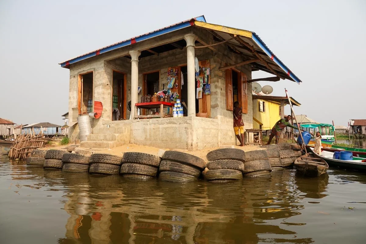
In the next photo, it is hard to see but there are a couple of pigs in the middle on a solid patch of ground. They blend in with the tires, both being black.

You might also notice that the children in Ganvie learn to stand and to operate the boats at an early age.

Now, we get down to business. The next photo is one of two water stations that we passed. Boats pull up with lots of barrels, tubs, and pots and the workers fill them all up with "clean water." I'm not sure where they get the clean water but one must assume that it's much better than the lake water to drink and cook.

We saw lots of wood in all of West Africa and Ganvie was no different. Even if you live on a lake, you need to cook and for that, you need wood.

There is also a lot of construction projects that need wood, such as the platform and ladders that you see.

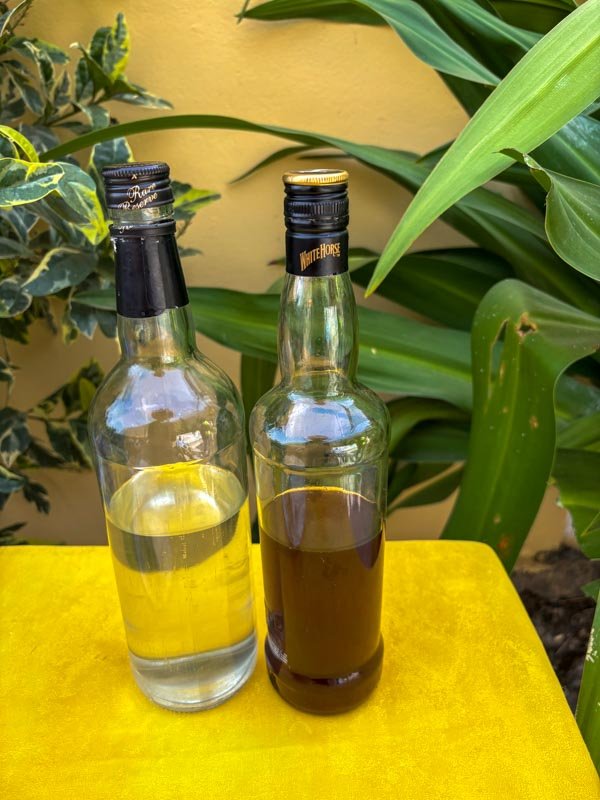
Now we move on to the more ordinary establishments of a village such as restaurants, bars, and so on. It gives a whole new meaning to don't drink and drive...

I included the next photo because it reminded me of what we might see, like a 7-11 store where you stop in for a quick purchase. It's also a very substantial building.

Money is always an issue that intrigues me with some of the small villages, like the fishing village. For that reason, I included the next photo.

Now for the grand finale photo of Ganvie. What village of this size could function without an ambulance service.

This post wraps up our visit to Benin. Next, we flew from Benin to Dakar, Senegal. 

Dakar, Senegal

     Welcome to Senegal and its capital city, Dakar. Dakar is a largest city in Senegal with over a million people and the Dakar metropolitan area has almost four million people. The area around Dakar was colonized by the Portuguese in the 15th century. They established a presence on Goree' Island, just off the coast, which became a base for the transatlantic slave trade. Dakar, as a city, was established by the French in 1857 when they established a fort here. The purpose of the French fort was to protect the interests of the French merchants that had established a presence here over the prior two decades. The French also took over Goree' Island in 1677. Under France, Dakar grew into a major regional port and a major city of the French colonial empire.

     For our part, the high temperature the day we arrived in Dakar was 72 degrees and very mild humidity and that was at least twenty degrees less than our previous stops. The low humidity was also very welcoming to us.

     Dakar was much more like a major city than Accra or Cotonou. It still has, of course, a substantial colonial presence. Below is Independence Square. Our hotel was across the street, right behind the large tree on the left in this photo. Our guide said that this square is in the heart of Dakar and is the beating heart of the city. 

The next two photos are on either side of the photo above, and across the street. They demonstrate the colonial presence in this part of Dakar.

The first building is (I believe) the Ministry of Finance building. The next is the Chamber of Commerce building.

Next will be two photos to demonstrate that Dakar is a genuinely important city with more infrastructure than our previous stops.

First is the Train Station which was not that large but at least they have trains here. The lack of vehicle traffic in the train station photo is because it was a Sunday.

Next is a photo of the port. The Dakar port is indeed a major shipping port. We saw lots of ships, shipping containers, and workers there.

Lastly, I'm including a photo of Vicky where we were eating our breakfast out on the veranda at the Pullman Hotel. We were having watermelon juice, crepes, omelets, and watermelon slices with coffee being delivered to us.

Behind Vicky is the lap pool. There was another pool farther down the hillside, in the trees. We also had ocean access down there which we utilized.

Behind Vicky on the hill is the Presidential Palace, so we were in the high-rent neighborhood.

Dakar's Kermel Market

     The Kermel Market is only a block away from Independence Square, so in the heart of the city. It appears to be an old market. It didn't look that big to me from the outside but inside, it opened up to be a substantial market. Kermel has loads of souvenirs, clothing, wood carvings, jewelry, and more. I was much more interested in the food market. It's a big grocery store for food with fruits, vegetables, meat and fish. 

     You can see the Kermel Market below. While it was interesting, I wasn't overly impressed. The only part of the market that really impressed me was the fish market area, so that's what I'm going to include in this post.

It was hard not to be impressed with the shrimp and the crabs in the Kermel Market.

They had lots of different fish in the fish market area, but I wasn't able to find out what kind of fish were for sale. I liked the color on these fish.

They also had piles of oysters, mussels, and clams. They all looked good to me.

And finally, some more fish. These weren't the biggest ones but they looked tasty.

Home Hosted Dinner

    We went out for a home-hosted dinner on this night in Dakar. It was in the Medina area of town, and we wound up in a long parade of some sort getting there. It's largely a Muslim area and some group was hosting a religious meeting and we ended up in the vehicle line going the same way. 95 percent of Dakar residents are Muslims and mostly Sunni Muslims. The whole area was lively, noisy, and active but it also looked run down and depressed.

     Our host family lived in a multi-level home with three generations. We met twelve or thirteen members of the family, so a large multi-family dwelling. In this family, they evidently just have one kitchen which was on the ground floor. We never made it upstairs to the rest of their house. You can see a photo of the home below.

Many people sat on the floor, but they had plenty of furniture, just not enough for all of them plus all of us. You can see some photos of the family below.

The "Mom" in the family cooked us dinner. We never got to see the kitchen, only the food. We had a one-dish dinner which was rice and fish with sweet potato, sweet peppers, cabbage, potatoes, carrots, and squash plus limes. Mom made the same for everyone and there was one large bowl for every four or five people to share. We all ate out of the same bowl, only using our right hands. (The left hand is used for going to the bathroom, but I don't know how the southpaws handled it.) I found it really messy and not very easy to do. We were supposed to scoop out a handful of food and roll it into a ball, just using one hand. I found the rice had quite a bit of liquid in it and that made each scoop very slippery to try and roll together into a ball to eat, but we managed to do it. You can see our dinner dish below.

Most everyone ate with their hands as you can see below. The woman with her back to us on the floor has her right hand pulling out a handful of food. The woman on the left is just going into the bowl for a handful. But you can notice that Grandma, next over, is using a spoon. We were offered spoons but we all used our hands like the locals.

Dessert was a fruit dish: bananas, grapes, tangerines, and pears. You can see a plate of fruit below.

We were also served baobab juice and hibiscus juice, both homemade. The baobab juice was like drinking a milkshake and the hibiscus was excellent too.

Lastly, we were served tea. It was a spiced Chinese tea and very bitter, but they put in enough sugar to overbalance it out.

It was a very good meal and a very slow meal. We were up to the challenge and got enough to eat. Plus, no one got sick, which is always a good thing.

Greater Dakar Area

     On this day, we drove out of Dakar but I'm pretty sure that we stayed in the greater Dakar area. In other words, we were out of Dakar proper but not too far away from the actual city of Dakar. We took in some sights, made several stops, and got to see some other areas of Senegal.

     Our first stop on this day was the African Renaissance Monument. This monument stands on one of two volcanic hills called Collines des Mamelles, not too far outside of Dakar. The bronze statue is 171 feet tall. What was more critical to our visit was that it was 198 steps up to get to the monument. We walked up all the way. 

     The monument was the idea of former Senegalese President Abdoulaye Wade. It was initiated as part of his Senegal prestige endeavors, trying to symbolize a new era of African Renaissance. The entire project took four years and was dedicated in 2010 to commemorate Senegal's 50th anniversary of independence from France.

     This monument is supposed to celebrate the rebirth of Africa, its cultural heritage, and its aspirations for a brighter future. We heard, of course, several versions of the significance of the statue from various local guides. One said it signified the rising out of slavery and moving to the light of a brighter future. I figured that I could take my pick of which particular story I wanted it to represent. You're welcome to do the same. I'll mostly remember walking up 198 steps to see it up close.  

     I'm also including a second photo, taken from the top of the steps, behind the monument, just to show some of the area around the monument.

Our next stop was the Mosque of the Divinity. It was built on the beach and completed in 1997. The location is the ancient fishing village of Ouakam which is not far outside of Dakar. Our guide gave us quite a bit of information about a holy man who inspired the building of the mosque. While it was built at the site of an ancient fishing village, I would add that it must still be an important fishing village. To the left of the mosque, there were dozens of fishing boats along the beach, and if you look out into the ocean, you can see many more fishing boats.

Our next stop was at an art gallery that specialized in "sand paintings." While we had a lecture and demonstration by the head of the gallery, I decided to show two photos of one of the artists working here that day. The idea with sand paintings is that all the sands are from Senegal and are different colors from different areas of Senegal. The artist first draws his picture, then adds glue, or something, and then pours small handfuls of sand onto the different areas of the picture.

Most of the sand paintings that were on display were more complicated than the one that this fellow did but we were here to watch him do the whole painting.

My next photo is just a place we passed on our drive. But we were stuck here in traffic for some time, so I took this photo. Senegal gained independence from France in 1960 and began to deliberately distance itself from the influences of Western architecture. They wanted to create a distinct African architectural style, characterized by strong geometrical forms, rocket-shaped obelisks, and the use of rammed earth. One example of this new architecture is the Institute of Social Hygiene.

This institute also plays a crucial role in Senegal's healthcare and it is a level two hospital providing medical care to key populations of the Dakar region.

We are still driving outside of Dakar proper but still in the greater Dakar area. I will mostly show some of the streets and areas that we visited. I wasn't brave enough to take many market photos. I got yelled at multiple times, just for taking my camera out of its case. These were not, however, great markets. We visited the market in the Medina area and then we visited the Kilen Market. The Medina market was mostly second-hand goods being sold cheaply. It was hot, dusty, dirty, and stinky. The Kilen market was better but still not great. It had a wider variety of goods and some of the produce looked okay but we encountered many angry people here.

My first photo is just a roundabout. It was really a large one with many roads coming into it. It also had way more traffic than it could easily accommodate.

The next photo will give you an idea of what it was like to drive through some of these areas. It was very slow and adventurous driving.

Next is just a place that we passed that I would say was typical of much of our drive. These were very small fruit and vegetable sellers, probably just for real locals.

I found the "local busses" to be interesting. They really crammed the people in. The guy on the back in the multi-colored shirt is the Conductor, collecting the fares. 

The rest of these photos are at the Kilen Market. They are all general photos as I was trying hard not to upset the vendors. It also wasn't a very impressive market.

Goree Island

     Goree Island was evidently a major slave trading center from the 15th to the 19th centuries. It's a small island (3000 feet by 1,150 feet) and is only 1.2 miles from the port of Dakar. Today it is part of the city of Dakar. The importance to the slave trade and the numbers of slaves shipped from here seem to be in wide dispute. There were evidently no records kept so the truth is hard to determine. It was originally occupied by the Portuguese, then the Dutch, but the French took over with short periods of British control. The French controlled Goree Island for the most part from 1677 to 1960.

     While its relative importance in the transatlantic slave trade seems to be in question, it seems that its importance in remembrance of the slave trade is not. Today, Goree Island gets over 200,000 tourist visits a year. Some of the past visitors to Goree Island include Pope John Paul II, Bill Clinton, Nelson Mandela, Barack Obama, and Michael Jackson.

     We took the twenty-minute ferry ride from the Dakar port over to Goree Island. My first photo is from the Ferry. The slave houses were all on the left side in this photo. The harbor is ahead with the white sand beach and the Fort d'Estrees is off to the right and not in this photo.

The next photo is also from the Ferry but focuses on the right side of the photo above. These were the official buildings, schools, homes and such back in slavery times, and today are restaurants and galleries and things. 

It's obvious that this is a tourist destination, even before you get off the Ferry. There are vendors on the Ferry, and you get greeted upon arrival here. Most paths are lined with vendors. Some vendors were quite persistent but not all of them. They offered everything from souvenirs to food and drinks to music and more. 

We were walking towards the last remaining House of Slaves, built in 1776 as one of the holding centers for enslaved Africans to be shipped to the Americas. It was like walking through a small village or town.

I never got a good photograph of the House of Slaves. It was too large, and I was too close but clearly, they had room for many slaves here. Slaves were separated with men, women, and children in separate quarters. Additionally, slaves that were not up to weight were also kept separately with the hope that they would gain weight. And while slaves were all separated, meaning families were separated, they were shipped out with no regards to family units. In fact, it sounded like families were broken up as part of the plan. Additionally, young girls were kept separately and paraded around the courtyard so enslavers and traders could see them to choose them for sex. If the girls became pregnant, then they had to be held until after having the baby before being shipped out to the Americas.

The photo below is the infamous "Door of No Return." This was the last door slaves went through before being put on a ship and sent to the Americas.

Below was a slave quarter but I think this was perhaps the nicest one. Most had no windows for air, etc. Slaves were chained to the walls and could not move. For that reason, I think this might have been the quarters for slaves that needed to gain weight in order to be sold. But even the nicest rooms here were very unpleasant.

I suppose that after a long week of beating, starving, whipping, and having sex with your slaves, an enslaver or trader would then want to take the very short walk to Saint Charles Church. There, he could attend mass and get all his sins washed away. It was quite a nice church and even had a giant clam shell to hold the holy water.

The fortifications on Goree Island were prominent and another part of the tourist trek. From the photos in my prior post, the Fort d'Estrees would have been on the right side. The fort was on the opposite side of the island from the House of Slaves. You can see the fort below. It looked quite formidable. 

The next photo was taken from the fort's upper area where you see the canons. From there, it's looking across the harbor to the area of the House of Slaves.

Next, we can see inside the fort. Of course, it's empty now but there is room for lots of soldiers plus it has rooms all around it.

The following photo is taken from the top, like above, only looking over to the right side of the island. It was quite a nice area to sit and have a drink while contemplating slavery.

Aside from the fort, Goree Island had other fortifications. Our guide told us about them but visiting the highest point of the island was on our own. Vicky and I opted to walk up and see what things looked like from the top. It was a steep uphill walk but the vendors were not as thick here as in other areas of the island. I liked the baobab trees.

Below is a view from the top of the island looking down towards the House of Slaves. Streets wound around the hill with residences and places of business.

One more highlight from the top of Goree Island was the canons we found. We had no guide, but my understanding is that these were from World War II. All I know for sure is that these are the biggest canons I can ever remember seeing. I think they must have had ten-foot barrels.

It also seems to me to indicate the importance of islands and locations such as these in that they were important in slave times and also during our world wars. 

To Cape Verde, on the SS Corinthian

     We went from Goree Island directly back to the Port of Dakar and boarded the M/S Corinthian, which was our home for the next 14 days.

     Our destination was Cape Verde, officially the Republic of Cabo Verde, which is an island country that is part of West Africa. Cape Verde is made up of ten volcanic islands and we visited five of them. The islands are between 375 and 525 miles off the coast of Africa, and Senegal specifically. It was over 400 miles to reach our first island, Santiago.

     These islands were uninhabited until discovered by Portuguese navigators around 1456. They were perhaps uninhabited because they are volcanic and have very little natural water available for people or plants. Water is still an issue today for much of the islands. Only about ten percent of the land is arable in Cape Verde islands.

     The small settlements eventually prospered due to the slave trade in the 16th century. That lasted until the 19th century when the decline of the slave trade resulted in an economic crisis for Cape Verde. But it transitioned into re-supplying ships in the mid-Atlantic shipping lanes. It also has some natural resources such as salt. Other nations also had some degree of presence here and the results of that always make me chuckle. For instance, I remember Sir Francis Drake as a great English explorer and for circumnavigating the globe. But here, he was Sir Francis Drake, the pirate.

     Cape Verde didn't gain its independence, from Portugal, until 1975. Cape Verde still lacks economic opportunities. For that reason, Cape Verde citizens have a long history of emigration. Around twice as many citizens of Cape Verde live abroad than live in Cape Verde. The population of Cape Verde is over 500,000 but there are a million citizens of Cape Verde living abroad. 

And what country, would you guess, hosts more citizens of Cape Verde than any other country in the world?

The answer is the United States! Who knew?

The United States hosts about 102,000 citizens of Cape Verde, mostly on the New England coastal area.

     Today, Cape Verde is greatly increasing its tourism industry, and that's where we come in. We spent two weeks on our navigation of Cape Verde.

     We took the Ferry from Goree Island to the Dakar Port and then boarded the M/S Corinthian. This ship is owned by our travel company, OAT or Overseas Adventure Travel. The ship is a 98-passenger vessel, so a small ship. You can see it below.

     We boarded our ship and after introductions and processing were shown to our cabin. This ship has passenger cabins on five decks or levels. I was curious about where our cabin was. We boarded on the fourth deck, but our guide took us down two flights to the bottom deck for cabins, or deck two. I was surprised and I looked at Vicky and said, "How did we get down here?" Vicky gave me "the look." "Oh right," I said, "I booked this trip." And of course, I booked the cheapest cabin on the ship.

     But much to our surprise, these were the largest cabins on the ship. We had more space than any other ship quarters on any of our other cruise trips. True, we didn't have an outside deck, only port-holes for windows. But the space was highly redeeming. I felt better and better as the trip progressed.

Yes, I booked this cabin for the luxurious space. That's my story and I'm sticking to it!

But, if you're not sold yet, and Vicky wasn't, check out our "walk-in" closet. That was incredible. I've never even imagined such luxury in a cruise cabin. Check it out. My big red travel suitcase looks like a duffle bag in the corner. Heck, If Vicky had booted me out of bed, I could have stayed by myself in the closet! 

We saved so much money that we drank more cocktails than anyone on the entire ship. The bar waiters hung around us because we were the big spenders.

And even if we were on the bottom deck, the lobster tasted just as good, if not better.

And being on the bottom deck didn't hamper anyone from being able to go on the bridge and tell them how they should be steering the ship (around the 12-foot swells!)

Praia, Santiago Island, Cape Verde

     We first visited the island of Santiago which was discovered in 1460. Praia is the capital and largest city of Cape Verde with a population of around 160,000 people. It is located on the southern coast of Santiago and is reputed to be the political, economic, and cultural center of Cape Verde. Praia has a natural harbor which was a big draw for it being a major city, plus the main part of the city sits on a plateau, some 120 feet above the sea. In fact, the main part of the city of Praia is called The Plateau. Being on the plateau gave Praia much more protection from pirate attacks which happened over time.

     One historical note that I'll add is that Charles Darwin stopped here in 1823. It was the first stop on the voyage of the Beagle, and they have a plaque honoring him here.

     We started our visit here with a walking tour of the Plateau. This is the historic center of Praia and includes some of the most preserved older buildings. The first building that we saw after getting off the bus was below. I don't know about the building, but the man painted on the side was the guy who initiated Cape Verde's independence, according to our local guide.

The next building is one of many buildings left over from the colonial days. Today, it's the Supreme Court of Cape Verde.

The next building is a historic building in the city center, originally built between 1823 and 1826 as a military barracks. Today is serves as the Ministry of Defense services plus houses a military museum.

The next photo is a view of Praia below the Plateau. I took this photo from the plateau.

I also took the next photo from the plateau, looking down at a beach. Praia is Portuguese for "beach." This is part of the natural harbor of Praia.

Next, we walked past the Presidential Palace. It had locked gates and armed guards so this was as close as we could get. It's in the center of the Plateau.

The last photo is the Main Square. It's the center of the Plateau and the buildings above are all very near to here. I was amazed at how clean everything was with no litter or garbage or broken vehicles. It was a very different situation from the mainland.

Praia Market

We visited a market in Praia on the Plateau. This market has been here since Colonial times. It was well organized and roomy compared to other markets that we visited, and it was one of the cleanest markets that we have ever visited. Vendors were very civil here and not aggressive or annoyed with us at all. The fruits and vegetables looked good but not great. The fish looked good. They had everything that anyone could want to buy here. It was an indoor, two-story market. 

I took the first photo from the top story, looking down on the ground floor of the market.

I soon learned that these people didn't care if I took photos or not. They minded their business and not mine.

This market also had small food places, like mini-fast-food joints. I took this photo from the second floor of the market. The customer at the counter was eating a noodle dish.

I was more impressed with the fish than most everything else in the market. That was true as well for the rest of West Africa.

I would really have liked to take home some of the fish that this lady was cutting up. It looked fabulous!

We left the market but just as I stepped outside, the guy below drove up in a small wheeled vehicle. The fish in the back stuck out of the back of his vehicle bed. It was a yellow-fin tuna.

Cidade Velha

     We drove out of Praia but only about six miles. Here we visited Cidade Velha, the oldest settlement in Cape Verde and its former capital. It was founded in 1462 and was formerly called Ribeira Grande. One of its best features and reason for being was its location at the mouth of the river Ribeira Grande de Santiago. Having an abundance of water made this a key port in the early days of colonization. Cidade Velha was the first colonial settlement in the tropics. 

     I'll put Cidade Velha into some perspective for you. Vasco da Gama stopped here on his way to India in 1497. Christopher Columbus stopped here in 1498 on his third voyage to the Americas. Ferdinand Magellan stopped here in 1522 on his final leg of the survivors circumnavigation of the world. And of course, I've already mentioned that Charles Darwin stopped here in 1823 on his voyage of the Beagle.

     The Portuguese established this town, so naturally their colonial rivals, the French and English, wanted it. Sir Francis Drake attacked and raided Santiago in 1585, so between 1587 and 1593, Portugal's Philip I built Forte Real de Sao Filipe. It was built high above the town on a plateau from stones imported from Portugal. As I stood at the fort, it seemed doubtful to me that it could really protect the settlement. Our local guide said that when the town came under fire, the people would run up the mountain to the fort. It evidently didn't work out that great and they eventually moved the capital to Praia. The fort went into decay in more recent times but the walls have been rebuilt by UNESCO. They only rebuilt the walls, nothing else. You can see a view from the fort looking over the town below. And by the way, Cidade Velha is Portuguese for "old city."

The next photo is to one side of the fort. You can see that this area of Santiago is a series of plateaus with deep gullies between them. You can also notice that they are doing lots of farming down in the valley and seem to have plenty of water, the original draw for this location.

Next is a photo of Cidade Velha taken from the fort.

We drove down to the town. It's not very big. We walked the oldest part of town. The next two photos were taken on "Banana Street."

Cidade Velha has the oldest colonial church in the world called Nossa Senhora do Rosario Church. It was constructed in 1495.

Lastly, we can see the town center and its Pillory which was erected in 1512 or 1520. It's a marble pillar used to punish rebellious slaves by publicly chaining them here for all to see. This town, like much of West Africa, flourished during the slave trade and was a key shipping stop.

Harmattan

     The Harmattan is a season in West Africa that occurs between the end of November and the middle of March. We were in West Africa right in the middle of the Harmattan. It's characterized by dry and dusty northeasterly trade winds that blow from the Sahara Desert over West Africa and into the Gulf of Guinea. In addition to seeing the dust, we could smell and taste the Sahara. All I kept thinking was, "I never saw this in the brochure!"

     As a reminder, we are still on Sal Island. At the point of the photo below, our local guide was pointing out a large mirage lake. He went on at some length about this mirage lake which was evidently quite impressive to see. I strained my eyes, but no luck.

Shortly after seeing the mirage lake above, we were told all about the inactive ancient volcano, seen below. I didn't get much of the information as I was straining just to see it. At least I could actually see this landmark.

     At about this time, I inquired with our local guides about the haze and dust. I received several answers such as, "It never lasts more than two days," and "These are usually just for a day or two but never more than three days."

     We were in West Africa for almost a month and learned that this was called the Harmattan Season. It actually lasts for about five months. BUT, before I even learned about Harmattan season, I determined, by myself, that our local guides were full of beans. How, you ask? By looking at the trees that we passed along the way in Sal. You can see some below and decide for yourself if this is just an occasional wind or a complete and regular season.

     I'm not showing this to bash West Africa, but I think you should see some of what we had to deal with on this trip. It was really bad for about three days, but we dealt with the dusty wind, to some degree, almost every day of the trip.

These trees were not suddenly caught and bent over in a mighty wind on the day we visited. These trees are permanently bent over from the constant winds there.

Buracona, The Blue Eye, on Sal Island

     We are now on the island of Sal, which is Portuguese for "salt." It is one of three sandy-beached eastern islands of Cape Verde. This island was sparsely inhabited for the first three centuries but that changed at the end of the 18th century when they developed a salt industry. In the early years, 30,000 tons of salt a year were being exported, mostly to Brazil. Most of the island is fairly flat but it does have several old volcanic remnants. We also experienced some severe Sahara blowing sand today on Sal.

     Our first visit was to Buracona. It's a natural wonder on the northwest coast of Sal Island. The key features are some dark volcanic stone, seawater that is bright blue in the sunlight, and a large opening in a cave, actually a lava tube eroded by the sea, that can be accessed from the sea.

     I'll start with some photos of the blue water and volcanic rocks that we passed leading up to the blue eye.

At this point, we reached the end of the line, leading to the Blue Eye. We patiently waited our turn, anxious to see this natural wonder. You can see it below.

As we walked away, Vicky turned to me and said, "They can call it the blue eye if they want to, but I'm calling it the Black Eye." 

There was evidently too much sand in the air which blocked the sun from shining this far into the cave.

But otherwise, this was a strikingly beautiful section of the Sal coast.

Plus, if you look at the next photo, the blue eye is in the upper right corner area, and it can be accessed through the lava tube from the entry below.

Shark Bay

     Our next visit on the island of Sal was to Shark Bay, or Baia da Parda. It's located on the northeastern coast of Sal Island and near the village of Pedra le Lume. It's a large very shallow bay where Lemon Sharks deliver their babies. The momma sharks have their babies here where they are protected in the shallow water. The momma sharks are still farther out in the bay. The baby sharks live in the shallows of this bay for a year or more. 

     Lemon sharks often return to specific nursery sites for breeding, and this is one of those sites. Lemon sharks are known for their sleek, grey bodies and their distinctive fins. It was fun to stand in the shallows and have them swimming all around us. It was an up-close-and-personal experience. Vicky was a little tentative walking out into the bay.

Our local guides told us that the Lemon Sharks wouldn't harm us, but they did say not to dangle our fingers in the water. You can see how close they got to us as I took the photo with my foot in it. On occasion, they would brush past our legs.

Vicky turned full of confidence in no time and we both really enjoyed the experience. You can see a shark in the bottom left corner of the photo with Vicky.

Both Sal and Santiago Islands had been so clean and devoid of trash that I was surprised by what I saw (below) as we left Shark Bay. I asked our driver about all the garbage along the coast. Our local guide said it was indeed a problem for them. He said that they did an extensive study last year and they found garbage from 25 different countries in the trash collected from the coast here. That's a sad commentary and not reflective of the people on Sal Island.

Pedra de Lume Salt Mine

     Our next stop on Sal Island, before lunch, was to the Pedra de Lume salt mine. It's located on the eastern side of Sal and is located within a moon-like crater of an old extinct volcano. The bottom sits below sea level and seawater infiltrated the crater and then evaporated, leaving behind natural salt. It varies in color from white to bright pink. Mineral salt was discovered on Sal in 1833 and it became a major industry. Salt production on a large scale lasted up until 1985. 

     This continues to be a productive place, only now the salt has largely been replaced by tourism. That's what brought us here. Some tourists come to observe the remains of the salt production. We came to swim in the salt lake. Our local guide claimed that we would be swimming in "Lake Salinas." My position is that we were swimming in a salt pond.

     Our guides said that this was the second saltiest water on earth, second only to the Dead Sea. The pond is 27 times saltier than sea water. They also had salt and mud packs, but floating in the pond was enough for us.

     It hardly seemed like we were going to a lake for a swim as we started into the mine area. It was also a long walk on a warm day with lots of Sahara dust blowing.

This next photo is why it seemed to me that we were going swimming in a salt pond. See what you think.

The water was interesting. The water on the top three feet or so was about 70 degrees. But the water right below that was about 90 degrees. That seemed backwards to me. This was still a far nicer experience than the two times we swam in the Dead Sea. Here, we didn't come out of the water all crusted over and we didn't crackle when we walked out. 

As we were leaving, I was tired and ready to go back to our ship for a shower, some lunch, and some air conditioning. Perhaps I'm getting older.

Santa Maria

     We are now on the southern part of the island of Sal in the town of Santa Maria. It was founded in 1830 for the production and shipping of salt and is the former capital of Sal Island. A small rail track was constructed to ship the salt from the mine to the pier. Again, 30,000 tons of salt were shipped from Santa Maria annually, mostly to Brazil. But that ended and since 1986, tourism has become a significant industry here.

     For tourism, Santa Maria has beautiful beaches and ocean, fishing, boating, surfing, swimming, seado's, and many other endeavors along with bars, restaurants, and souvenirs for sale. We took it all in. The Sahara sand is still with us but not nearly as bad right here.

I believe that the pier below is the pier where the salt was shipped from. Today, it's mostly being used for fishing, boating, and for tourism.

The next photos will just give you a glimpse of the tourist area and development. It was a very nice place to visit, and I wished we had more time here.

Santo Antao Island and the village of Janela

     We are now on Santo Antao, our third island in Cape Verde to visit. Santo Antao is both the most westerly island and the most northerly island of the country. It's also the second largest island in Cape Verde. It's a volcanic island, very mountainous, has two high plateaus, several steep river valleys, and is known for its verdant mountains and lush interior, but not the whole island is like that. In fact, the southern part has a desert climate. Santo Antao has genuinely rugged mountains and many remarkable vistas. The island is so mountainous and rugged that it does not have an airport. People need to fly to Sao Vicente island and take a Ferry here. 

     We were in Santo Antao for two days and had some interesting experiences. Our first visit was a short drive to the village of Janela. We were told that Janela means "window" in Portuguese and the window is the rock formations along the coast here. I'm not sure if I saw the window or not. I'm also uncertain about the exact location of Janela. I think that the first village we saw might be a separate village but I'll point it out below. You can see the coastline and the village is on the right in the distance and in the Sahara sand.

When we reached the village in the above photo, we turned up into the mountains. There are evidently several villages up in the valley of the river Ribeira da Janela. We were told that we were in the village of Janela. Below, you can see that we are driving up the river valley and it is a steep and rugged valley but with plenty of water and agriculture. 

One of the features that most impressed me was the terracing done for agriculture. It had to be a real challenge to put in all those terraces on such a steep hillside. 

As we got off our bus at the bottom of the valley, the lushness and productivity of the agriculture was very evident. In these photos, we see bananas, papayas, breadfruits, sugar cane, mangoes, manyak (tapioca), yams, and others.

Below is a part of the village. Even being very low down in the valley, everything was still steep and had to be terraced to make the street below.

Most of the village of Janela was rugged mountains as you can see below. Some of the houses appeared to be very utilitarian but not all of them.

In the next post, we will take a hike through this village, which was a substantial uphill and downhill hike.

Janela Village Hike

     We took a lengthy hike in Janela. Our guides told us not to take this hike if we were not fully capable of hiking up steep mountains, with high steps and rough footing. We rolled our eyes and proceeded with the hike. I will say that it was challenging at times. This hike was basically like walking through this village on "main street." It was not a road for vehicles but for people and donkeys. It was a well-established road that I'm sure gets lots of use. We enjoyed the trail and the hike felt good to us.

     Below you can see how well defined this trail was, which is why I thought of it as main street.

The next two photos show how far up from the valley we hiked. They also show why this was not a vehicle road. Here we were mostly hiking through bananas and sugar cane.

Water conservation and use is critically important here, despite how green it is. They have a short rainy season, about three months, and a long dry season. For that reason, they have reservoirs and channels for the water to collect and move around the village.

Transportation was mostly done by people but we did see several people, like this one fellow below, transporting by donkey.

Local people that we passed in the village were mostly quiet but not unfriendly. I would say that they mostly seemed curious about us. I don't think this village and this hike have yet become tourist destinations. 

Now we were back down from the mountain and our circular hike. You can still get the sense of the steepness of this village and the depth of the canyons.

I would say that we saw and passed more banana plants than any other. Bananas grow very well here.

Janela Distillery Business

     You might know how much I like to see and meet with the simple and small businesses. We got to visit a distillery in the village of Janela. It was a small, simple, low-technology, minimal investment business that seemed to be very efficient. Our local guides said that it was a successful business. They called their product "grogue" (grog). I half expected to meet a pirate or two at the shop. Grogue is the national drink of Cape Verde.

     In the first photo, I would like to point out the sugar cane growing on the hillside above their shop. That's their raw material.

They chop down the sugar cane and stack it for processing.

The job of grinding up the raw sugar cane to get the sugar cane juice seemed simple enough. You can see their crew of two below. The white frothy juice below is their start.

They have to let the sugar cane juice ferment for several days. Afterwards, they cook the juice to distill it. I would not like the job of tending the fires in the heat and humidity of this place, but I guess it's a job. They use the spent sugar cane husks for their fuel for the fire. 

The next guy, on the distilled alcohol end of the operation looks like he has a pretty cushy job.

     We visited a village school, but it was a Saturday, so there were no students. Still, we were expected, and the teachers gave us a snack of bananas, dumplings, biscuits, doughnuts, and fried breadfruit. Plus, they served us some local grogue. They had two kinds and we tried them both.

     We were told that the clearer grogue was for the men. It was stronger. The darker grogue was for the ladies as it was sweeter and not as strong. I like the darker grogue. But I had to try each one about three times to complete my test and determine my preference. No more hiking today mateys.

Porto Novo, San Antao Island

     This is the municipality of Porto Novo. It is on the south coast of Santo Antao island and the most populous settlement on the island. Due to its location, it did not develop very early. In fact, it was not a municipality until 1962. It was originally just a small fishing village. The port was also inaugurated in 1962. It's still a small town.

     We had a walking tour here one day and free time here the next afternoon. And while we were told that it was an exciting town, we were here on a weekend and evidently all the excitement must happen here during the week. But our visit here is still worth a post. There were fishing boats on the beach and many more moored out in the harbor.

The architecture was mostly somewhat boxish, and also included lots of bright colors. The main street was all cobblestones.

We did see a few buildings that struck me as being different, such as the one below.

The one above and the one below were both on the main street in town. The building below seems to pay homage to the town's fishing history.

It appeared to me that anyone could quite readily enter the local transportation business. We saw many of these small trucks hauling people about town.

The next photo is one I took looking over the wall, right where Vicky is standing in the above photo. I'd say this is still somewhat of a fishing village.

The Rope Road

     If anyone were to ask me what was the single most impressive thing that I saw in Cape Verde, it would be the Rope Road, or the Estrada A Corda. That would probably be true for all of West Africa. This is a road that runs from Porto Novo to the northeast to Ribeira Granda, the administrative capital of Santo Antao. It's a national road and an incredible driving experience. 

     It's called the Rope Road because it winds around and back and forth like a rope and looks like a rope on the map. The whole road is somewhat over 22 miles long. Now that may not sound like much but wait until you hear the rest of it. The entire road was made with hand-laid cobblestones. They used approximately 15 million cobblestones, each an irregular shape, and each one laid by hand to make this road. It took 30 years to complete the Rope Road. It's a work of art.

     The road traverses the island going from coast to coast but climbing up foothills to incredible peaks, passing lush forests, canyons, agriculture, a volcanic crater, and more incredible viewpoints than I could imagine. I will just take us from Porto Novo up to the top of the mountains. At the start, it might not look so spectacular, but just wait.

I'll point out several things in the next photo. We were just progressing up through the foothills but the lush forests up above were something new to us on the islands. You might also notice terracing for agriculture with rock walls. Plus, if you can see the corn growing, each stalk of corn is about three feet apart. Water is precious here in Santo Antao.

As we started passing canyons like below, I started to get a feel for why this road might be considered so spectacular.

And while I thought some of the canyons would have been difficult to put a road over, it was nothing like the mountains still ahead. And remember, this road was all hand-made. In the photo below, I'm standing on the edge of the road and the drop-off is equal to the mountains across from here.

And if the lower elevations don't appear to be so steep, the next photo will zoom in on the agriculture area in the bottom center of the above photo.

One of the key stops along the rope road was to see Cova-Paul-Ribeira da Torre Natural Park. It is in the Cova Crater, a volcanic crater that's about .62 miles across. The elevation of the crater is from about 1,300 feet to 5,200 feet. It features steep cliffs and deep river valleys. Cova Crater features lots of unique flora and fauna plus agriculture which we were told is mostly maize and beans. We spent quite a bit of time looking at the park from the road.

Continuing along the rope road, you can notice several things in the next photo. First, there is a lot of agriculture taking place, even at these high and steep elevations. Second, you can see many houses which makes it more evident why they needed to build the rope road. Third, you can see that we are still dealing with the Sahara sand but it's finally getting better.

The next four photos are all near what I believe was the high point of the rope road. The photo below is from the crest looking east, towards Janela. I would especially say to look at the ridge line and the sharpness of the peaks. Next, I would have you notice the steepness of the mountains and the depth of the valleys.

Below is a section of the rope road along this high point of the road. The drop-off on both sides is incredibly steep. We stopped here for a good while. At one point, I casually said to our local guide that a lot of good men must have died making this road. I fully expected him to pooh-pooh my comment, but he didn't. He immediately said oh yes, many men died making this road.

And now from this same section of the road, the next photo looks west, which is to the left in the above photo.

I walked down the road past where Vicky is above and took the last photo looking back towards where Vicky was sitting. The rope road is a handmade marvel.