Home Visit

This post and the next are from our home visit on our “day in the life day.”  We were put to work doing chores.  Our chores were not hard but the temperature was about ninety-eight degrees.  Altogether, it was a pleasant and easy day for us.

The first photo is of the inner area of their housing compound.  There is an outer wall by the road.  We entered a room and then came out the back of the room into this courtyard.  The family has houses and rooms all around this courtyard.  At least three generations live in the houses, so it is really a family compound.  The garden is quite sizeable along with the greenhouse and areas for animals.  They have all sorts of fruit trees and vegetables, everything from pomegranates to horseradish.

DSC04771.JPG

My first job was picking fruit for our lunch drink.  My second job was digging potatoes which you can see in the second photo.  I dug about twice as much as the red bucket would hold.  The potatoes were for lunch.

DSC04782.JPG

My third job was cutting alfalfa from the garden to feed their goats.  I cut the alfalfa laying on the ground in the third photo.  The family guy was cutting it up to make the pieces smaller before feeding the goats.

DSC04786.JPG

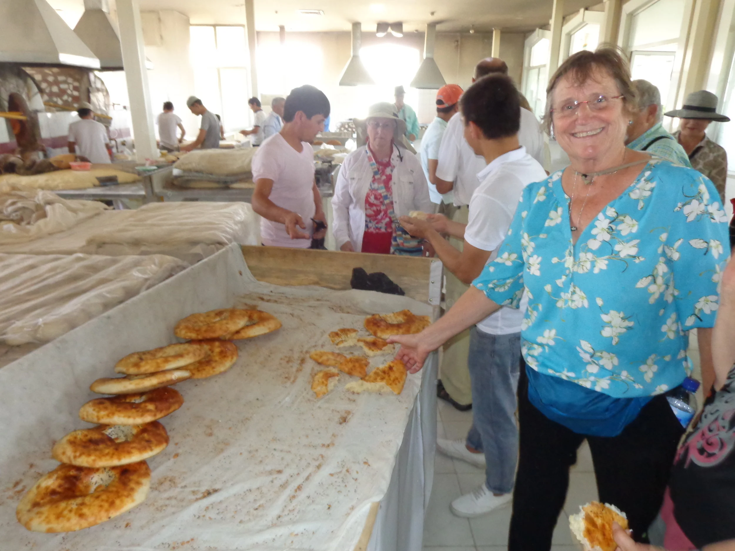
Vicky is on the samosa-making detail in the fourth photo.  I think some of my potatoes ended up in some of the samosas. 

DSC04790.JPG

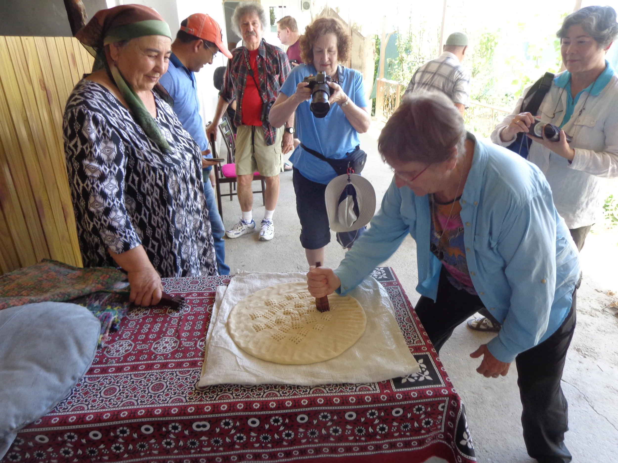
Vicky is pounding the bread under the eye of the woman of the house in the last photo.  She had to pound and re-pound every square inch of it several times.

DSC04797.JPG

Home-cooked Meal

This post is about the meal that we helped prepare and eat.  We did most of the preparation work but the family did the cooking.  All the cooking was done outside the house.  It was done in the courtyard but under the roof that covered the walkway on two sides of the courtyard.  They used either four or five fires/stoves to do the cooking. 

The samosas are being cooked in the first photo.  They were really good.

DSC04796.JPG

This was the fruit drink we had for lunch (2nd photo).  We picked the fruit (apples, cherries) and put it in the pot.  As the fruit did not look ripe to me, I had low expectations.  But I must say that it was an excellent drink.  I’m not sure why they like a warm drink on such a hot day but it didn’t keep me from going back for more.

DSC04799.JPG

The main cooking operation can be seen in the third photo.  The bread oven is behind the woman on the left side.  The other two ovens cooked rice and other dishes.  They were just getting started at this point.

DSC04803.JPG

I got put back to work after the cooking.  I was tearing up the bread into pieces in the fourth photo. 

DSC04805.JPG

You can see some of our lunch in the last photo.  Some cooked vegetables are in the upper left.  A Cole slaw salad is next to that.  Samosas are in the upper right.  The main dish was rice pilaf with chickpeas, carrots, garlic, cumin, raisins, and meat.  It was an excellent lunch and I definitely ate too much.

DSC04809.JPG

Around Bukhara

I thought I would show some things that we experienced in Bukhara that were not Silk Road highlights.  These are just from walking about town for a couple of days on our own and just seeing what we could see.  Bukhara was a nice place to wander.

The first photo was in the central plaza in Old Town Bukhara.  We must have passed this table more than ten times during our stay here and every time there was a game of dominoes being played.  Only four guys played at a time but there was always a good sized bunch of guys either waiting to play or just enjoying the game as spectators.  And you have never heard such a lively game of dominoes.  Most guys would bang down the dominos like they were trying to break the table and they would holler things out when they played.  The crowd also got boisterous at times.  Who knew dominoes could be such a lively game. 

DSC04624.JPG

I don’t know how many weddings we saw in central Asia but enough that seeing one was not a surprise.  The parts that we saw were always out in public.  I’m guessing these are just photo ops but there were always lots of people milling around.  They also never minded others taking their photos.

DSC04626.JPG

We visited a puppet shop in Old Town Bukhara.  The owner gave us quite a presentation on puppets and how they make them and so on.  It was an old established business.  At one point, he stopped and with a gleam in his eye, brought this puppet over to me.  He handed me the puppet you see in the third photo.  I have no idea why he did that.

DSC04690.JPG

I walked out of our hotel early one morning, just to observe the area.  The fourth photo is right in front of our hotel.  I saw the fruit seller pushing his cart along the sidewalk.  Eventually, several ladies stopped him.  At the point in the photo, the lady on the left was evidently arguing either that the fruit was not good or that it cost too much.  Right after this photo, the seller took a handful of fruit and shoved it in his mouth, as if to say that it was excellent.  The woman eventually purchased some fruit.

DSC04755.JPG

We went out to dinner in Bukhara one night with our good friends Ron and Patty.  We ate upstairs at the restaurant which was open-air seating.  We had a nice cool breeze and a good view of the area.  I believe that we all had kabobs as that was the specialty of the house.  Dinner was excellent.  I never noticed the cat under the table in the photo until I put it into this post.  Too bad for the cat as we ate everything.

DSC04814.JPG

Caravanserais

Caravanserais were as much a part of the Silk Road as anything.  My own thought is that they remind me of the Missions in California.  A caravansary was like a large guest house or hotel complex for merchant caravans to stop at as they made their way along the trade routes.  They gave the merchants a place to eat and rest for the night.  They also gave the merchants an opportunity to exchange goods with other travelers and local merchants.  A caravansary also gave the merchants protection from the dangers of the road, particularly in times of economic or political unrest and particularly if they were carrying precious cargo, such as silk.

Caravanserais ended up being much more than all of the above.  Over time, they provided the opportunities for the exchange of cultures, languages, news, religions, and ideas.  They were the proverbial mixing bowl for cultures.  Cities that had caravanserais often became the cultural and intellectual centers along the Silk Road.  Caravanserais go back as early as the third century BC but gained popularity as trade flourished across Central Asia in the 10th century.  They continued to be used in places as late as the 19th century.  Some still exist and we saw parts of caravanserais on our trip.

Our guide said that caravanserais were twenty miles apart because that was a day’s travel for the camel caravan.  Our California missions were thirty miles apart as that was a day’s ride for a horse.

I’ll show two separate caravanserais in this post, just for examples.  One was in Old Town Bukhara and the other was on the Silk Road between Bukhara and Samarkand.

The first photo is the front of an old caravansary that is in Old Town, Bukhara.  They were usually constructed outside of the walls of a town or village.  The front was a heavy-doored gateway, high and wide enough to admit loaded camels and they usually only had one entrance.  The caravanserais were open from early morning until after dusk and then shut up tight at night.  This caravansary was obviously a very nice one in Bukhara.

DSC04634.JPG

The caravansary in the second photo was out in the middle of nowhere.  It was across the road at a roadside stop on the highway.  You can, however, see the similarity.  This one was not in or near any town or city.

DSC04851.JPG

The third photo is the inside of the caravansary in the first photo, in Bukhara.  A Caravansary was usually quadrangular in form on the inside.  They had massive walls.  The 300 – 400 camels, mules, and horses would either stay in back somewhere, if enough space, or would just be tethered in the middle of the quad.  The lower portion of the rooms would be for storing their merchandise.  The upper portion of the wall would be rooms for lodging the people.  Meals would be prepared in one corner of the quad.  There often might be a well with a fountain basin in the center of the quad for water for the travelers and their animals.  Can you imagine the smells with the camels and food when the temperature hit one-hundred degrees.

DSC04629.JPG

The fourth photo was right next to where we parked our bus in the roadside stop and across the highway from the caravansary entrance in the second photo.  I was very curious about this structure. 

DSC04846.JPG

If you look at the right side of the fourth photo, you see two low walls.  These are each side of a ramp that goes down below the domed structure in the photo.  You can see in the last photo that this is a cistern and this was the source of water so that a caravansary could be located here.  So I presume that there was a well or river or some source of water at least every twenty miles across these deserts, as that was the distance between caravanserais.

DSC04849.JPG

Registan Square, Samarkand

We are now in Samarkand.  It is one of the oldest continuously inhabited cities in Central Asia.  Human activity here dates from the late Paleolithic era though there is no evidence of exactly when Samarkand was founded.  It was most likely founded between the 8th and 7th centuries BC.  Samarkand prospered from its location on the Silk Road between China and the Mediterranean.  Samarkand was Tamerlane’s (Timur’s) capital city.  The city also had some very low periods during its existence. 

Registan Square is Samarkand’s central square, going back to ancient times.  “Registan” means sand place as the square was covered with sand, long before any buildings were built.  Back then, it was the gathering place for people to meet, trade, announce the Khan’s orders, hold celebrations and festivals, collect the army leaving for war, and public executions.  The area right around the square had many trade rows where farmers and artists sold their goods.  All main roads in Samarkand led to the Registan where it was always noisy and lively.  Registan was also always the center of social life for the people of Samarkand.   

There are three Madrassahs (teaching and learning place) on Registan Square, erected by two rulers at different times:

Ulugh Beg Madrassah, built 1417 – 1420, which is on the left facing the square.

Sher-Dor Madrassah, built 1619 – 1636, on the right side facing the square.

Tilya-Kori Madrassah, built 1646 – 1660, in the center between the other two.

Registan Square, looking north, is in the first photo.  The oldest madrassah is on the left, the next oldest on the right, and the newest is straight ahead – not that it matters as they are all very old.

DSC04870.JPG

Vicky is in front of the Tilya-Kori Madrassah in the second photo.  The tile work was really excellent.

DSC04910.JPG

The Sher-Dor Madrassah is in the third and fourth photos.  The fourth is a close-up of the entrance.  You can see that the tile is not just a repeating pattern, but that almost each piece of tile had to be made for a specific position.

DSC04929.JPG
DSC04932.JPG

How do we account for a couple of tourists, having never been there before, showing up to Registan Square and dressing to perfectly match the madrassah’s cupolas?

DSC04871.JPG

More Registan Square

We are still in Registan Square.  The view from the front of the square was spectacular but that was just the start of an interesting morning.  Once we entered the madrassahs, there was an overwhelming amount more to see.  I will just post a few photos with explanations but a person could spend a long time looking at all the spaces and intricate details from inside the madrassahs.

The interior courtyard of the Tilla-Kori Madrassah can be seen in the first photo.  You can see the blue domed tower of the mosque within this madrassah.  The interior courtyards are quite large.

DSC04903.JPG

The interior courtyard of the Ulugh Beg Madrassah can be seen in the second photo.  This is just one corner of the courtyard.  The entire square looks like this.  There are the original entrances to the student’s cells along the walls.  This madrassah had room for around 100 students.  At that time, this madrassah was the largest scientific-education establishment in Samarkand.  Students were taught philosophy, astronomy, mathematics, and theology.  

DSC04915.JPG

Going into the interior of the buildings held some great surprises, as you can see in the third photo.  Uzbekistan is blessed with lots of gold.

DSC04896.JPG

The small door in the fourth photo was the entrance into a student cell, where perhaps four students lived and studied.  Today, some cells are given over to vendors.

DSC04916.JPG

I went into several cells but it was a challenge.  I’m speculating that the locals were shorter back then, plus they didn’t have much wood.

DSC04881.JPG

Bibi-Khanym Mosque

The Bibi-Khanym Mosque is not far from Registan Square.  This was once one of the Islamic world’s biggest mosques with the cupola on the main mosque being 135 feet tall and 59 feet in diameter.  The mosque was built between 1399 and 1404 but also had additional work done at later times.  The mosque was built by Tamerlane’s “senior wife” to please her husband.  It was financed from the spoils of Tamerlane’s invasion of India.  There is a legend that Bibi-Khanym, Tamerlane’s Chinese wife, ordered the mosque built as a surprise.  But the architect fell madly in love with her and refused to finish the job unless she gave him a kiss.  Tamerlane found out and ordered her thrown off the minaret.  But she put on every dress she owned and was so cushioned by all the dresses that she survived the fall, at which time Tamerlane spared her life.

The mosque holds 10,000 to 12,000 people.  Much of the original mosque was destroyed in an 1897 earthquake.  It was not until 1974 that the rebuilding started under the Russians and it was not finished until recently.  I believe that it has been fully restored to its original size, though parts within it have not been restored yet.

The first photo was taken outside the mosque on our walk there but I think it was the best photo of the mosque that I got, because I wasn’t too close at that point.

DSC04949.JPG

The mosque entrance is in the second photo.  It’s very large and if you look, it looks like it still needs more restoration work.

DSC04952.JPG

Once inside, there is a very large courtyard (3rd photo).  I think it is longer and much wider than a football field.  Besides the main mosque, there are two smaller mosques on either side of the courtyard. 

DSC04956.JPG

Some of the interiors are very nice and quite intricate as you can see in the fourth photo.

DSC04977.JPG

Inside one room there was a museum or historical section.  I photographed a photo which you can see in the last photo.  This is to give you an idea of what was left after the 1897 earthquake.  Most of the beautiful buildings that we saw on this trip had been destroyed by invaders or earthquakes or both.  So most of what can be seen today is restorations.  But they use photos and fragments and try to replicate what was there originally.

DSC04979.JPG

Siab Bazaar

We are at the Siab Bazaar, right next to the Bibi-Khanym Mosque.  This is a 600 year old bazaar.  I think this might have been the nicest bazaar that I’ve ever seen.  The floor and vendor booths were all marble.  The overhead wood roof was equally beautiful.  It was spotlessly clean with flowers and decorative touches.  Yes, very nice indeed as you can see in the first photo.  This is just one section of the bazaar but it went on down the hill to a much larger area.  I tried to pick photos of goods that we saw less often, so not the regular fruits and vegetables.  They were selling all sorts of things.

DSC04982.JPG

The egg lady is in the second photo.  She’s got the big browns, the small browns, the big whites, the small whites, and the quail eggs.  I think this guy ordered two hands full of quail eggs.

DSC05003.JPG

A honey seller is in the third photo and you could get anything honey related from her.  It all looked very good.

DSC05005.JPG

Around the edges of the market, people were selling goods as well.  This woman in the fourth photo did not have a booth but she had plenty of customers.  She was selling dried fruit, cherries, and seeds.

DSC04993.JPG

The last photo was taken near the end of our tour of the market.  My guess is that this guy had heard of my reputation for taking samples but not purchasing anything, so he continued on with his nap.  But still, he did an impressive job of stacking his dried fruit and nuts.  Nice marketing.

DSC05009.JPG

Gur Emir Mausoleum

We are at the Gur Emir Mausoleum.  This complex was right next to our hotel in Samarkand.  I went by it four or five times during our stay in Samarkand.  We were told that this was a significant architectural ensemble.  The complex started out as a madrassah by Muhammad Sultan, grandson of Tamerlane (Amir Timur).  But Sultan died and Timur temporarily ordered his grandson’s remains put in the corner of the madrassah and ordered construction of the mausoleum.  Tamerlane (Timur) however died before the mausoleum was finished, in 1405.  Ulugbek, another of Timur’s grandsons, finished the mausoleum and even though Timur already had prepared his own mausoleum, Ulugbek buried Timur here.  Timur’s two sons, two grandsons, and his spiritual mentor were also buried here.  So this is the mausoleum of one of the great conquerors of the world, Amir Timur – or Tamerlane.

The first photo was taken on the walk up to the mausoleum.  It’s a beautiful structure from any angle.

DSC05024.JPG

The entrance is in the second photo and hundreds of tourists were visiting this place.  We talked, through our interpreter, with several groups.  These ladies are Uzbeks and are on vacation making a visit here.

DSC05026.JPG

The third photo is going through the entry portal but you can see some of the fine tile work, some of the courtyard and the cupola on the main complex.

DSC05062.JPG

The fourth photo is inside and that was very crowded as well.  Timur’s gravestone is made of a single piece of jade.  It is to the right of this photo.  The burials are actually below in the mausoleum basement.

DSC05054.JPG

I’ve mentioned Timur, or Tamerlane, numerous times on this trip.  Just to give you some idea, I’ve attached a map that was in one of the rooms in the mausoleum.  If you can see it, is shows routes of Timur’s military campaigns.  He was born in 1336 and died in 1405.  He was a vicious conqueror who razed ancient cities to the ground and killed them all.  But he was also known as a great patron of the arts, literature, and architecture.  He was a Turkic-Mongol and on the map, it is amazing to see all his military campaigns.  He went to Delhi, Bagdad, Istanbul, Kiev, Russia, China and all over the land at that time. 

DSC05057.JPG

Gissar Mountains

We drove south from Samarkand to the Gissar Mountains.  The Gissar Mountains are part of the western portion of the Pamir-Alay mountain system.  The Gissar Mountains stretch east-west across Uzbekistan and Tajikistan for about 125 miles.  Our purpose was to take a hike in the Gissar Mountains and visit the small village of Ohilik.  Ohilik is a small farming town with about 400 families and about 2,000 people.  We hiked up from the village and our guides said that we were hiking near the Afghanistan border.  We were hiking at an elevation of about 3,500 feet.

We were just getting above the village of Ohilik in the first photo.  A river came out of the mountains and ran through town.  It was a small river but enough water to keep the town and farms green.  The land above the village was not without plants but was mostly just dirt and dried grass at this time of the year.

DSC05086.JPG

One of the last buildings we passed on our hike up to a ridge was this couple’s goat barn in the second photo.  We had started by visiting their home when we got off the bus but we hadn’t met them yet as they were out working.  Their home is in the village but their goats are kept up in the hills.  They let the goats out in the morning to graze the hills finding food and they lock them back up at night.  When we passed them on the way up, they were raking up the goat manure.  On our way back down, they were loading the bags of goat manure into a guy’s truck for him to take and sell or do something with it.  We had a good chat with this couple.  At one point, the woman said something to our guide and pointed to Vicky and myself, who were not standing right next to each other.  We asked what they said and our guide said that she asked if Vicky and I were a couple.  How she picked the two of out from the 16 people and many other couples, I don’t know.  On a side note, I told Vicky that from now on when she works out in our garden, I expect her to be wearing something as fashionable and beautiful as this woman. 

DSC05091.JPG

You can see one of the young goats in the third photo.  If you look at the top right of the photo, you can also see some of their village. 

DSC05092.JPG

Another family was drying apricots in the fourth photo.  It was a small lot, so we weren’t sure if it was for home use or for sale.  They were drying the whole apricot, pit and all.

DSC05095.JPG

The last photo was farther up the mountain.  Some of the buildings are homes and some are just outbuildings.  The wild plant growing on the side of the hill with the white flower spike on top was called “Erasmus”. 

DSC05100.JPG

Two Sticks (game)

We are at the peak of our hike up in the Gissar Mountains.  We stopped while our local guides cooked us some tea and gave us some local nuts and fruits.  But while the fire was getting started we had some time.  Our two local guides asked if anyone wanted to play a game called (something like) Ehil Like – which we were told meant “Two Sticks”.  Another of our tour group, Roger, and I volunteered to give it a go.

The game went like this.  One person (Roger) put one stick down on the ground.  Then, with a second stick, he put his second stick underneath the first stick and flung the first stick.  My job was to try and catch the stick.  But if I didn’t catch the stick (and Roger’s job was to fling it so that I couldn’t catch it), then I had another task.  I couldn’t catch the stick.  So then, Roger flicked the stick again as far as he could.  After that, I had to hold my breath and making sounds with my mouth, run to get the flung stick and run back to the first stick – all in one breath.  Only I held my breath and did it, but since I didn’t make a sound, they made me do it again.  So I held my breath, made a loud sound, and ran and got the stick and ran back again to the first stick in time.  That gave me a turn at flinging the stick.

In the first photo, Roger was thinking of throwing the stick downhill since he could throw it farther and I couldn’t possibly catch it.  But they said no, he had to throw it in my direction.

DSC05102.JPG

Roger is getting some advice on pitching the stick in the second photo.  I’m waiting to try and catch the stick.

DSC05103.JPG

Roger pitched the stick a long way and I ran and got it and am on my way back in the third photo, still holding my breath.

DSC05104.JPG

I’m hurrying to get back in the fourth photo but also trying to slow myself down as I’m running downhill and need to stop at the exact right spot.

DSC05105.JPG

I’m considering my options on pitching the stick in the last photo.


DSC05106.JPG

This game was made up to give the shepherds something to do while out watching their grazing animals.  They had time on their hands but not much else, so they invented the game of two sticks.

Samarkand Restaurant

We ate lunch in the newer, or Russian, part of Samarkand.  I don’t remember the name of the restaurant but the lunch was really good.

Two of our salads are in the first photo.  On the left is a salad of corn, potatoes, and squash.  On the right is a salad of meat, lettuce, tomatoes, eggplant, peppers, and onion.  Both were very good.  We also had samosas (meat in dough).

DSC05119.JPG

Who would show a photo of a bowl of soup?  Me and I’m going to show you two photos of our soup, my soup bowl (2nd photo) and Vicky’s soup bowl (3rd photo).  The soup was potato, carrots, and onion.  It was very good.  But I’m including the photos for the decoration on the top of the soup.  And I’m showing both our bowls of soup to show that the decorations were done individually and not with some sort of template.  I was quite impressed.

DSC05121.JPG
DSC05122.JPG

Our main course was two lamb and two beef kabobs with rice and onions.  The onions were thinly sliced white onions and as sweet as could be, really excellent.  The red sauce was something called “itchy kaboom”, or at least that was what it sounded like and we asked them to repeat the name several times.  Once again, it was all very good.

DSC05123.JPG

Desert was apple strudel and vanilla ice cream, in the last photo.  Nice presentation too.

DSC05124.JPG

Shah-i-Zinda Necropolis

Samarkand’s Shah-i-Zinda is a towering necropolis which features an avenue of over twenty mausoleums.  The name means “Tomb of the Living King”.  This refers to its original and most holiest shrine which is a complex of cool, quiet rooms around the grave of Qusam ibn-Abbas.  Qusam is said to have brought Islam to Samarkand from Mecca in the 7th century and he was a cousin of the Prophet Mohammed.

The avenue itself is over 650 feet long with buildings all along it.  The complex houses the remains of numerous people, both famous and unknown.  That, in large part, is probably why the place has remained intact for so long.  There seems to have been some respect or fear of disturbing the dead.  The complex is a multi-teared design with the avenue, staircases, archways, and dusty paths.  Along with this being hallowed ground, continual improvements and additions and restorations have managed to keep this place well preserved and protected.

The earliest mausoleums date back to the 11th and 12th centuries.  Most of the buildings and the most impressive tile work dates to the 14th and 15th centuries.  The portal and few buildings at the foot of the hill were built in the 19th century.

Besides Qusam, Timur (Tamerlane) and his grandson Ulugbek buried some of their family, noblemen, and generals here.  I’m sure that had a lot to do with the complex’s preservation.  For all these people, Shah-i-Zinda is an important place of pilgrimage.  The complex also opens up at the back into Samarkand’s main cemetery of today which was also a fascinating place to see.

I was never in a location to get a decent photo of the complex.  We were dropped off very near it and it is large and high.  These will just be some exterior photos to try and give a glimpse of this place. 

The first photo was probably about the middle of the complex and about midway along the main walkway.  There were lots of people making a pilgrimage here and also tourists.

DSC05152.JPG

The tile work here was stunning to say the least.  In the second photo, I believe this beautiful tomb is the Shodi Mulk Oko Mausoleum, built in 1372.  It was the resting place of a sister and niece of Timur.  The majolica and terracotta tile work here with the miniscule amount of space between the tiles is of such exceptional quality that it has merited almost no restoration – since 1372.  Vicky is blending in at the bottom of the stairs.

DSC05146.JPG

The third photo is farther along the main walk, looking back at the beginning.  You can see some restoration work on a dome but there was not much work being done here. 

DSC05171.JPG

The fourth photo is at the back of the main walkway and around the corner from it.  I was up at the regular main cemetery to take this photo.  Vicky is at the bottom and you can get a sense of how vertical is the complex.

DSC05166.JPG

The last photo is just back around the corner from the fourth photo.  This is the end of the main walk.  Pilgrims, tourists, and everyone else was taking photos, and who could blame us.

DSC05164.JPG

More Shah-i-Zinda

Samarkand’s Shah-i-Zinda necropolis features some of the best Islamic tile work.  We heard that the best tile work was done in the 14th and 15th centuries.  In the first post from here, I showed some of the exterior tile work.  This post, we will go inside some of the mausoleums to see some of the tile work there.  I’ll repeat that most of the tile work is not just repeating patterns.  Most of the tile was made for once place on the wall or ceiling.

The first three photos are just examples of tile work in three different mausoleums.  I chose these photos just to show some that were different from the others.  We probably went into most of the more than twenty mausoleums so we got to see a large variety of tile work and decorations.  The third photo was in the mausoleum of Qusam ibn-Abbas, the cousin of the Prophet Mohammed.  It was very crowded in there but at least there was a fan in that tomb.

DSC05150.JPG
DSC05151.JPG
DSC05162.JPG

The fourth photo might seem odd.  I was not taking a photo of the cleaners broom and mop cloth.  Vicky had me take this photo because she loved the ancient “barber poles” on either side of the door entry area.  I guess the idea of barber poles must go back to at least the 14th or 15th century.  The carved wooden door was also impressive.

DSC05159.JPG

The last photo was behind this complex.  It was the regular Samarkand cemetery.  It was also quite impressive as you can see in this photo.  I’m not sure that I’ve ever been in a U.S. cemetery as impressive as this one.

DSC05168.JPG

Tashkent, city center area

We are now in Tashkent, the capital and largest city of Uzbekistan.  It was the largest city in ex-Soviet Central Asia with a population of near 2.5 million people.  The city plus the surrounding area have 3.5 million people.  Tashkent is situated in northeastern Uzbekistan and very near the Kazakhstan border.  In 2009, Tashkent celebrated 2,200 years of written history.  Some of that history, they might wish to forget.  Genghis Khan leveled the city in 1219.  It was rebuilt and greatly profited as one of the greatest cities on the Silk Road.  It fell to the Russian empire in 1865.  It was greatly modernized after Russia’s 1917 Revolution.  It was again largely destroyed after a 9.0 earthquake in 1966.  So today Tashkent is mostly a Soviet-era city rather than a Silk Road city.  It’s a mixture of crumbling Soviet-style apartment blocks, modern new office buildings, beautiful parks, hotels, bars, and shops.  The central city area is very clean and quite impressive.  My understanding is that things are not as impressive the farther away you get from the city center.

Our hotel was very near the center of Tashkent.  This post and the next are all within an easy walking distance of our hotel.  We spent much of our two days in Tashkent walking around the city center area.  It was in the ninety degree range but was actually reasonably comfortable as the photos will hopefully show.  The city center area is full of parks, museums, mosques, landmarks, memorials, theaters, concert halls, and art galleries, not to mention nice restaurants.  It was a lively and fun area to stay in Tashkent. 

You can see an ancient irrigation canal in the first photo.  Its origins may go back 1,000 years.  Since this is and was a major source of water for the city, much of the city center is very near the canal.  Yet, it was a beautiful and peaceful place to walk.  The walkways hide many of the nearby buildings by being screened out by trees.  Many of the trees and plants bloom but few were since this was summer time and not spring.  The canal water inflow is controlled so there is no flooding according to our guide.  We were told that the canal area is popular in all seasons of the year.  You can see why.

DSC05219.JPG

A World War II memorial is in the second photo, a mourning mother.  It is located in Independence Square (formerly Lenin Square).  There is an eternal flame right in front of the statue.  It was constructed in 1999 to honor the Uzbek soldiers who died during WW II.  There are two long corridors on either side of this memorial that house the names of all Uzbekistan people who died for the Motherland in the Second World War.  Our guide said that something like 650,000 Uzbeks died in the war.  At that time, Uzbekistan had about 6.5 million people in the country, so roughly ten percent of their entire country died in WW II.  U.S. losses pale in comparison to the losses of the central Asian republics.  They fought with Russia under Russia orders and on the side of the US and Allies.  But my assumption is that the Russians sent them into highly dangerous duties and they suffered high casualties.  Our guide said that every single Uzbek was affected by WW II, in that everyone had a spouse, brother, cousin, friend, parent, etc. who died in the war. 

DSC05224.JPG

Independence Square is about 30 acres, so quite a large area.  A statue of Lenin stood in the center in Soviet times.  Lenin was replaced in 1992 by an Independence Monument in the form of a globe with Uzbekistan’s borders outlined on it which you can see in the third photo.  Under the world globe is a woman holding a baby in her arms, a symbol of Mother-Motherland.  The square is a place to hold solemn events on festive days such as Independence Day (September 1).  On those occasions, they have musicians, dancers, clowns, and rope-dancers.  It was quiet on the warm afternoon that we were here.

DSC05233.JPG

In the independent Uzbekistan era, the square had an overall reconstruction.  Many buildings were renovated and the square took on a modern look.  The central figure of the square is sixteen marble columns joined by a bridge, supporting the sculptures of storks who symbolize peace and quietness from the earliest times.  You can see a part of this in the fourth photo.  Most buildings in the square area are government buildings and administrative institutions.  I can’t remember which building is behind in the photo, the Senate building or cabinet of ministers building, but some government building.  On a side not, we saw lots and lots of storks nesting on our drive from Samarkand to Tashkent. 

DSC05232.JPG

The Palace of Prince Romanov is in the last photo.  For being in the heart of Tashkent, it is an interesting and unusual building.  It was built for Grand Prince Nikolay Konstantinovich Romanov who was a first cousin of Tsar Nikolay II.  The prince was deported here in 1881 to mine precious stones.  The building was constructed in 1891.  It was converted into a museum in 1919.  In 1935, it became a Lenin Young Pioneers Palace.  It went through several other functions and today is not used much.  But the one story brick building is highly decorated with domes and spires and sculptures and looks very interesting.  The area is quiet and the house set back and we were told that the trees are over 130 years old.  

DSC05236.JPG

More Central Tashkent

We are still in the central area of Tashkent.  This is all still very near our hotel.

There were lots of water features in central Tashkent.  I don’t know their water situation but it certainly appeared that they have plenty of water.  The first photo was a very nice water feature for a hot day.  The water fluctuated up and down and around in varying patterns.  The park areas meander through the buildings in central Tashkent.

DSC05240.JPG

Tashkent has three Metro lines.  We saw several entry places into their metro system.  It all looked very neat and clean and artistic.  Of course, probably the most beautiful metro system I’ve ever seen was in Moscow, so there you go – the Russians.  You can see a metro entrance in the second photo. We took a ride on their metro and it was quite nice.

DSC05239.JPG

The third photo is a large park area.  The water feature in the first photo was at one end of this park area.  If you look closely, you can see that streets run through this park.  The next street up has cars parked on it.  One of the cross streets was closed and there was an art show or fair going when we were there.  I am just including one photo from the art fair which you can see in the fourth photo.  This photo was one where there were quite a few paintings grouped together.  Themes include horses, water, mosques, and even beautiful women.  The crowd at the street art fair was very “artsy”.

DSC05243.JPG
DSC05246.JPG

The Monument of Courage Earthquake Memorial is seen in the last photo.  It is dedicated to the men and women who rebuilt their flattened city following the 1966 earthquake.  The quake was a magnitude 5.1 or so with an epicenter deep under the center of Tashkent so that the magnitude at the earth’s surface was like a 9.0 earthquake.  The quake killed between 15 and 200 people and left 300,000 homeless.  It took three and a half years to restore Tashkent.  The monument shows an Uzbek man shielding a woman and child from the earth opening up before them.  There is more to the monument but that’s the gist of it.

DSC05273.JPG

Tashkent Hotel

Our hotel in Tashkent was the Lotte City Tashkent Palace Hotel.  You can see Vicky standing in front of the hotel in the first photo.  We spent two nights here.

DSC05258.JPG

Looking across the street from our hotel (2nd photo) was the Alisher Navoi Opera and Ballet Theater, the largest theater in central and southeast Asia.  The theater’s water fountain was in the center of a very large plaza.  It was not too crowded during the day but at night, the whole place was packed.  It was mostly families with young children and young couples.  In the cool of the evening, the place really came alive.  There were food vendors, especially ice cream.  People sold toys and trinkets for kids (yes, we purchased some).  It was just a great place to spend an hour in the evening. 

DSC05398.JPG

We ate breakfast outside in the central area of the hotel each morning.  It may look like Vicky is inside but those are just sun screens behind her.  It was beautiful outside in the morning air and cool.

DSC05260.JPG

The World Cup (soccer) was on the big screen on the hotel roof in the evening.  The crowd got raucous at times, depending on who was playing.  You can see the size of the screen in the fourth photo but that was just a part of the screen.

DSC05399.JPG

The bad news was that our hotel had some nice shops, last photo.  The good news was that I didn’t have to carry Vicky’s purchases very far, just to our room.

DSC05395.JPG

Hotel Wedding

There was a wedding in our hotel on our second night.  It was our best chance to see more of the wedding.  But we learned that the couple usually go to the justice of the peace (or their equal) to get married and then just have their party.  The party was at our hotel.  It went late into the night but our room was on the opposite side of the hotel from the party, so we were good.

Our first clue about the wedding came when we got back from a walk around the central area of Tashkent and found the musicians you see in the first photo.  I was pretty sure they weren’t tooting about our arrival to the hotel. 

DSC05401.JPG

The second photo is inside the hotel’s main lobby.  People were very dressed up and we never saw a single person dressed casually.

DSC05403.JPG

I took the third and fourth photos from the hotel elevator, which had glass windows.  I was several floors up when I took them and through the glass so they are not great photos.  But in the third photo, you can see that they had a large central area for dancing.  The wedding couple is on the stage at the top end of the dance area.  The bride was carried in like a queen on a bed carried by many men.  There were probably 200 guests with about half on each side of the dance floor.  Musicians were both in place at the bottom while others strolled around and performed out on the dance floor.  The music was good and loud. 

DSC05409.JPG

The fourth photo is grainy but you can get an idea about how much food was piled on the tables.  And this was just at the start of the meal.  I have no idea how much more food they were served. 

DSC05416.JPG

We were down on the ground floor for the last photo.  There were multiple sets of dancers that performed on the dance floor, together with music and light shows.  It was quite a celebration.

DSC05425.JPG

Barak Khan Madrassah

We are at the Barak Khan Madrassah in Tashkent.  I really should say that we are at the Hast Imam Square which is a religious center of Tashkent.  It is located in old town within the area that was devastated by the 1966 earthquake.  The main feature here is probably the Barak Khan Madrassah, at least in terms of architectural monuments.  But the square has in important library, a mosque, two mausoleums within the madrassah, and other buildings.  We asked about the huge open area here and were told that prior to the 1966 earthquake, it was all “earth housing”.  It was all destroyed in the earthquake.  So now they have a huge open square here.

You can see the Barak Khan Madrassah in the first photo.  It’s decorated with unique mosaics and paintings.  It has two mausoleums within it that were built before the construction of the madrassah.  The madrassah is built of brick and topped with three blue domes.  The gate and doors within are inlaid with ivory and non-ferrous metals.  It was completed in 1532.  It was also badly damaged in an earthquake in 1868.

DSC05282.JPG

After passing through the gate of the madrassah, you get to the inner court which you can see in the second photo.  The courtyard was also quite large.  As part of the project of restoration and preservation, the cells of the madrassah here were opened up for crafts workshops.  They produce quite a number of different products, all for sale of course.  You can see some paintings and clothing outside of some of the cells, formerly occupied by students at the madrassah.

DSC05292.JPG

If you were to walk to the left from the first photo and then turn around, you would see what you see in the third photo.  In the back is a mosque and in front of that and on the right is a library.  I believe that both of these were built in 2007 and yet, as you can see, they were constructed to maintain the authenticity of the older buildings.  We went into the library which houses the world famous Quran of Caliph Uthman, or Ottoman Koran.  It is the primary source of Islam holy book that was written in the middle of the 7th century.  It’s an ancient manuscript consisting of 353 very large parchment sheets with original text.  The Koran has a long and interesting history as it traveled from Medina to Damascus to Bagdad to St Petersburg and back.  While under the control of Russia, Russian scientists evidently proved its authenticity.  I can say, it looked very old.

DSC05296.JPG

In looking at the mosque in the back in the third photo, if you walked around to the other side, your view of it would be what you see in the fourth photo.  Other than the green electronic information board just above the door, I would say that they did an excellent job of making this mosque appear to be very old.  That’s sort of why I wanted to show this mosque.  Not because it is old, but because most of what we saw in central Asia has been renovated due to conquerors or earthquakes or neglect.  But they have done a good job in most cases – and much of it was done by the Russians. 

DSC05304.JPG

If you go through the entry portal in the fourth photo, you would see what you see in the last photo.  They really did a great job with the woodcarving and the work represents various woodcarving schools in Uzbekistan.  The whole square area was also really nicely landscaped.  It made it a very nice place to visit on a warm day.

DSC05310.JPG

Chorsu Bazaar

Chorsu Bazaar is an open-air market where you can get anything you want, literally.  It was on the Silk Road and it has been operating for centuries.  It’s also located in old town.  It was a very busy bazaar.  Some old buildings have been replaced by new buildings but the market just keeps on going.  You can get spices, vegetables, meats, fruits, dried fruits and nuts, carpets, clothing, hardware, jewelry, pottery, national costumes, housewares, saffron, ceramics, souvenirs, handicrafts, traditional Uzbek men’s caps, bread, shoes, and food – lots and lots of food.  It’s open every day of the week from early morning until late in the evening.  It’s where the locals shop.

The first photo is just the center of the bazaar.  The whole market includes many acres of land around this central domed shopping area.  Other areas are covered buildings, tented areas, and just open areas.  We were here several hours and we barely scratched the surface of the market.

DSC05320.JPG

The second photo is from inside the central market dome, in the first photo.  It has a second story that runs around the edge of the building.  I went upstairs to take this photo.  This area of the bazaar was very decorative and clean and was probably the least crowded of the various sections of the bazaar that we visited.

DSC05339.JPG

I gave considerable thought to this posting.  I could fill a dozen posts on the Chorsu Bazaar but am not going to do that.  So I just picked out my favorite stop of the entire bazaar and will devote the last three photos to that stop.  My favorite stop was the bread vendors.  The bread people were as busy as a beehive.  I don’t know how many bread ovens were working but they were really cranking out the bread.  It was like an assembly line operation.  You can see a photo of one small part of the bread making operation in the third photo.  The fourth photo is the back end of the operation.  It looked like most people took home some bread.  In the bread making area, they had a sampler table which you can see in the last photo.  They would tear up a bunch of loaves and people could sample all they wanted.  You can see Vicky reaching for a piece of bread.  I sampled a bit for everyone.  The bread was delicious.

DSC05366.JPG
DSC05372.JPG
DSC05371.JPG